Ensign, Kansas
| Ensign, Kansas | |
|---|---|
| City | |
 Location within Gray County and Kansas | |
 KDOT map of Gray County (legend) | |
| Coordinates: 37°39′9″N 100°13′58″W / 37.65250°N 100.23278°WCoordinates: 37°39′9″N 100°13′58″W / 37.65250°N 100.23278°W | |
| Country | United States |
| State | Kansas |
| County | Gray |
| Area[1] | |
| • Total | 0.29 sq mi (0.75 km2) |
| • Land | 0.29 sq mi (0.75 km2) |
| • Water | 0 sq mi (0 km2) |
| Elevation | 2,720 ft (829 m) |
| Population (2010)[2] | |
| • Total | 187 |
| • Estimate (2015)[3] | 185 |
| • Density | 640/sq mi (250/km2) |
| Time zone | Central (CST) (UTC-6) |
| • Summer (DST) | CDT (UTC-5) |
| ZIP code | 67841 |
| Area code(s) | 620 |
| FIPS code | 20-21400 [4] |
| GNIS feature ID | 0471691 [5] |
Ensign is a city in Gray County, Kansas, United States. As of the 2010 census, the city population was 187.[6]
History
Ensign was originally called Lone Lake, and under the latter name laid out about 1886. It was renamed Ensign in 1888 in honor of its founder, G. L. Ensign.[7][8]
Geography
Ensign is located at 37°39′9″N 100°13′58″W / 37.65250°N 100.23278°W (37.652608, -100.232657).[9] According to the United States Census Bureau, the city has a total area of 0.29 square miles (0.75 km2), all of it land.[1]
Demographics
| Historical population | |||
|---|---|---|---|
| Census | Pop. | %± | |
| 1930 | 244 | — | |
| 1940 | 202 | −17.2% | |
| 1950 | 227 | 12.4% | |
| 1960 | 255 | 12.3% | |
| 1970 | 237 | −7.1% | |
| 1980 | 209 | −11.8% | |
| 1990 | 192 | −8.1% | |
| 2000 | 203 | 5.7% | |
| 2010 | 187 | −7.9% | |
| Est. 2015 | 185 | [3] | −1.1% |
| U.S. Decennial Census | |||
2010 census
As of the census[2] of 2010, there were 187 people, 76 households, and 52 families residing in the city. The population density was 644.8 inhabitants per square mile (249.0/km2). There were 86 housing units at an average density of 296.6 per square mile (114.5/km2). The racial makeup of the city was 88.2% White, 1.6% African American, 1.6% Native American, 5.9% from other races, and 2.7% from two or more races. Hispanic or Latino of any race were 28.3% of the population.
There were 76 households of which 27.6% had children under the age of 18 living with them, 56.6% were married couples living together, 7.9% had a female householder with no husband present, 3.9% had a male householder with no wife present, and 31.6% were non-families. 27.6% of all households were made up of individuals and 14.5% had someone living alone who was 65 years of age or older. The average household size was 2.46 and the average family size was 3.02.
The median age in the city was 41.5 years. 24.1% of residents were under the age of 18; 8% were between the ages of 18 and 24; 21.9% were from 25 to 44; 32.6% were from 45 to 64; and 13.4% were 65 years of age or older. The gender makeup of the city was 48.1% male and 51.9% female.
2000 census
As of the census[4] of 2000, there were 203 people, 72 households, and 55 families residing in the city. The population density was 727.1 people per square mile (279.9/km²). There were 77 housing units at an average density of 275.8 per square mile (106.2/km²). The racial makeup of the city was 90.64% White, 0.99% Asian, 6.90% from other races, and 1.48% from two or more races. Hispanic or Latino of any race were 21.18% of the population.
There were 72 households out of which 33.3% had children under the age of 18 living with them, 69.4% were married couples living together, 4.2% had a female householder with no husband present, and 23.6% were non-families. 16.7% of all households were made up of individuals and 12.5% had someone living alone who was 65 years of age or older. The average household size was 2.82 and the average family size was 3.22.
In the city the population was spread out with 26.6% under the age of 18, 8.9% from 18 to 24, 25.6% from 25 to 44, 26.1% from 45 to 64, and 12.8% who were 65 years of age or older. The median age was 36 years. For every 100 females there were 97.1 males. For every 100 females age 18 and over, there were 98.7 males.
As of 2000 the median income for a household in the city was $48,438, and the median income for a family was $56,250. Males had a median income of $31,071 versus $17,292 for females. The per capita income for the city was $35,637. About 5.8% of families and 11.0% of the population were below the poverty line, including 17.8% of those under the age of eighteen and 20.7% of those sixty five or over.
Economy
The Gray County Wind Farm near Ensign is the largest wind farm in Kansas.
References
- 1 2 "US Gazetteer files 2010". United States Census Bureau. Retrieved 2012-07-06.
- 1 2 "American FactFinder". United States Census Bureau. Retrieved 2012-07-06.
- 1 2 "Annual Estimates of the Resident Population for Incorporated Places: April 1, 2010 to July 1, 2015". Retrieved July 2, 2016.
- 1 2 "American FactFinder". United States Census Bureau. Retrieved 2008-01-31.
- ↑ "US Board on Geographic Names". United States Geological Survey. 2007-10-25. Retrieved 2008-01-31.
- ↑ "2010 City Population and Housing Occupancy Status". U.S. Census Bureau. Retrieved September 1, 2011.
- ↑ Kansas State Historical Society (1916). Biennial Report of the Board of Directors of the Kansas State Historical Society. Kansas State Printing Plant. p. 197.
- ↑ "Profile for Ensign, Kansas". ePodunk. Retrieved 10 June 2014.
- ↑ "US Gazetteer files: 2010, 2000, and 1990". United States Census Bureau. 2011-02-12. Retrieved 2011-04-23.
External links
| Wikimedia Commons has media related to Ensign, Kansas. |
- City
- Schools
- USD 102, local school district
- Maps
- Ensign City Map, KDOT
Municipalities and communities of Gray County, Kansas, United States | ||
|---|---|---|
| Cities | 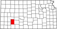 | |
| Unincorporated communities | ||
| Townships | ||