Ellery, New York
| Ellery, New York | |
|---|---|
| Town | |
|
Bemus Point Hotel and Boat Dock, Bemus Point, NY | |
 Location within Chautauqua County and New York | |
 Ellery Location within the state of New York | |
| Coordinates: 42°10′15″N 79°22′37″W / 42.17083°N 79.37694°WCoordinates: 42°10′15″N 79°22′37″W / 42.17083°N 79.37694°W | |
| Country | United States |
| State | New York |
| County | Chautauqua |
| Government | |
| • Type | Town Council |
| • Town Supervisor | Arden E. Johnson (R) |
| • Town Council |
Members' List
|
| Area | |
| • Total | 47.6 sq mi (123.2 km2) |
| • Land | 47.5 sq mi (122.9 km2) |
| • Water | 0.1 sq mi (0.3 km2) |
| Elevation | 1,594 ft (486 m) |
| Population (2010) | |
| • Total | 4,528 |
| • Density | 95/sq mi (36.8/km2) |
| Time zone | Eastern (EST) (UTC-5) |
| • Summer (DST) | EDT (UTC-4) |
| FIPS code | 36-23976 |
| GNIS feature ID | 0978932 |
| Website |
elleryny |

Ellery is a town in Chautauqua County, New York, United States, located northwest of Jamestown and with an extended lakefront on the east side of Chautauqua Lake. In the 2010 census, Ellery had a population of 4,528.[1]
History
The first settlement was made around 1806. The town of Ellery was founded in 1821 from a part of the town of Chautauqua. William Ellery, signer of the Declaration of Independence, is the town's namesake.[2] The lake frontage was developed early as a tourist and recreational location.
Government
The Ellery town government consists of a supervisor, council, and various department heads.[3]
Supervisors
The following is an incomplete list of supervisors of the town:
| # | Supervisor[4] | Took office | Left office | Political party |
|---|---|---|---|---|
| 1 | Almon Ives | 1821 | 1822 | |
| 2 | Peter Loucks | 1822 | 1823 | |
| 3 | Abijah Clark | 1823 | 1824 | |
| 4 | Almon Ives | 1824 | 1828 | |
| 5 | Jonadab Winchester | 1828 | 1829 | |
| 6 | Robertson Whiteside | 1829 | 1830 | |
| 7 | John Hammond | 1830 | 1831 | |
| 8 | Jonadab Winchester | 1831 | 1832 | |
| 9 | Almon Ives | 1832 | 1833 | |
| 10 | Odin Benedict | 1833 | 1840 | |
| Arden E. Johnson | Incumbent | Republican |
Geography
According to the United States Census Bureau, the town has a total area of 47.6 square miles (123.2 km2), of which 47.5 square miles (122.9 km2) is land and 0.12 square miles (0.3 km2), or 0.25%, is water.[1]
The Southern Tier Expressway (Interstate 86 and New York State Route 17) crosses Chautauqua Lake at Bemus Point. New York State Route 430 follows the east shore of Chautauqua Lake. New York State Route 380 is a north-south highway in the eastern part of Ellery.
Adjacent towns and locations
Ellery is bordered mostly by the town of Stockton to the north, although its northwest corner shares a small border with the town of Chautauqua. Directly to the east of Ellery are the towns of Gerry and Ellicott. Its southern and western edges are mostly bordered by Chautauqua Lake.
Demographics
| Historical population | |||
|---|---|---|---|
| Census | Pop. | %± | |
| 1830 | 2,001 | — | |
| 1840 | 2,242 | 12.0% | |
| 1850 | 2,104 | −6.2% | |
| 1860 | 1,751 | −16.8% | |
| 1870 | 1,616 | −7.7% | |
| 1880 | 1,555 | −3.8% | |
| 1890 | 1,789 | 15.0% | |
| 1900 | 1,628 | −9.0% | |
| 1910 | 1,695 | 4.1% | |
| 1920 | 1,496 | −11.7% | |
| 1930 | 1,919 | 28.3% | |
| 1940 | 2,088 | 8.8% | |
| 1950 | 2,852 | 36.6% | |
| 1960 | 3,953 | 38.6% | |
| 1970 | 4,594 | 16.2% | |
| 1980 | 4,617 | 0.5% | |
| 1990 | 4,534 | −1.8% | |
| 2000 | 4,574 | 0.9% | |
| 2010 | 4,528 | −1.0% | |
| Est. 2014 | 4,458 | [5] | −1.5% |
As of the census[7] of 2000, there were 4,576 people, 1,852 households, and 1,316 families residing in the town. The population density was 96.2 people per square mile (37.1/km²). There were 2,630 housing units at an average density of 55.3 per square mile (21.3/km²). The racial makeup of the town was 98.40% White, 0.20% African American, 0.22% Native American, 0.17% Asian, 0.57% from other races, and 0.44% from two or more races. Hispanic or Latino of any race were 0.85% of the population.
There were 1,852 households out of which 29.0% had children under the age of 18 living with them, 60.5% were married couples living together, 7.5% had a female householder with no husband present, and 28.9% were non-families. 26.2% of all households were made up of individuals and 13.0% had someone living alone who was 65 years of age or older. The average household size was 2.42 and the average family size was 2.91.
In the town the population was spread out with 23.8% under the age of 18, 4.8% from 18 to 24, 23.3% from 25 to 44, 28.0% from 45 to 64, and 20.1% who were 65 years of age or older. The median age was 44 years. For every 100 females there were 95.8 males. For every 100 females age 18 and over, there were 93.0 males.
The median income for a household in the town was $41,916, and the median income for a family was $48,093. Males had a median income of $40,733 versus $29,128 for females. The per capita income for the town was $20,619. About 6.1% of families and 8.3% of the population were below the poverty line, including 12.5% of those under age 18 and 4.4% of those age 65 or over.
As of the Census of 2010, there were 4,528 (a decrease of 48 people or 1.05%) and 1,891 households (an increase of 39 households or 2.11%). The population density was 95.1 people per square mile (36.8/km²). The racial makeup of the town was: 97.9% (4,433 people) white; 0.49% (22 people) African-American; 0.49% (22 people) Asian; 0.07% (3 people) Native American/Alaskan; 0.11% (5 people) other; and 0.95% (43 people) two or more races. The Hispanic/Latino population of any race was 0.60% (27 people).
In the town the population was spread out with 19.92% (902 people) under the age of 18, 1.83% ages (83 people) 18 and 19, 3.34% (151 people) ages 20–24, 6.45% (292 people) ages 25–34, 19.46% (881 people) ages 35–49, 25.20% (1,141 people) ages 50–64, and 23.81% (1,078 people) over the age of 65. Of the population, 48.96% (2,217 people) were male and 51.04% (2,311 people) were female.[8]
Communities and locations in Ellery
- Alden Corners – A location north of Ellery Center at the crossing of Route 52 and Slide Joslyn Road.
- Bayview – A lakeside hamlet north of Bemus Point.
- Belleview – A small lakeside community on Route 430 in the south part of the town.
- Bemus Bay – A bay on Chautauqua Lake between Long Point State Park and Bemus Point.
- Bemus Point – The village of Bemus Point, named after a projection of land into Chautauqua Lake.
- Chedwel – A lakeside community along the north shore of the town.
- Colburns – A hamlet on the shore of the lake and on Route 430 south of Bemus Point.
- Crosswinds – A marina community on Route 430 in the northwest corner of the town.
- Driftwood – A lakeside community south of Colburns.
- Dutch Hollow Creek – A stream that flows southward from Ellery Center and enters Chautauqua Lake between Greenhurst and Sunnyside.
- Ellery Center – A hamlet at the junction of County Roads 44, 46, 48, and 57.
- Greenhurst – A lakeside hamlet in the south part of the town.
- Griffiths – A lakeside hamlet in the south part of the town.
- Jones Corners – A hamlet at the intersection of County Roads 52 and 57.
- Long Point State Park – On Route 430 on the east shore of the lake.
- Maple Springs – A lakeside hamlet north of Long Point State Park.
- Midway Park – A location on the lake shore north of Long Point State Park.
- Oriental Park – A hamlet bordering Bemus Point on the south.
- Phillips Mill – A hamlet on the shore of Chautauqua Lake.
- Point Stockholm – A lakeside community.
- Red Bird – A hamlet on Route 380 in the northeast town corner.
- Sheldon Hall – A lakeside community in the south part of the town.
- Sunnyside – A lakeside community in the south part of the town.
- Sunset Bay – A hamlet located by a bay with the same name on Chautauqua Lake.
- Towerville – A hamlet at the junction of County Road 48 and Route 380 in the northeast town corner.
- Watermans Corners – A hamlet on the junction of County Road 52, Thumb Road and Bayview Road in the north part of the town.
- West Ellery – A hamlet in the north part of the town on County Road 46.
- Willow Brook – A location north of Bemus Point.
References
- 1 2 "Geographic Identifiers: 2010 Demographic Profile Data (G001): Ellery town, Chautauqua County, New York". U.S. Census Bureau, American Factfinder. Retrieved November 6, 2014.
- ↑ Gannett, Henry (1905). The Origin of Certain Place Names in the United States. Govt. Print. Off. p. 117.
- ↑
- ↑ A History Vignette of Chautauqua County Politics
- ↑ "Annual Estimates of the Resident Population for Incorporated Places: April 1, 2010 to July 1, 2014". Retrieved June 4, 2015.
- ↑ "Census of Population and Housing". Census.gov. Retrieved June 4, 2015.
- ↑ "American FactFinder". United States Census Bureau. Retrieved 2008-01-31.
- ↑ "2010 U.S. Census". Retrieved 14 September 2012.
External links
Municipalities and communities of Chautauqua County, New York, United States | ||
|---|---|---|
| Cities | 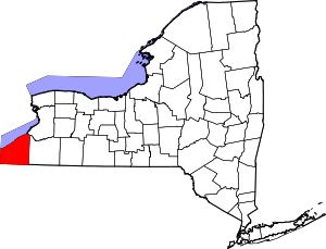 | |
| Towns | ||
| Villages | ||
| CDPs | ||
| Other hamlets | ||
| Indian reservation | ||