Eldoret
| Eldoret Eldoret | |
|---|---|
| Town | |
| Nickname(s): Eldy, Sisibo | |
 Eldoret Location in Kenya | |
| Coordinates: 0°31′N 35°17′E / 0.517°N 35.283°ECoordinates: 0°31′N 35°17′E / 0.517°N 35.283°E | |
| Country |
|
| County | Uasin Gishu County |
| Government | |
| Population (2009) | |
| • Total | 289,380[1] |
| Time zone | EAT (UTC+3) |
| Post code, Postal code | 30100 |
| Area code(s) | +254 53 |
| Climate | Cfb |
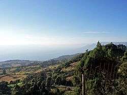
Eldoret is a principal city in western Kenya. It is the capital and largest city in Uasin Gishu County. Lying south of the Cherangani Hills, the local elevation varies from about 2100 metres above sea level at the airport to more than 2700 metres in nearby areas (7000–9000 feet). The population was 289,380 in the 2009 census,[1][2] and it is currently the fastest growing town in Kenya. It is also the second largest urban centre in midwestern Kenya after Nakuru and the fifth largest urban centre in the country.
Etymology
The name "Eldoret" is based on the Maasai word "eldore" meaning "stony river"; a reference to the bed of the Sosiani River (a tributary of the Nile), that runs through the city.
History
The area that is now Eldoret and the plateau around it had been occupied by the Sirikwa for several centuries prior to the era of Maasai ascendancy.[3] Innovation in weaponry, brought about the Maasai era of the 16th and 17th centuries. With new weapons and forms of governance, they swept down from their original homelands in the north, closer to Lake Turkana, down to their present homelands south of Kenya. The Maasai clan that took over the Plateau were known as the Ilwasin Kishu, after whom it is presently named.
Eldoret as a town, founded as it was by Afrikaners is almost unique in the British-dominated Kenya of the early 20th century. The first of the Afrikaners, the Van Breda brothers arrived in 1903 and were joined two years later by Franz Arnoldi and his family. The big influx followed shortly thereafter.[4]
In August 1908, fifty-eight families of displaced Afrikaners left Nakuru for the Uasin Gishu plateau after a journey from South Africa by sea and by rail from Mombasa. Led by Jan van Rensburg, they endured an arduous trek laden as they were with wagons that would often get bogged in mud, finally arriving at Sergoit Hill on 22 October of that year.
The land had earlier been surveyed by a certain van Breda and the new arrivals took up leaseholds of between 800 and 5,000 acres (320 and 2,020 ha) on condition that they would develop it within five years. Each family built a shack, put up fences, in-spanned oxen to simple ploughs and turned the first furrows. They sowed wheat, maize and vegetables laying the foundation for the transformation of the Plateau into a prosperous agricultural region.
The farms were later officially registered and each was given a number.[5]
Eldoret was established in the midst of the farms they created on what was known to the settlers as "Farm 64", "64" or "Sisibo" to the locals because at that time it was 64 miles (103 km) from the newly built Uganda Railway railhead at Kibigori.[6] Willy van Aardt owned the farm. The Central Lounge in Eldoret is all that remains of Willy's farm.
The official town site started in 1910 with the development of a Post Office at "Sisibo". This was followed shortly after by the arrival of sixty more Afrikaner families in 1911.[7] The governor decided to establish an administrative centre in the area 1912 and thus the Post Office was renamed from "64" to a new official town name: "Eldoret" . Becoming an administrative centre caused an enormous increase in trade within the prospective city. A bank and several shops were built.
The Uganda Railway extension, from Kibigori toward Uganda, reached Eldoret in 1924, starting a new era of prosperity and growth. In 1928, a piped water supply from the Sosiani River was installed. In 1933, the East African Power and Lighting Company installed an electricity generator plant. By that time, Eldoret had a small airport, and low-cost rental housing had been constructed.[7]
In the 1950s the town was literally divided into two, along the main street (now Uganda Road), with the Afrikaans on the north and the British on the south. The former took their children to Highland School, (now Moi Girls High School)[8] and the latter, to Hill School.[9] Recreation was also along the divide – 'Brits' used the Lincoln Hotel and the Race-Course near the now "Chinese Area" while the Afrikaans converged at the Wagon Wheel for recreation.
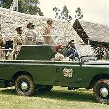
Daniel arap Moi was born in the neighbouring Baringo District, and under his presidency, the town was developed further. The country's second institution of higher learning, Moi University was established by the government in 1984 and the third international airport was subsequently constructed, significantly boosting the fortunes of the town.
By 1987, only two Afrikaner households remained in Eldoret, with the rest having moved back to South Africa in the late 1950s and early 1960s, in the aftermath of the Mau Mau rebellion[10] and in anticipation of independence.
The city was significantly impacted by the 2007–2008 Kenyan crisis, when violence gripped Kenya in the aftermath of controversial presidential elections. The athlete Lucas Sang was murdered about ten kilometres away from the town while on his way home to Chepkoilel. On 1 January 2008 a mob attacked and set fire to a church in the town, where hundreds of people had taken refuge during Kenyan massacres. As a result, about forty to eighty people,[11] mostly Kikuyus, were burnt to death.
William Ruto the current Deputy President of the Republic of Kenya is a son of the city. He has previously represented Eldoret North constituency in parliament.
Climate
| Climate data for Eldoret (2120 m), Kenya (1941-1968, Records: 1930-1968) | |||||||||||||
|---|---|---|---|---|---|---|---|---|---|---|---|---|---|
| Month | Jan | Feb | Mar | Apr | May | Jun | Jul | Aug | Sep | Oct | Nov | Dec | Year |
| Record high °C (°F) | 29.5 (85.1) |
29.1 (84.4) |
30.6 (87.1) |
28.9 (84) |
27.8 (82) |
28.0 (82.4) |
27.2 (81) |
25.2 (77.4) |
27.0 (80.6) |
27.2 (81) |
27.3 (81.1) |
27.5 (81.5) |
30.6 (87.1) |
| Average high °C (°F) | 25.3 (77.5) |
26.0 (78.8) |
25.9 (78.6) |
24.5 (76.1) |
23.5 (74.3) |
22.7 (72.9) |
21.4 (70.5) |
21.8 (71.2) |
23.3 (73.9) |
23.9 (75) |
23.7 (74.7) |
23.9 (75) |
23.8 (74.8) |
| Daily mean °C (°F) | 17.1 (62.8) |
17.6 (63.7) |
18.0 (64.4) |
17.0 (62.6) |
16.9 (62.4) |
15.9 (60.6) |
15.5 (59.9) |
15.7 (60.3) |
16.0 (60.8) |
16.9 (62.4) |
17.0 (62.6) |
16.8 (62.2) |
16.7 (62.1) |
| Average low °C (°F) | 8.5 (47.3) |
8.8 (47.8) |
9.7 (49.5) |
8.9 (48) |
10.3 (50.5) |
9.0 (48.2) |
9.4 (48.9) |
9.3 (48.7) |
8.6 (47.5) |
9.5 (49.1) |
10.1 (50.2) |
9.4 (48.9) |
9.3 (48.7) |
| Record low °C (°F) | 1.6 (34.9) |
2.6 (36.7) |
3.4 (38.1) |
5.0 (41) |
4.9 (40.8) |
1.1 (34) |
2.8 (37) |
5.0 (41) |
4.4 (39.9) |
1.1 (34) |
2.2 (36) |
3.6 (38.5) |
1.1 (34) |
| Average precipitation mm (inches) | 29 (1.14) |
40 (1.57) |
57 (2.24) |
150 (5.91) |
124 (4.88) |
104 (4.09) |
172 (6.77) |
196 (7.72) |
87 (3.43) |
48 (1.89) |
50 (1.97) |
46 (1.81) |
1,103 (43.42) |
| Average precipitation days (≥ 0.2 mm) | 5 | 5 | 8 | 15 | 15 | 13 | 19 | 21 | 11 | 9 | 9 | 7 | 137 |
| Average relative humidity (%) | 57 | 57 | 59 | 70 | 73 | 76 | 76 | 78 | 70 | 65 | 67 | 62 | 67.5 |
| Mean monthly sunshine hours | 276 | 260 | 267 | 243 | 233 | 228 | 183 | 180 | 225 | 242 | 222 | 273 | 2,832 |
| Source #1: Deutscher Wetterdienst[12] | |||||||||||||
| Source #2: Danish Meteorological Institute[13] | |||||||||||||
Local governance
Eldoret is governed by a county Government of Uasin Gishu. The council manages all the city affairs. The city is divided into thirteen wards. Six of them (Huruma, Kamukunji, Kapyemit, Kidiwa/Kapsuswa, and Stadium/Industrial, Market) are in Eldoret North Constituency, Three (Hospital, Kapsoya and Kimumu/Sergoit) are in Eldoret East Constituency, and the remaining four (Kipkenyo, Langas, Pioneer/Elgon View and Race Course) are part of Eldoret South Constituency. All of these three constituencies have more wards within other local authorities than Eldoret municipality.[14]
Suburbs
Eldoret has a number of estates. Estates vary in that some are posh and others are residents of the middle class community. Almost each estate has it identity. Some of the estates include; Elgon View, Langas, Kapseret, Huruma, Kapsoya, Kahoya, West Indies, West, Kipkaren, Kimumu, Jerusalem, Annex and Pioneer among many others.
Economy
Eldoret is surrounded by prime agricultural lands and acts as a trading centre for Uasin Gishu's economy which is driven by large-scale grain farming, dairy and horticultural farming. The town is also a local manufacturing hub with a number of nationally recognised manufacturing concerns, including Raiplywoods, Rupa Textiles, Kenya Pipeline Company, Kenya Co-operative Creameries as well as corn, wheat and pyrethrum factories all within the town.[15]
The city is home to a large market and is known for the Doinyo Lessos cheese factory, Moi University and Eldoret International Airport. The runners from Eldoret have also contributed significantly to the economy of Eldoret town, primarily investing in small businesses and real estate, from their winnings in races all over the world. Moses Kiptanui is a stake holder in one of the largest buildings Komora that houses a large supermarket chain and many offices.
Notable professional firms include Nyairo and Company, the oldest law firm in the city, founded by Alfred Momanyi Nyairo in the sixties. Other law firms have also come up and some of the largest and busiest law firms are D.L Were and Were Company being managed by the experienced duo of Michael Wabomba Masinde and Daniel Lawrence Were, Gumbo and Associate Advocates, Mburu Maina & Company Advocates, Nyaundi Tuiyott & Company Advocates, Kalya & Company Advocates,Tarus and Company Advocates and Gicheru & Company Advocates.
Textiles Industry
The town has a vibrant textile industry that is led by Ken Knit (Kenya). It is the first, fully integrated textile manufacturing company in East and Central Africa and has been based in Eldoret for close to 50 years. It is Kenya's leading manufacturer of wool products and with a workforce of 2,000, is presently the largest textile related employer in the North-Rift.[16]
Another notable textile firm is Rivatex EA which was opened in 1975 by then Vice President, Daniel Toroitich arap Moi as Rift Valley Textiles (Rivatex), a parastatal that was the first Kenyan textile mill to operate computerized mills. It quickly became a success, achieving profitability within three years while employing 400 people and consuming 3,000 tons of cotton a year at its peak. By the late 1990s, the liberalization of Kenya's market which led to massive imports of cheap used clothing coupled with mismanagement led to the decline of the country's textile industry. Rivatex in Eldoret was placed under receivership in 1998 and finally shut its doors in 2000.[17]
The town of Eldoret, through Moi University and its subsidiary firm Rivatex, has played a leading role in the revival of the Kenyan textile industry.[17][18]
The defunct Rivatex, was purchased from the Government of Kenya in 2007 by Moi University as a facility for research, product development, extension and production. The university identified the high cost of imported dyes as a factor affecting profitability. This was resolved in 2008, when Prof Richard Mibey, invented the Tami Dye, a natural dye made from Mexican Marigold which was previously considered a weed in the surrounding regions. The university holds the patent to this dye.[17]
Being able to produce affordable dye in Kenya has been a key contributing factor to the revival of Rivatex East Africa and the wider Kenyan textile industry.[18] The university won a $60 million grant from the World Bank to carry out a face-lift as a result of the work on the Tami Dye. It also secured a pledged investment of $40 million from the Indian Government.[17]
Tourism
Eldoret has traditionally not been known as a tourist destination and does not have much to differentiate it from Kenya's other highland centres. Being Kenya's fifth-largest city however, it is a great deal bigger and serves as a base for touring the North-Rift circuit. The city has a decent variety of accommodation options, notably the Sirikwa Hotel,[19] Poa Place[20] and the ultra-modern Boma Inn[21] as well as enough night-life options to interest one for an evening or two.[22]
Notable attractions within easy distance of Eldoret include the Nandi Hills area to the south, home of the Nandi, the fiercest early opponents to British rule. It is also the home of the Chemosit, a crypto-beast that is said to devour human brains.[22] To the north lies the town of Iten, the world's foremost manufacturer of elite-middle and long distance runners and a popular destination for foreigners looking to hone their talent.[23]
The city has also lately grown into a sports tourism destination thanks to a number of resident, renowned world runners and a high-altitude that makes the local area suitable for athletics training.[15]
Education
Eldoret is home to Moi University with a student population of 14,855 as of 2006. The second medical school in Kenya, Moi Teaching and Referral Hospital (MTRH), is also located in the city limits of Eldoret city. The growth of the University of Eldoret is also playing a major role in the economic sector because of its high population.
The city also is home to many technical and vocational institutes including Rift Valley Technical Training Institute, Eldoret National Polytechnic, African Institute for Research and Applied Studies.
Health
There are a number of medical facilities in the city, notably Moi Teaching & Referral Hospital; one of two national hospitals in Kenya. The county has the Uasin Gishu District Hospital, and there are several private institutions: St. Luke Orthopaedic And Trauma Hospital, Eldoret Hospital, Mediheal Hospital, and Elgon View Hospital among others.
In 2015 East & Central Africa's first public children's hospital; The Shoe4Africa Children's Hospital, a 105-bed state of the art general hospital, was opened, behind the Moi Referral.
Sport
Eldoret, in particular the Elgon View area, is the hometown of numerous Kenyan runners, the most renowned of whom is Kipchoge Keino. The high altitude is an ideal training ground for many middle and long distance athletes. The area has also been a popular stage in the KCB Safari Rally.

Kipchoge Keino Stadium is the town's main stadium and is a multi-use stadium with a capacity of 10,000 people. The stadium is used for athletic meetings and used to host local football teams including Rivatex and Eldoret KCC.
The stadium fell into disrepair and was refurbished beginning in 2007 when the Kenyan Government allocated Ksh.100 million for its upgrade.[24]
Eldoret is also home to the International Association of Athletics Federations (IAAF)'s High Altitude Training Center for Kenyan and international athletes.
Infrastructure
Transport
Airports
Eldoret International Airport is a large airport that serves the city of Eldoret and the surrounding communities. Situated at 2,150 metres (7,050 ft) above sea level,[25] the airport has a single asphalt runway that measures 3,475 metres (11,401 ft) in length.[26] It was voted the cleanest airport in the country in 2001.
Roads
The Trans-African highway passes through the city central business district.
Railway
The city is also served by the Kenya-Uganda railway.
Oil Pipelines
It also has the oil pipeline passing through the city and a station is there.
Sister cities
Eldoret is a sister city of:
| Country | City | County/District/Province/Region/State | Date |
|---|---|---|---|
| |
Bad Vilbel | Hessen | 1982[27] |
| |
Minneapolis | Minnesota | 2000[28] |
| |
Indianapolis | Indiana | 2007[29] |
| |
Ithaca | New York | 2007[30] |
| |
Portsmouth | Virginia | unknown |
References
- 1 2 "Kenya | U.S. Agency for International Development" (PDF). Kenya.usaid.gov. Retrieved 10 December 2013.
- ↑ "Population of Local Authorities" (with towns), Government of Kenya, 1999, GovtKenya-Population-PDF.
- ↑ https://books.google.co.ke/books?id=pJ1BZbgF8IEC&pg=PA47&lpg=PA47&dq=being+maasai+sirikwa&source=bl&ots=U07Az8H-cL&sig=PzNc67deLTnVCAsVAlh6tcoOr_k&hl=en&sa=X&ei=vxcxVdf9E4Tmao-xgdgG&redir_esc=y#v=onepage&q=being%20maasai%20sirikwa&f=false
- ↑ https://afrikanerway.wordpress.com/2013/07/15/eldoret-a-boer-settlement/
- ↑ Retief, Ronaldo (2014). Afrikaners trek to East Africa, Old Africa: Stories from East Africa's Past (Issue 55), p. 14-15
- ↑ Red strangers: the white tribe of Kenya, ISBN 1-85725-206-3, by Christine Stephanie Nicholls
- 1 2 http://www.ipsos.co.ke/NEWBASE_EXPORTS/ICC/131030_Kass%20Magazine_15_60eef.pdf
- ↑ http://moigirlseldoret.ac.ke
- ↑ http://www.mccrow.org.uk/EastAfrica/Hill_School_now/Hill%20School%20Eldoret%20Kenya
- ↑ "Remnants of Boer Colony Glad They Stayed in Kenya". 1 April 1987. Retrieved 16 September 2013.
- ↑ 40 to 80 people
- ↑ "Klimatafel von Eldoret / Kenia" (PDF). Federal Ministry of Transport and Digital Infrastructure. Retrieved 4 November 2016.
- ↑ "STATIONSNUMMER 63686" (PDF). Ministry of Energy, Utilities and Climate. Retrieved 4 November 2016.
- ↑ Electoral Commission of Kenya: Registration centres by electoral area and constituency
- 1 2 http://uasingishu.go.ke/reports/8/about-the-county
- ↑ http://www.kenknit.com/about-us.html
- 1 2 3 4 Olingo, A. The rise, fall and rise again of Rivatex, firm that now holds patent for Tami dye, March 10, 2016
- 1 2 Kibet, D., New dye made from weed revives Kenya’s textile industry and brings local fabric costs down, Moi University Research Uptake May 18, 2015
- ↑ http://www.sirikwahotel.com/
- ↑ http://poaplace.co.ke/
- ↑ http://www.theboma.co.ke/boma-inn-eldoret/
- 1 2 http://www.roughguides.com/destinations/africa/kenya/western-kenya/eldoret-around/
- ↑ http://www.nytimes.com/2012/05/02/sports/iten-a-kenyan-town-made-for-marathoners.html?_r=0
- ↑ http://www.kbc.co.ke/story.asp?ID=45497 Kenya Broadcasting Corporation – Government to upgrade Kipchoge Keino stadium
- ↑ Elevation of Eldoret Airport Runway
- ↑ Length of Eldoret Airport Runway
- ↑ "Bad Vilbel – Stadt der Quellen". Bad-vilbel.de. Retrieved 10 December 2013.
- ↑ http://www.tcdailyplanet.net/news/2013/06/17/eldoret-city-benchmarks-minneapolis
- ↑ "Minutes of the City-County Council and Special Service District Councils of Indianapolis, Marion County, Indiana" (PDF). Indy.gov. Retrieved 10 December 2013.
- ↑ "The Rift Makes Ithaca Shift". HepsTrack.com. HepsTrack, LLC. 31 March 2014. Retrieved 27 April 2014.
External links
| Wikimedia Commons has media related to Eldoret. |
| Wikivoyage has a travel guide for Eldoret. |