El Ouata
| El Ouata اﻟﻮ ﻃﺎء | |
|---|---|
| Commune and town | |
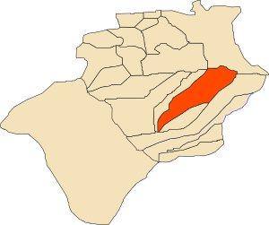 Location of El Ouata commune within Béchar Province | |
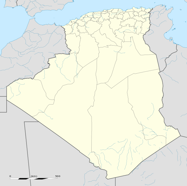 El Ouata Location of El Ouata within Algeria | |
| Coordinates: 29°52′N 1°50′W / 29.867°N 1.833°WCoordinates: 29°52′N 1°50′W / 29.867°N 1.833°W | |
| Country |
|
| Province | Béchar Province |
| District | El Ouata District |
| Area[1] | |
| • Total | 7,950 km2 (3,070 sq mi) |
| Elevation | 431 m (1,414 ft) |
| Population (2008)[2] | |
| • Total | 7,343 |
| • Density | 0.92/km2 (2.4/sq mi) |
| Time zone | CET (UTC+1) |
El Ouata (Arabic: اﻟﻮ ﻃﺎء) is a town and commune in Béchar Province, western Algeria. The commune is coextensive with El Ouata District, which is named after the town.[3] According to the 2008 census its population is 7,343,[2] up from 7,014 in 1998,[4] with an annual population growth rate of 0.5%.[2] The commune covers an area of 2,870 square kilometres (1,110 sq mi).[1]
Geography
El Ouata lies on the left (northeast) bank of the Oued Saoura in the Saoura valley. The Grand Erg Occidental, a large area of continuous sand dunes lies to the east, while the rocky ridges of the Ougarta Range rise to the west, running from northwest to southeast along the opposite side of the river from the town.
Climate
El Ouata has a hot desert climate, with extremely hot summers and warm winters, and very little precipitation throughout the year.
| Climate data for El Ouata | |||||||||||||
|---|---|---|---|---|---|---|---|---|---|---|---|---|---|
| Month | Jan | Feb | Mar | Apr | May | Jun | Jul | Aug | Sep | Oct | Nov | Dec | Year |
| Average high °C (°F) | 18.8 (65.8) |
22.0 (71.6) |
26.0 (78.8) |
30.6 (87.1) |
35.4 (95.7) |
41.9 (107.4) |
44.6 (112.3) |
44.0 (111.2) |
40.0 (104) |
32.8 (91) |
24.9 (76.8) |
18.8 (65.8) |
31.65 (88.96) |
| Daily mean °C (°F) | 11.2 (52.2) |
14.2 (57.6) |
18.2 (64.8) |
22.5 (72.5) |
27.3 (81.1) |
32.6 (90.7) |
36.2 (97.2) |
35.7 (96.3) |
31.5 (88.7) |
24.6 (76.3) |
17.6 (63.7) |
12.0 (53.6) |
23.63 (74.56) |
| Average low °C (°F) | 3.7 (38.7) |
6.4 (43.5) |
10.5 (50.9) |
14.5 (58.1) |
19.2 (66.6) |
24.3 (75.7) |
27.8 (82) |
26.7 (80.1) |
23.0 (73.4) |
16.4 (61.5) |
10.4 (50.7) |
5.3 (41.5) |
15.68 (60.22) |
| Average precipitation mm (inches) | 8 (0.31) |
6 (0.24) |
3 (0.12) |
3 (0.12) |
3 (0.12) |
1 (0.04) |
1 (0.04) |
2 (0.08) |
4 (0.16) |
7 (0.28) |
8 (0.31) |
8 (0.31) |
54 (2.13) |
| Source: climate-data.org[5] | |||||||||||||
Economy
Agriculture is the main industry in El Ouata. The commune has a total of 1,680 hectares (4,200 acres) of arable land, of which 1,264 hectares (3,120 acres) is irrigated.[6] There are a total of 136,180 date palms planted in the commune.[7] As of 2009 there were 1,009 sheep, 1,140 goats, 1,011 camels, and 8 cattle.[8]
Tourism in El Ouata is mainly focused around the sand dunes, palm groves, the old ksar, and the nearby Ougarta Range.[9]
Infrastructure and housing
85% of El Ouata's population are connected to drinking water (the second lowest rate in the province),[10] but 100% are connected to the sewerage system,[11] and 81% (including 2,527 buildings) have access to electricity (the equal lowest in the province).[12] There is one fuel service station in the town.[13]
El Ouata has a total of 1,503 houses, of which 905 are occupied, giving an occupation rate of 8.1 inhabitants per occupied building.[14]
Transportation
El Ouata is on the N6 national highway between Béchar to the northwest and Adrar to the southeast. Towns accessible to the north via the N6 include Béni Abbès and Igli, while to the south the towns of Béni Ikhlef, Kerzaz, Timoudi and Ouled Khoudir can be accessed.
There is a total length of 42 kilometres (26 mi) of roads in the commune.[15]
El Ouata is 271 kilometres (168 mi) from the provincial capital, Béchar.[16]
Education
There are 8 elementary schools, with 57 classrooms including 39 in use.[17] There are a total of 2,243 school students.[18]
5.6% of the population has a tertiary education, and another 15.3% has competed secondary education.[19] The overall literacy rate is 74.2%, and is 84.5% among males and 64.5% among females.[20]
Health
El Ouata has 2 polyclinics, 8 room care facilities, and a maternity ward.[21]
Religion
El Ouata has 11 operational mosques, with another 1 under construction.[22]
Localities
The commune is composed of 10 localities:[23]
References
- 1 2 "Population, Area and Density per Commune" (in French). Official Website of the Wilaya of Bechar. Retrieved 16 March 2013.
- 1 2 3 "Population: Béchar Wilaya" (PDF) (in French). Office National des Statistiques Algérie. Retrieved 13 February 2013.
- ↑ "Dairas et Communes" (in French). Site Officiel de la Wilaya de Béchar. Retrieved 19 February 2013.
- ↑ "Algeria Communes". Statoids. Retrieved 9 March 2013.
- ↑ "Climate data for: El Ouatta". climate-data.org. Retrieved 10 March 2013.
- ↑ "Distribution of Agricultural Land" (in French). Official Website of the Wilaya of Bechar. Retrieved 9 March 2013.
- ↑ "Plant Productions" (in French). Official Website of the Wilaya of Bechar. Retrieved 9 March 2013.
- ↑ "Animal Production" (in French). Official Website of the Wilaya of Bechar. Retrieved 9 March 2013.
- ↑ "Tourist Sites and Monuments" (in French). Official Website of the Wilaya of Bechar. Retrieved 9 March 2013.
- ↑ "Drinking Water" (in French). Official Website of the Wilaya of Bechar. Retrieved 9 March 2013.
- ↑ "Sewerage Networks" (in French). Official Website of the Wilaya of Bechar. Retrieved 9 March 2013.
- ↑ "Electrification" (in French). Official Website of the Wilaya of Bechar. Retrieved 9 March 2013.
- ↑ "Fuel Distribution" (in French). Official Website of the Wilaya of Bechar. Retrieved 9 March 2013.
- ↑ "Housing" (in French). Official Website of the Wilaya of Bechar. Retrieved 9 March 2013.
- ↑ "Density Kilometres" (in French). Official Website of the Wilaya of Bechar. Retrieved 9 March 2013.
- ↑ "Presentation" (in French). Site Officiel de la Wilaya de Béchar. Retrieved 19 February 2013.
- ↑ "School Infrastructure" (in French). Official Website of the Wilaya of Bechar. Retrieved 9 March 2013.
- ↑ "Number of Pupils" (in French). Official Website of the Wilaya of Bechar. Retrieved 9 March 2013.
- ↑ "Structure relative de la population résidente des ménages ordinaires et collectifs âgée de 6 ans et plus selon le niveau d'instruction et la commune de résidence." (PDF) (in French). Office National des Statistiques Algérie. Retrieved 13 February 2013.
- ↑ "Taux d'analphabétisme et taux d'alphabétisation de la population âgée de 15 ans et plus, selon le sexe et la commune de résidence ." (PDF) (in French). Office National des Statistiques Algérie. Retrieved 13 February 2013.
- ↑ "Health Facilities by Commune" (in French). Official Website of the Wilaya of Bechar. Retrieved 9 March 2013.
- ↑ "Mosques and Koranic Rooms" (in French). Official Website of the Wilaya of Bechar. Retrieved 9 March 2013.
- ↑ "Décret n° 84-365, fixant la composition, la consistance et les limites territoriale des communes. Wilaya d'El Oued" (PDF) (in French). Journal officiel de la République Algérienne,. 19 December 1984. p. 1489. Archived from the original (PDF) on 2 March 2013 or before. Retrieved 2 March 2013. Check date values in:
|archive-date=(help)
 |
Béni Abbès Tamtert Idigh |
Béchar Taghit Bouhadid |
Béni Ounif Grand Erg Occidental |
|
| Tindouf | |
Grand Erg Occidental | ||
| ||||
| | ||||
| Tabelbala | Ougarta Range | Ammas El Maffa Béni Ikhlef Adrar |
Capital: Béchar | ||
| Béchar District |  | |
| Abadla District | ||
| Béni Abbès District | ||
| Béni Ounif District | ||
| El Ouata District | ||
| Igli District | ||
| Kénadsa District | ||
| Kerzaz District | ||
| Lahmar District | ||
| Ouled Khodeïr District | ||
| Tabelbala District | ||
| Taghit District | ||