El Abra
 Petroglyph of El Abra | |
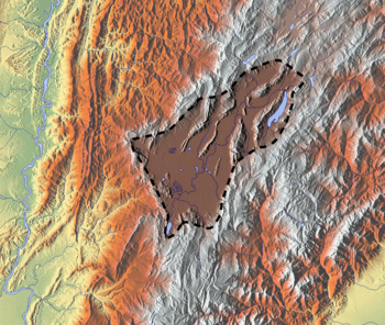
 Location within Colombia | |
| Location | Zipaquirá, Cundinamarca |
|---|---|
| Region |
Altiplano Cundiboyacense, |
| Coordinates | 5°01′02.49″N 73°57′04.33″W / 5.0173583°N 73.9512028°WCoordinates: 5°01′02.49″N 73°57′04.33″W / 5.0173583°N 73.9512028°W |
| Altitude | 2,570 m (8,432 ft) |
| Type | Rock shelter, petroglyphs |
| Part of | Pre-Muisca sites |
| History | |
| Material | Sandstone |
| Abandoned | Herrera Period |
| Periods | Prehistory-Herrera |
| Cultures | Hunter-gatherers |
| Site notes | |
| Archaeologists | Hammen, Correal |
| Public access | Yes |
El Abra is located at the northern edge
El Abra is an archaeological excavation site, located in the valley of the same name, east of the city of Zipaquirá, department Cundinamarca, Colombia; on the Altiplano Cundiboyacense, at an altitude of 2,570 metres (8,430 ft). This cave system is one of the first evidences of human settlement in the Americas, used by the hunter-gatherers of the late Pleistocene epoch. The rock shelter is situated at the northern edge of the Bogotá savanna.
Stratigraphy
The first research in the place was conducted in 1967, and the stratigraphy of lithic instruments, bones and vegetal charcoal with radiocarbon dating established the date of the settlement in 12,400 BCE ± 160 years.[1][2]
Archaeological research
In 1960, the Indiana University collaborated in a deeper research. In 1970 the Dutch Foundation for the Advancement of Tropical Research (NWO-WOTRO) discovered four new preceramic sites and the analysis of lacustrine sediments allowed a more accurate understanding of the paleoclimate and flora.
Fúquene stadial
The Fúquene stadial, named after Lake Fúquene, close to the village, is defined from 15,000 BCE to 12,500 BCE. It is characterized by a cold climate, flora typical of páramo ecosystems, and lithic tools.
Guantivá interstadial
About 12,500 years ago, a gradual rise of temperature allowed the return of Andean cloud forest and the settlement of many animal species, making hunting easier. Articles of this period are abrienses: flint (tool)s, and chopper cores. While the climate was more benign, the cave system was gradually abandoned.
Tibitó stadial
The excavations of this period, near Tocancipá at Tibitó, dated 11,400 years BCE, show lithic instruments, bone tools and remains of Pleistocene megafauna, such as mastodons (Haplomastodon and Cuvieronius hyodon), American horse (Equus amerhipuus lasallei), and deer (Odocoileus virginianus) with traces of ritual ceremonies.
El Abra stadial
Dated 11,000 BCE, it is characterized by a new cooling of the climate, recession of the forests and a last glaciation. From this period the archaeological places of Tequendama Falls in Soacha shows lithic instruments (Tequendamenses tools) with a more smooth manufacture, many of them made with materials brought to this place from the Magdalena River valley, such as quartzite.
Holocene
Around 10,000 years BCE the last glaciation ended, the Andean forest appeared again. The lithic instruments show a rise in recollecting activities, with rodents and vegetables consumed, and low amounts of large animals hunted. The El Abra caves were abandoned gradually.
Aguazuque
In Aguazuque, around 5,000 BCE agriculture was established on elevated terraces, grinding stone instruments can be observed in association with itinerant habits. The abriense type instruments disappear.
See also
References
- ↑ (Spanish) Nivel Paleoindio. Abrigos rocosos del Tequendama
- ↑ Gómez Mejía, 2012, p.153
Bibliography
- Gómez Mejía, Juliana. 2012. Análisis de marcadores óseos de estrés en poblaciones del Holoceno Medio y Tardío incial de la sabana de Bogotá, Colombia - Analysis of bone stress markers in populations of the Middle and Late Holocene of the Bogotá savanna, Colombia. Revista Colombiana de Antropología 48. 143-168.
Further reading
- Correal Urrego, Gonzalo. 1990. Evidencias culturales durante el Pleistocene y Holoceno de Colombia - Cultural evidences during the Pleistocene and Holocene of Colombia. Revista de Arqueología Americana 1. 69–89. Accessed 2016-07-08.
- Correal Urrego, Gonzalo. 1980. Estado actual de las investigaciones sobre la etapa lítica en Colombia. Antropológicas 2. 11-30.
- Correal Urrego, Gonzalo; Thomas van der Hammen, and J.C. Lerman. 1970. Artefactos líticos de abrigos en El Abra, Colombia. Revista Colombiana de Antropología 14. 9-46.
- Hurt, Wesley; Thomas van der Hammen, and Gonzalo Correal Urrego. 1976. La ecología y tecnología de los abrigos rocosos en El Abra, Sabana de Bogotá, Colombia. Boletín de la Sociedad Geográfica Colombiana 109. 1-21.
- Hammen, Thomas van der, and E González. 1963. Historia de clima y vegetación del Pleistoceno superior y Holoceno de la Sabana de Bogotá. Boletín Geológico 1-3. 189-266.
- Hammen, Thomas van der, and Gonzalo Correal Urrego. 1978. Prehistoric man on the Sabana de Bogota: data for an ecological prehistory. Paleography, Paleoclimatology, Paleoecology 25. 179-190.
- Hammen, Thomas van der. 1992. El hombre prehistórico en la Sabana de Bogotá: datos para una prehistoria ecológica. Historia, Ecología y Vegetación _. 217-231.
| Prehistoric-preceramic |  | |
|---|---|---|
| Preceramic-ceramic | ||