Efland, North Carolina
| Efland, North Carolina | |
|---|---|
| Census-designated place | |
 Efland, North Carolina Location within the state of North Carolina | |
| Coordinates: 36°4′52″N 79°10′17″W / 36.08111°N 79.17139°WCoordinates: 36°4′52″N 79°10′17″W / 36.08111°N 79.17139°W | |
| Country | United States |
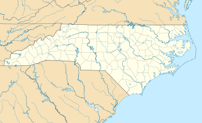
| State | North Carolina |
| County | Orange |
| Area | |
| • Total | 1.8 sq mi (4.7 km2) |
| • Land | 1.8 sq mi (4.7 km2) |
| • Water | 0.0 sq mi (0.0 km2) |
| Population (2010) | |
| • Total | 734 |
| • Density | 400/sq mi (160/km2) |
| Time zone | Eastern (EST) (UTC-5) |
| • Summer (DST) | EDT (UTC-4) |
Efland is a census-designated place in Orange County, North Carolina, United States. As of the 2010 census it had a population of 734.[1]
Efland is located along U.S. Route 70, 3 miles (5 km) west of Hillsborough, the Orange County seat, and 5 miles (8 km) east of Mebane. It is served by exit 160 from Interstate 85.
The original name of the Efland community was Green Springs. Efland Ruritan Club hosts most of the CDP's activities, including an annual rodeo, lumberjack show, tractor pull, car show and Hog Day. The club began in 1981 with Ben Lloyd (former County Commissioner and Farmer) as its first president. Efland has two schools, Efland-Cheeks Elementary School and Gravelly Hill Middle School.
The David Faucette House was listed on the National Register of Historic Places in 1999.[2]
References
- ↑ "Profile of General Population and Housing Characteristics: 2010 Demographic Profile Data (DP-1): Efland CDP, North Carolina". U.S. Census Bureau, American Factfinder. Retrieved July 30, 2012.
- ↑ National Park Service (2010-07-09). "National Register Information System". National Register of Historic Places. National Park Service.
External links
Municipalities and communities of Orange County, North Carolina, United States | ||
|---|---|---|
| Cities | 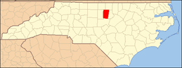 | |
| Towns | ||
| CDPs | ||
| Unincorporated communities | ||
| Footnotes | ‡This populated place also has portions in an adjacent county or counties | |