Eastport, Michigan
| Eastport, Michigan | |
|---|---|
| Census-designated place & Unincorporated community | |
 Eastport | |
| Coordinates: 45°6′26″N 85°21′0″W / 45.10722°N 85.35000°WCoordinates: 45°6′26″N 85°21′0″W / 45.10722°N 85.35000°W | |
| Country | United States |
| State | Michigan |
| County | Antrim County |
| Township | Torch Lake Township |
| Area | |
| • Total | 2.00 sq mi (5.19 km2) |
| • Land | 2.00 sq mi (5.17 km2) |
| • Water | 0.008 sq mi (0.02 km2) |
| Elevation | 607 ft (185 m) |
| Population (2010) | |
| • Total | 218 |
| • Density | 109/sq mi (42.2/km2) |
| Time zone | Eastern (EST) (UTC-5) |
| • Summer (DST) | EDT (UTC-4) |
| ZIP code | 49627 |
| FIPS code | 26-24300[1] |
| GNIS feature ID | 625301[2] |
Eastport is an unincorporated community and census-designated place (CDP) in Torch Lake Township, Antrim County, in the U.S. state of Michigan. The population was 218 at the 2010 census.[3]
Geography
The community is located in northern Michigan between Grand Traverse Bay of Lake Michigan and the northern end of Torch Lake. U.S. Highway 31 (US 31) runs through the center of the community, intersecting state highway M-88. US 31 leads north 17 miles (27 km) to Charlevoix and 34 miles (55 km) north to Petoskey, and it leads south 16 miles (26 km) to Elk Rapids and 33 miles (53 km) to Traverse City. M-88 leads southeast 26 miles (42 km) to Mancelona.
According to the United States Census Bureau, the Eastport CDP has a total area of 2.0 square miles (5.2 km2), of which 0.008 square miles (0.02 km2), or 0.35%, is water.[3]
References
- ↑ "American FactFinder". United States Census Bureau. Retrieved 2008-01-31.
- ↑ U.S. Geological Survey Geographic Names Information System: Eastport, Michigan
- 1 2 "Geographic Identifiers: 2010 Demographic Profile Data (G001): Eastport CDP, Michigan". U.S. Census Bureau, American Factfinder. Retrieved June 10, 2013.
Municipalities and communities of Antrim County, Michigan, United States | ||
|---|---|---|
| Villages | 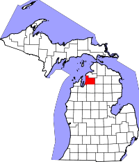 | |
| Townships | ||
| Unincorporated communities | ||