Eastern Township, Franklin County, Illinois
| Eastern Township | |
|---|---|
| Township | |
 Location in Franklin County | |
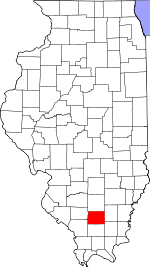 Franklin County's location in Illinois | |
| Coordinates: 37°59′47″N 88°45′40″W / 37.99639°N 88.76111°WCoordinates: 37°59′47″N 88°45′40″W / 37.99639°N 88.76111°W | |
| Country | United States |
| State | Illinois |
| County | Franklin |
| Established | November 4, 1884 |
| Area | |
| • Total | 36.22 sq mi (93.8 km2) |
| • Land | 36.13 sq mi (93.6 km2) |
| • Water | 0.09 sq mi (0.2 km2) 0.25% |
| Elevation | 453 ft (138 m) |
| Population (2010) | |
| • Total | 582 |
| • Density | 16.1/sq mi (6.2/km2) |
| Time zone | CST (UTC-6) |
| • Summer (DST) | CDT (UTC-5) |
| ZIP codes | 62812, 62860, 62890 |
| GNIS feature ID | 0428930 |
Eastern Township is one of twelve townships in Franklin County, Illinois, USA. As of the 2010 census, its population was 582 and it contained 267 housing units.[1]
Geography
According to the 2010 census, the township has a total area of 36.22 square miles (93.8 km2), of which 36.13 square miles (93.6 km2) (or 99.75%) is land and 0.09 square miles (0.23 km2) (or 0.25%) is water.[1]
Unincorporated towns
- Akin
- Akin Junction
- Bessie
- Boothby
- Rust
(This list is based on USGS data and may include former settlements.)
Cemeteries
The township contains these five cemeteries: Brady, Cook, Jones, Manion and Otterson.
Major highways
School districts
- Hamilton County Community Unit School District 10
Political districts
- Illinois' 12th congressional district
- State House District 117
- State Senate District 59
References
- "Eastern Township, Franklin County, Illinois". Geographic Names Information System. United States Geological Survey. Retrieved 2010-01-16.
- United States Census Bureau 2007 TIGER/Line Shapefiles
- United States National Atlas
- 1 2 "Population, Housing Units, Area, and Density: 2010 - County -- County Subdivision and Place -- 2010 Census Summary File 1". United States Census. Retrieved 2013-05-28.
External links

Municipalities and communities of Franklin County, Illinois, United States | ||
|---|---|---|
| Cities | ||
| Villages | ||
| Townships | ||
| CDP | ||
| Other unincorporated communities | ||
This article is issued from Wikipedia - version of the 11/29/2013. The text is available under the Creative Commons Attribution/Share Alike but additional terms may apply for the media files.