East Pleasanton, California
| East Pleasanton | |
|---|---|
| Unincorporated community | |
 East Pleasanton Location in California | |
| Coordinates: 37°40′25″N 121°49′48″W / 37.67361°N 121.83000°WCoordinates: 37°40′25″N 121°49′48″W / 37.67361°N 121.83000°W | |
| Country | United States |
| State | California |
| County | Alameda County |
| Elevation[1] | 384 ft (117 m) |
East Pleasanton (formerly, East Pleasanton Siding) is an unincorporated community in Alameda County, California.[1] It is located 2.25 miles (3.6 km) east-northeast of Pleasanton,[2] at an elevation of 384 feet (117 m).[1]
Climate
This region experiences warm/hot and dry summers, with no average monthly temperatures above 71.6 °F. According to the Köppen Climate Classification system, East Pleasanton has a warm-summer Mediterranean climate, abbreviated "Csb" on climate maps.[3]
References
- 1 2 3 "East Pleasanton". Geographic Names Information System. United States Geological Survey.
- ↑ Durham, David L. (1998). California's Geographic Names: A Gazetteer of Historic and Modern Names of the State. Clovis, Calif.: Word Dancer Press. p. 628. ISBN 1-884995-14-4.
- ↑ Climate Summary for East Pleasanton, California
Municipalities and communities of Alameda County, California, United States | ||
|---|---|---|
| Cities | 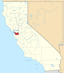 | |
| CDPs | ||
| Unincorporated communities | ||
| Former settlements | ||
This article is issued from Wikipedia - version of the 11/17/2016. The text is available under the Creative Commons Attribution/Share Alike but additional terms may apply for the media files.