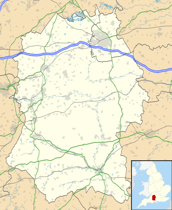
Grafton, Wiltshire
| Grafton | |
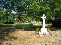 War Memorial, East Grafton |
|
 Grafton |
|
| Population | 686 (in 2011)[1] |
|---|---|
| OS grid reference | SU257605 |
| Civil parish | Grafton |
| Unitary authority | Wiltshire |
| Ceremonial county | Wiltshire |
| Region | South West |
| Country | England |
| Sovereign state | United Kingdom |
| Post town | Marlborough |
| Postcode district | SN8 |
| Dialling code | 01672 |
| Police | Wiltshire |
| Fire | Dorset and Wiltshire |
| Ambulance | South Western |
| EU Parliament | South West England |
| UK Parliament | Devizes |
| Website | Parish Council |
Coordinates: 51°09′18″N 1°42′40″W / 51.155°N 1.711°W
Grafton is a civil parish in Wiltshire, England, in the Vale of Pewsey about 7 miles (11 km) southeast of Marlborough. Its main settlement is the village of East Grafton, on the A338 Burbage - Hungerford road; the parish includes the village of Wilton (not to be confused with the town of Wilton near Salisbury) and the hamlets of West Grafton, Marten and Wexcombe.
The parish is within the North Wessex Downs Area of Outstanding Natural Beauty, while Marten lies under the northwest edge of the Hampshire Downs.
History
Prehistoric earthworks in the parish include the long barrow known as Tow Barrow, on Wexcombe Down, south of Wexcombe. Neolithic pottery was found in 1914 when the site was partially excavated by Crawford and Hooton.[2]
A Roman road between Cirencester and Winchester passes Wilton and Marten.
Marten is one of several suggested sites for the Battle of Marton in 871, in which Æthelred of Wessex suffered a defeat by the Viking army.[3]
The area was part of the ancient parish of Great Bedwyn, formed from a large estate called Bedwyn which was recorded in 968.[3] The 1086 Domesday Book recorded 16 households at (East) Grafton[4] and six at Marten.[5]
Earthworks at Marten, including evidence of a moat, are listed as a deserted medieval village.[6] The Manor Farmhouses at West Grafton[7] and Wilton[8] are from the 17th century; Wexcombe Manor is from the 18th.[9]
The southern half of Great Bedwyn parish (south of the railway) became a separate ecclesiastical district in 1844, when the church was built at East Grafton; the civil parish of Grafton was created in 1895.[3] Having no large settlements, the population of the parish changed little in the 20th century.[1] The manor of Wolfhall was transferred to Burbage parish in 1988.[10]
Canal and railways
The Kennet and Avon Canal, opened in 1809, passes north of Wilton. Wilton Water was created by damming a spring-fed valley as a reservoir for the summit pound of the canal. Seven of the nine Crofton Locks are within the parish.
In 1862 the Great Western Railway built the Berks and Hants Extension Railway from Hungerford to Pewsey and Devizes, closely following the route of the canal; in Grafton parish the line is immediately north of the canal. The local stations were Savernake Low Level and Bedwyn. The line is still in use as part of the Reading to Taunton line, and Bedwyn station is still open.
The Swindon, Marlborough and Andover Railway was built northwards from Andover in 1882, terminating at Grafton and Burbage station which was on the south side of the main road at West Grafton; the next year the line was completed to Marlborough and Swindon. In 1905, owing to traffic for army camps on Salisbury Plain, the two lines were linked by the Grafton Curve and a bridge over the canal. This allowed trains to run between Bedwyn station and Grafton & Burbage.[3] The line and station were closed in 1961.
Church and chapels
The Church of England parish church of St Nicholas at East Grafton was built in 1842-44, to designs by Benjamin Ferrey;[11] before then the parish church was at Great Bedwyn.[3] In 1986 the church was designated as Grade II* listed.[12]
East Grafton, Marten and Wilton each had a chapel of ease in the 14th and 15th centuries, and possibly earlier. Wexcombe had a chapel of ease by 1879, which closed in the 1920s.[3]
A Wesleyan Methodist chapel was built at Wilton in 1811, extended with a schoolroom in 1843 and improved in the 1860s. It closed in 1994 and is in residential use.[13]
Primitive Methodist chapels were built at West Grafton by 1874[14] and at Wexcombe in the 1880s.[15] By the 1960s, both were in residential use.
Local government
The civil parish elects a parish council. It is in the area of Wiltshire Council unitary authority, which performs all significant local government functions.
Amenities and attractions
East Grafton has village hall, the Coronation Hall, built in 1937 and renovated in 2009.[16]
There is no school in the parish. A National School was opened at East Grafton in 1846 and improved in the 20th century; it closed in 2011 owing to falling pupil numbers.[17]
Wilton has a pub, The Swan. On high ground above Wilton is a working 19th-century flour mill, Wilton Windmill.
Crofton Pumping Station, which supplies the Kennet and Avon Canal and has a 200-year-old beam engine, is just beyond the northern boundary of the parish. Its reservoir, Wilton Water, is a nature reserve.[18]
References
- 1 2 "Wiltshire Community History - Census". Wiltshire Council. Retrieved 26 November 2015.
- ↑ Historic England. "Tow Barrow: a long barrow on Wexcombe Down (1013219)". National Heritage List for England. Retrieved 28 November 2015.
- 1 2 3 4 5 6 "Victoria County History - Wiltshire - Vol 16 pp8-49 - Great Bedwyn". British History Online. University of London. Retrieved 27 November 2015.
- ↑ Grafton in the Domesday Book
- ↑ Marten in the Domesday Book
- ↑ Historic England. "Marten: deserted medieval village and moated site (1013104)". National Heritage List for England. Retrieved 30 November 2015.
- ↑ Historic England. "Manor Farmhouse, West Grafton (1300462)". National Heritage List for England. Retrieved 28 November 2015.
- ↑ Historic England. "Manor Farmhouse, Wilton (1365487)". National Heritage List for England. Retrieved 28 November 2015.
- ↑ Historic England. "Wexcombe Manor, alias Upper Farm (1034031)". National Heritage List for England. Retrieved 28 November 2015.
- ↑ "Where exactly was Wolfhall?". Wiltshire Community History. Wiltshire Council. July 2007. Retrieved 29 November 2015.
- ↑ "Church of St. Nicholas, East Grafton". Wiltshire Community History. Wiltshire Council. Retrieved 27 November 2015.
- ↑ Historic England. "Church of St Nicholas, Grafton (1365521)". National Heritage List for England. Retrieved 27 November 2015.
- ↑ "Wesleyan Methodist Bethel Chapel, Wilton, Grafton". Wiltshire Community History. Wiltshire Council. Retrieved 27 November 2015.
- ↑ "Primitive Methodist Chapel, West Grafton". Wiltshire Community History. Wiltshire Council. Retrieved 27 November 2015.
- ↑ "Primitive Methodists, Wexcombe, Grafton". Wiltshire Community History. Wiltshire Council. Retrieved 27 November 2015.
- ↑ "Grafton". Wiltshire Community History. Wiltshire Council. Retrieved 28 November 2015.
- ↑ "Grafton Primary School". Wiltshire Community History. Wiltshire Council. Retrieved 28 November 2015.
- ↑ "Wilton Water". Visit Pewsey Vale. Retrieved 28 November 2015.
External links
![]() Media related to Grafton, Wiltshire at Wikimedia Commons
Media related to Grafton, Wiltshire at Wikimedia Commons