East Caracas
| East | |
|---|---|
| Municipalities of East Caracas | |
| Coordinates: VE 10°15′N 66°31′W / 10.25°N 66.52°W | |
| Sovereign state | Venezuela |
| State | Miranda |
| City | Metropolitan District of Caracas |
| Comprises | Chacao, Altamira, Baruta, El Hatillo, Petare |
| Area | |
| • Total | 344.1 km2 (132.9 sq mi) |
| Population | |
| • Total | 1,140,756 |
| • Density | 3,300/km2 (8,600/sq mi) |
East Caracas generally refers to the eastern portions of Caracas, and may refer specifically to the municipalities from the Metropolitan District of Caracas located in Miranda State: Chacao, Baruta, Sucre, and El Hatillo. It concentrates the 34.8% population of the Metropolitan District of Caracas, and the 21.7% population of the Greater Caracas Area.
It's considered as the safer part of Caracas since most neighbourhoods on the eastern side have a lower crime rate than those to West Caracas,[1][2][3][4] also is the richest side since there is more middle class to upscale neighbourhoods rather than low-class.[5] It holds most of the trendy shops, malls, restaurants, bars, and clubs in Caracas.
Geography
Limits and extent
| Municipality | Baruta | Chacao | El Hatillo | Sucre |
|---|---|---|---|---|
| Location |  |  | 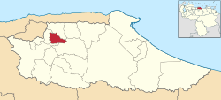 |  |
| Major centres | Baruta | Chacao | El Hatillo | Petare |
| Population (2013)[6] | 326,377 | 71,085 | 74,006 | 669,288 |
Division
East Caracas is divided geographically in Eastern Caracas and Southeastern Caracas. The list of neighborhoods are:
- Eastern: El Pedregal, San Marino, Campo Alegre, Chacao, Bello Campo, El Rosal, El Retiro, Las Mercedes, Tamanaco, Chuao, Altamira, Los Palos Grandes, La Castellana, La Floresta, Santa Eduvigis, Sebucán, La Carlota, Santa Cecilia, Campo Claro, Los Ruices, Montecristo, Los Chorros, Los Dos Caminos, Boleíta, Los Cortijos, La California, Horizonte, El Marqués, La Urbina, Terrazas del Ávila, Lomas del Ávila, El Llanito, Macaracuay, La Guairita, Caurimare, El Cafetal, San Román, Santa Rosa, San Luis, Santa Sofía, Santa Paula, Santa Inés, Los Pomelos, Palo Verde, Petare.
- Southeastern: Valle Arriba, Santa Fe, Los Campitos, Prados del Este, Alto Prado, Manzanares, El Peñón, Baruta, Piedra Azul, La Trinidad, La Tahona, Monterrey, Las Minas, Los Samanes, Cerro Verde, Los Naranjos, La Boyera, Alto Hatillo, El Hatillo, Los Geranios, La Lagunita, El Placer, El Guayabao, El Volcán, La Unión, Sartanejas.
Notes
External links
References
- ↑ http://soundsandcolours.com/subjects/travel/calling-on-caracas-3872/ In the east, the streets are safer but it’s too cheap to walk.
- ↑ http://www.nytimes.com/2014/03/01/world/americas/slum-dwellers-in-caracas-ask-what-protests.html?_r=0 On the east side of this capital city, where the rich people tend to live
- ↑ http://www.noticierodigital.com/2013/08/vea-usted-si-vive-en-una-zona-segura-menos-segura-o-insegura-de-acuerdo-con-la-embajada-de-ee-uu-en-caracas/
- ↑ http://www.localyte.com/answers/1224 Safest neighborhoods in Caracas?
- ↑ http://soundsandcolours.com/subjects/travel/calling-on-caracas-3872/ Chacao, the east’s proud commercial and business centre is said to be one of the wealthiest zones in South America
- ↑ http://www.cne.gov.ve/web/normativa_electoral/elecciones/2013/municipales/circunscripciones/CabildoMetropolitano.pdf Cabildo Metroolitano del Área Metropolitana de Caracas