East Berlin, Pennsylvania
| East Berlin, Pennsylvania | |
|---|---|
| Borough | |
 | |
 Location in Adams County and the state of Pennsylvania. | |
| Coordinates: 39°56′16″N 76°58′51″W / 39.93778°N 76.98083°WCoordinates: 39°56′16″N 76°58′51″W / 39.93778°N 76.98083°W | |
| Country | United States |
| State | Pennsylvania |
| County | Adams |
| Settled | 1764 |
| Incorporated | 1879 |
| Government | |
| • Type | Borough Council |
| Area | |
| • Total | 0.7 sq mi (2 km2) |
| Elevation | 443 ft (135 m) |
| Population (2010) | |
| • Total | 1,521 |
| • Density | 1,962.1/sq mi (757.6/km2) |
| Time zone | Eastern (EST) (UTC-5) |
| • Summer (DST) | EDT (UTC-4) |
| Zip code | 17316 |
| Area code(s) | 717 |
| Website |
eastberlinboro |
East Berlin is a borough in Adams County, Pennsylvania, United States. The population was 1,521 at the 2010 census. East Berlin is served by the Bermudian Springs School District.
East Berlin is located in the southern part of Pennsylvania, adjacent to the York County border and 13 miles (21 km) west of York.
History
In 1764, John Frankenberger purchased and laid out eighty-five lots with streets and alleys and named it "Berlin," his home in Germany. Subsequently, confusion with another community in Pennsylvania, led to altering the name to "East Berlin." By 1797 under the new owner John Hildebrand, East Berlin had approximately one hundred houses. When York County was divided in 1800, East Berlin became part of the newly created Adams County.
In 1877, the Berlin Branch Railroad was completed, linking the town to Berlin Junction on the Hanover Junction, Hanover and Gettysburg Railroad. The railroad operated until 1914, when the tracks were removed from East Berlin to Abbottstown. The rail line was relaid in 1916 and continued to operate as the East Berlin Railroad until 1939. The tracks were again removed in 1940.[1]
In 1879, the community was incorporated as a borough.
The East Berlin Historic District was added to the National Register of Historic Places in 1985.[2]
Geography
East Berlin is located at 39°56′16″N 76°58′51″W / 39.93778°N 76.98083°W (39.937890, -76.980942).[3]
According to the United States Census Bureau, the borough has a total area of 0.7 square miles (1.8 km2), all of it land.
East Berlin is at the junction of State highways 194 and 234.
Demographics
| Historical population | |||
|---|---|---|---|
| Census | Pop. | %± | |
| 1880 | 510 | — | |
| 1890 | 595 | 16.7% | |
| 1900 | 668 | 12.3% | |
| 1910 | 672 | 0.6% | |
| 1920 | 616 | −8.3% | |
| 1930 | 790 | 28.2% | |
| 1940 | 792 | 0.3% | |
| 1950 | 913 | 15.3% | |
| 1960 | 1,037 | 13.6% | |
| 1970 | 1,086 | 4.7% | |
| 1980 | 1,054 | −2.9% | |
| 1990 | 1,175 | 11.5% | |
| 2000 | 1,365 | 16.2% | |
| 2010 | 1,521 | 11.4% | |
| Est. 2015 | 1,534 | [4] | 0.9% |
| Sources:[5][6][7] | |||
As of the census[6] of 2000, there were 1,365 people, 557 households, and 387 families residing in the borough. The population density was 1,962.1 people per square mile (752.9/km²). There were 588 housing units at an average density of 845.2 per square mile (324.3/km²). The racial makeup of the borough was 97.44% White, 0.51% African American, 0.15% Native American, 0.29% Asian, 0.88% from other races, and 0.73% from two or more races. Hispanic or Latino of any race were 2.86% of the population.
There were 557 households, out of which 34.1% had children under the age of 18 living with them, 56.0% were married couples living together, 10.4% had a female householder with no husband present, and 30.5% were non-families. 26.0% of all households were made up of individuals, and 11.5% had someone living alone who was 65 years of age or older. The average household size was 2.45 and the average family size was 2.95.
In the borough the population was spread out, with 26.4% under the age of 18, 8.1% from 18 to 24, 32.0% from 25 to 44, 18.2% from 45 to 64, and 15.3% who were 65 years of age or older. The median age was 35 years. For every 100 females there were 86.2 males. For every 100 females age 18 and over, there were 88.0 males.
The median income for a household in the borough was $38,819, and the median income for a family was $43,646. Males had a median income of $34,659 versus $21,971 for females. The per capita income for the borough was $19,818. About 5.7% of families and 6.7% of the population were below the poverty line, including 10.5% of those under age 18 and 5.2% of those age 65 or over.
See also
References
- ↑ Taber, Thomas T., III (1987). Railroads of Pennsylvania Encyclopedia and Atlas. Thomas T. Taber III. p. 6. ISBN 0-9603398-5-X.
- ↑ National Park Service (2010-07-09). "National Register Information System". National Register of Historic Places. National Park Service.
- ↑ "US Gazetteer files: 2010, 2000, and 1990". United States Census Bureau. 2011-02-12. Retrieved 2011-04-23.
- ↑ "Annual Estimates of the Resident Population for Incorporated Places: April 1, 2010 to July 1, 2015". Retrieved July 2, 2016.
- ↑ "Census of Population and Housing". U.S. Census Bureau. Retrieved 11 December 2013.
- 1 2 "American FactFinder". United States Census Bureau. Retrieved 2008-01-31.
- ↑ "Incorporated Places and Minor Civil Divisions Datasets: Subcounty Resident Population Estimates: April 1, 2010 to July 1, 2012". Population Estimates. U.S. Census Bureau. Retrieved 11 December 2013.
External links
Municipalities and communities of Adams County, Pennsylvania, United States | ||
|---|---|---|
| Boroughs | 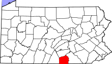 | |
| Townships | ||
| CDPs | ||
| Unincorporated communities | ||
| Ghost town | ||