Eagleville, Missouri
| Eagleville, Missouri | |
|---|---|
| Village | |
| Motto: A small town with a big tomorrow! | |
 Location of Eagleville, Missouri | |
| Coordinates: 40°28′9″N 93°59′15″W / 40.46917°N 93.98750°WCoordinates: 40°28′9″N 93°59′15″W / 40.46917°N 93.98750°W | |
| Country | United States |
| State | Missouri |
| County | Harrison |
| Area[1] | |
| • Total | 1.02 sq mi (2.64 km2) |
| • Land | 1.01 sq mi (2.62 km2) |
| • Water | 0.01 sq mi (0.03 km2) |
| Elevation | 1,093 ft (333 m) |
| Population (2010)[2] | |
| • Total | 316 |
| • Estimate (2012[3]) | 308 |
| • Density | 312.9/sq mi (120.8/km2) |
| Time zone | Central (CST) (UTC-6) |
| • Summer (DST) | CDT (UTC-5) |
| ZIP code | 64442 |
| Area code(s) | 660 |
| FIPS code | 29-20674[4] |
| GNIS feature ID | 0730088[5] |
| Website | http://www.eagleville.com/ |
Eagleville is a village in Harrison County, Missouri, United States. The population was 316 at the 2010 census. It is located halfway between Des Moines, Iowa and Kansas City, Missouri, being 90 miles from Des Moines and 104 miles from Kansas City. It is 14 miles from Harrison County's seat, Bethany, Missouri. It is about 230 miles from Missouri's capital, Jefferson City, Missouri.
History
Eagleville was originally called Eagle, and under the latter name was platted in 1851.[6] A post office called Eagle was established in 1853, and the name was changed to Eagleville in 1881.[7]
Geography
Eagleville is located at 40°28′9″N 93°59′15″W / 40.46917°N 93.98750°W (40.469162, -93.987418).[8]
According to the United States Census Bureau, the village has a total area of 1.02 square miles (2.64 km2), of which, 1.01 square miles (2.62 km2) of it is land and 0.01 square miles (0.03 km2) is water.[1]
Demographics
| Historical population | |||
|---|---|---|---|
| Census | Pop. | %± | |
| 1880 | 453 | — | |
| 1890 | 305 | −32.7% | |
| 1900 | 292 | −4.3% | |
| 1910 | 330 | 13.0% | |
| 1920 | 340 | 3.0% | |
| 1930 | 305 | −10.3% | |
| 1940 | 353 | 15.7% | |
| 1950 | 360 | 2.0% | |
| 1960 | 341 | −5.3% | |
| 1970 | 388 | 13.8% | |
| 1980 | 364 | −6.2% | |
| 1990 | 275 | −24.5% | |
| 2000 | 321 | 16.7% | |
| 2010 | 316 | −1.6% | |
| Est. 2015 | 305 | [9] | −3.5% |
2010 census
As of the census[2] of 2010, there were 316 people, 131 households, and 81 families residing in the village. The population density was 312.9 inhabitants per square mile (120.8/km2). There were 149 housing units at an average density of 147.5 per square mile (57.0/km2). The racial makeup of the village was 98.1% White, 0.3% African American, 0.3% Native American, and 1.3% from two or more races. Hispanic or Latino of any race were 1.6% of the population.
There were 131 households of which 30.5% had children under the age of 18 living with them, 51.1% were married couples living together, 7.6% had a female householder with no husband present, 3.1% had a male householder with no wife present, and 38.2% were non-families. 32.1% of all households were made up of individuals and 16.1% had someone living alone who was 65 years of age or older. The average household size was 2.41 and the average family size was 3.10.
The median age in the village was 40 years. 27.8% of residents were under the age of 18; 5.7% were between the ages of 18 and 24; 23.5% were from 25 to 44; 19.7% were from 45 to 64; and 23.4% were 65 years of age or older. The gender makeup of the village was 47.8% male and 52.2% female.
2000 census
As of the census[4] of 2000, there were 321 people, 143 households, and 95 families residing in the town. The population density was 314.8 people per square mile (121.5/km²). There were 155 housing units at an average density of 152.0 per square mile (58.7/km²). The racial makeup of the town was 97.82% White, 0.62% Native American, 0.31% from other races, and 1.25% from two or more races. Hispanic or Latino of any race were 1.25% of the population.
There were 143 households out of which 29.4% had children under the age of 18 living with them, 54.5% were married couples living together, 9.8% had a female householder with no husband present, and 32.9% were non-families. 30.8% of all households were made up of individuals and 16.1% had someone living alone who was 65 years of age or older. The average household size was 2.24 and the average family size was 2.74.
In the town the population was spread out with 22.4% under the age of 18, 7.5% from 18 to 24, 24.9% from 25 to 44, 21.2% from 45 to 64, and 24.0% who were 65 years of age or older. The median age was 42 years. For every 100 females there were 84.5 males. For every 100 females age 18 and over, there were 81.8 males.
The median income for a household in the town was $24,821, and the median income for a family was $29,250. Males had a median income of $21,406 versus $16,250 for females. The per capita income for the town was $15,299. About 14.8% of families and 17.4% of the population were below the poverty line, including 3.4% of those under age 18 and 31.3% of those age 65 or over.
References
- 1 2 "US Gazetteer files 2010". United States Census Bureau. Retrieved 2012-07-08.
- 1 2 "American FactFinder". United States Census Bureau. Retrieved 2012-07-08.
- ↑ "Population Estimates". United States Census Bureau. Retrieved 2013-05-30.
- 1 2 "American FactFinder". United States Census Bureau. Retrieved 2008-01-31.
- ↑ "US Board on Geographic Names". United States Geological Survey. 2007-10-25. Retrieved 2008-01-31.
- ↑ "Harrison County Place Names, 1928–1945 (archived)". The State Historical Society of Missouri. Retrieved 3 October 2016.
- ↑ "Post Offices". Jim Forte Postal History. Retrieved 3 October 2016.
- ↑ "US Gazetteer files: 2010, 2000, and 1990". United States Census Bureau. 2011-02-12. Retrieved 2011-04-23.
- ↑ "Annual Estimates of the Resident Population for Incorporated Places: April 1, 2010 to July 1, 2015". Retrieved July 2, 2016.
- ↑ "Census of Population and Housing". Census.gov. Retrieved June 4, 2015.
Municipalities and communities of Harrison County, Missouri, United States | ||
|---|---|---|
| Cities | 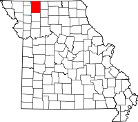 | |
| Villages | ||
| Townships | ||
| Unincorporated communities | ||
| Footnotes | ‡This populated place also has portions in an adjacent county or counties | |