Durfort, Ariège
| Durfort | |
|---|---|
|
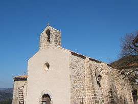
The church in Durfort | |
 Durfort | |
|
Location within Occitanie region  Durfort | |
| Coordinates: 43°12′26″N 1°27′28″E / 43.2072°N 1.4578°ECoordinates: 43°12′26″N 1°27′28″E / 43.2072°N 1.4578°E | |
| Country | France |
| Region | Occitanie |
| Department | Ariège |
| Arrondissement | Pamiers |
| Canton | Le Fossat |
| Intercommunality | Vallée de la Lèze |
| Government | |
| • Mayor (2014–2020) | Roger Buffa |
| Area1 | 10.98 km2 (4.24 sq mi) |
| Population (2008)2 | 173 |
| • Density | 16/km2 (41/sq mi) |
| Time zone | CET (UTC+1) |
| • Summer (DST) | CEST (UTC+2) |
| INSEE/Postal code | 09109 / 09130 |
| Elevation |
245–372 m (804–1,220 ft) (avg. 346 m or 1,135 ft) |
|
1 French Land Register data, which excludes lakes, ponds, glaciers > 1 km² (0.386 sq mi or 247 acres) and river estuaries. 2 Population without double counting: residents of multiple communes (e.g., students and military personnel) only counted once. | |
Durfort is a commune in the Ariège department in southwestern France.
Population
| Historical population | ||
|---|---|---|
| Year | Pop. | ±% |
| 1962 | 157 | — |
| 1968 | 167 | +6.4% |
| 1975 | 116 | −30.5% |
| 1982 | 120 | +3.4% |
| 1990 | 111 | −7.5% |
| 1999 | 126 | +13.5% |
| 2008 | 173 | +37.3% |
See also
References
| Wikimedia Commons has media related to Durfort (Ariège). |
This article is issued from Wikipedia - version of the 4/12/2015. The text is available under the Creative Commons Attribution/Share Alike but additional terms may apply for the media files.