Drain, Oregon
| Drain, Oregon | |
|---|---|
| City | |
|
| |
| Motto: Gateway to the Pacific[1] | |
 Location in Oregon | |
| Coordinates: 43°39′42″N 123°18′53″W / 43.66167°N 123.31472°WCoordinates: 43°39′42″N 123°18′53″W / 43.66167°N 123.31472°W | |
| Country | United States |
| State | Oregon |
| County | Douglas |
| Incorporated | 1887 |
| Government | |
| • Mayor | Suzanne Anderson |
| Area[2] | |
| • Total | 0.61 sq mi (1.58 km2) |
| • Land | 0.61 sq mi (1.58 km2) |
| • Water | 0 sq mi (0 km2) |
| Elevation | 290 ft (90 m) |
| Population (2010)[3] | |
| • Total | 1,151 |
| • Estimate (2012[4]) | 1,143 |
| • Density | 1,886.9/sq mi (728.5/km2) |
| Time zone | Pacific (UTC-8) |
| • Summer (DST) | Pacific (UTC-7) |
| ZIP code | 97435 |
| Area code(s) | 541 |
| FIPS code | 41-20500[3] |
| GNIS feature ID | 1166647[5] |
| Website | www.cityofdrain.org |
_-_cropped.jpg)
Drain is a city in Douglas County, Oregon, United States. The population was 1,151 at the 2010 census. Drain is named after town founder and politician Charles J. Drain, who donated 60 acres (24 ha) of nearby land to the Oregon and California Railroad in 1871.[6]
History
In 1876, a coach road was established between Drain and Scottsburg. Drain was the starting point for the Drain-Coos Bay stage line, which ran to Scottsburg and then by river steamer to Gardiner and the beach on the south side of the mouth of the Umpqua River.[7]
The Drain Normal School was founded in the community in 1883 by the Methodist Church. The state took over the school in 1885 and named it as the Central Oregon State Normal School, before it closed in June 1908.[6]
Geography

According to the United States Census Bureau, the city has a total area of 0.61 square miles (1.58 km2), all of it land.[2]
Drain is at the crossroads of Oregon Route 99 and Oregon Route 38, at a pass in the Coast Range, on the way west to the Pacific Ocean.
Elk Creek and Pass Creek, both tributaries of the Umpqua River, converge in Drain.
Pass Creek Bridge, a covered bridge in a park behind the Drain Civic Center, was formerly a road bridge. In 1987, the City moved the structure to the park and opened it to pedestrian traffic only. In 2014, the City completely closed the bridge, made unsafe by rotting support timbers.[8]
| Climate data for Drain, Oregon (1981–2010 normals) | |||||||||||||
|---|---|---|---|---|---|---|---|---|---|---|---|---|---|
| Month | Jan | Feb | Mar | Apr | May | Jun | Jul | Aug | Sep | Oct | Nov | Dec | Year |
| Average high °F (°C) | 49.6 (9.8) |
54.1 (12.3) |
58.9 (14.9) |
63.4 (17.4) |
69.9 (21.1) |
75.2 (24) |
83.6 (28.7) |
84.2 (29) |
79.4 (26.3) |
67.1 (19.5) |
54.5 (12.5) |
47.9 (8.8) |
65.65 (18.69) |
| Average low °F (°C) | 35.4 (1.9) |
35.6 (2) |
37.6 (3.1) |
39.9 (4.4) |
44.3 (6.8) |
48.5 (9.2) |
51.9 (11.1) |
51.2 (10.7) |
46.6 (8.1) |
42.4 (5.8) |
39.3 (4.1) |
35.0 (1.7) |
42.31 (5.74) |
| Average precipitation inches (mm) | 7.16 (181.9) |
5.60 (142.2) |
5.03 (127.8) |
3.89 (98.8) |
2.80 (71.1) |
1.34 (34) |
0.43 (10.9) |
0.62 (15.7) |
1.23 (31.2) |
3.34 (84.8) |
7.84 (199.1) |
8.63 (219.2) |
47.92 (1,217.2) |
| Average snowfall inches (cm) | 0.2 (0.5) |
0.8 (2) |
0 (0) |
0 (0) |
0 (0) |
0 (0) |
0 (0) |
0 (0) |
0 (0) |
0 (0) |
0 (0) |
0.7 (1.8) |
1.7 (4.3) |
| Average precipitation days (≥ 0.01 in) | 20.4 | 16.9 | 19.3 | 16.7 | 12.1 | 8.3 | 2.8 | 2.8 | 5.9 | 12.9 | 20.0 | 19.9 | 158 |
| Average snowy days (≥ 0.1 in) | 0.3 | 0.5 | 0 | 0 | 0 | 0 | 0 | 0 | 0 | 0 | 0.1 | 0.3 | 1.2 |
| Source: NOAA [9] | |||||||||||||
Demographics
| Historical population | |||
|---|---|---|---|
| Census | Pop. | %± | |
| 1880 | 188 | — | |
| 1900 | 193 | — | |
| 1910 | 335 | 73.6% | |
| 1920 | 607 | 81.2% | |
| 1930 | 497 | −18.1% | |
| 1940 | 597 | 20.1% | |
| 1950 | 1,150 | 92.6% | |
| 1960 | 1,052 | −8.5% | |
| 1970 | 1,204 | 14.4% | |
| 1980 | 1,148 | −4.7% | |
| 1990 | 1,011 | −11.9% | |
| 2000 | 1,021 | 1.0% | |
| 2010 | 1,151 | 12.7% | |
| Est. 2015 | 1,157 | [10] | 0.5% |
2010 census
As of the census of 2010, there were 1,151 people, 454 households, and 319 families residing in the city. The population density was 1,886.9 inhabitants per square mile (728.5/km2). There were 492 housing units at an average density of 806.6 per square mile (311.4/km2). The racial makeup of the city was 92.9% White, 0.2% African American, 2.7% Native American, 0.3% Asian, 1.0% from other races, and 3.0% from two or more races. Hispanic or Latino of any race were 4.4% of the population.[3]
There were 454 households of which 33.7% had children under the age of 18 living with them, 50.0% were married couples living together, 13.7% had a female householder with no husband present, 6.6% had a male householder with no wife present, and 29.7% were non-families. 22.9% of all households were made up of individuals and 9.5% had someone living alone who was 65 years of age or older. The average household size was 2.54 and the average family size was 2.95.[3]
The median age in the city was 39.5 years. 25.4% of residents were under the age of 18; 9.5% were between the ages of 18 and 24; 22.1% were from 25 to 44; 26.6% were from 45 to 64; and 16.4% were 65 years of age or older. The gender makeup of the city was 48.8% male and 51.2% female.[3]
2000 census
As of the census of 2000, there were 1,021 people, 397 households, and 289 families residing in the city. The population density was 1,879.0 people per square mile (730.0/km²). There were 441 housing units at an average density of 811.6 per square mile (315.3/km²). The racial makeup of the city was 90.60% White, 0.10% African American, 2.64% Native American, 0.49% Asian, 0.29% Pacific Islander, 1.57% from other races, and 4.31% from two or more races. Hispanic or Latino of any race were 3.33% of the population.[3]
There were 397 households out of which 36.5% had children under the age of 18 living with them, 55.7% were married couples living together, 13.4% had a female householder with no husband present, and 27.0% were non-families. 22.9% of all households were made up of individuals and 9.6% had someone living alone who was 65 years of age or older. The average household size was 2.57 and the average family size was 3.02.[3]
In the city the population was spread out with 26.7% under the age of 18, 8.8% from 18 to 24, 27.4% from 25 to 44, 23.8% from 45 to 64, and 13.2% who were 65 years of age or older. The median age was 38 years. For every 100 females there were 96.3 males. For every 100 females age 18 and over, there were 86.5 males.[3]
The median income for a household in the city was $27,833, and the median income for a family was $34,231. Males had a median income of $30,278 versus $20,063 for females. The per capita income for the city was $13,810. About 8.6% of families and 10.3% of the population were below the poverty line, including 10.3% of those under age 18 and 7.0% of those age 65 or over.[3]
Notable people
- David Ward, sheriff
References
- ↑ "Drain, Oregon". Retrieved 2008-11-27.
- 1 2 "US Gazetteer files 2010". United States Census Bureau. Retrieved 2012-12-21.
- 1 2 3 4 5 6 7 8 9 "American FactFinder". United States Census Bureau. Retrieved 2012-12-21.
- ↑ "Population Estimates". United States Census Bureau. Retrieved 2013-06-02.
- ↑ "US Board on Geographic Names". United States Geological Survey. 2007-10-25. Retrieved 2008-01-31.
- 1 2 Corning, Howard M. (1989). Dictionary of Oregon History. Portland, Oregon: Binfords & Mort Publishing. p. 76. ISBN 0832304492.
- ↑ Guyer, R. J., Douglas County Chronicles – History from the Land of One Hundred Valleys, History Press (2013) ISBN 978-1609497651 at pages 44–45.
- ↑ Pettit, Daniel K. (2016). "Pass Creek Covered Bridge". The Oregon Encyclopedia. Portland State University and the Oregon Historical Society. Retrieved March 26, 2016.
- ↑ "NowData - NOAA Online Weather Data". National Oceanic and Atmospheric Administration. Retrieved 2012-03-23.
- ↑ "Annual Estimates of the Resident Population for Incorporated Places: April 1, 2010 to July 1, 2015". Retrieved July 2, 2016.
- ↑ "Census of Population and Housing". Census.gov. Retrieved June 4, 2015.
External links
| Wikimedia Commons has media related to Drain, Oregon. |
Municipalities and communities of Douglas County, Oregon, United States | ||
|---|---|---|
| Cities | 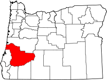 | |
| CDPs | ||
| Unincorporated communities | ||