Dowagiac Municipal Airport
| Dowagiac Municipal Airport | |||||||||||||||
|---|---|---|---|---|---|---|---|---|---|---|---|---|---|---|---|
| IATA: none – ICAO: none – FAA LID: C91 | |||||||||||||||
| Summary | |||||||||||||||
| Airport type | Public | ||||||||||||||
| Operator | City of Dowagiac | ||||||||||||||
| Location | Dowagiac, Michigan | ||||||||||||||
| Elevation AMSL | 748 ft / 228 m | ||||||||||||||
| Coordinates | 41°59′57″N 86°8′9″W / 41.99917°N 86.13583°WCoordinates: 41°59′57″N 86°8′9″W / 41.99917°N 86.13583°W | ||||||||||||||
| Map | |||||||||||||||
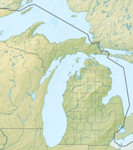 C91  C91 Location of airport in Michigan/United States | |||||||||||||||
| Runways | |||||||||||||||
| |||||||||||||||
Dowagiac Municipal Airport (FAA LID: C91) is a public airport owned and operated by the City of Dowagiac located 1m (1.6 km) northwest of Dowagiac, Michigan, United States. The airport in uncontrolled, and is used for general aviation purposes. It is included in the Federal Aviation Administration (FAA) National Plan of Integrated Airport Systems for 2017–2021, in which it is categorized as a local general aviation facility.[1]
Additionally, radio controlled aircraft operations are permitted on the southeast side of runway 04/22.
On average, 70 aircraft operations occur each week, and 100% of the operations are general aviation. No commercial airline service is available. 18 aircraft are based on the field.
References
- ↑ "List of NPIAS Airports" (PDF). FAA.gov. Federal Aviation Administration. 21 October 2016. Retrieved 25 November 2016.
External links
- Resources for this airport:
- FAA airport information for C91
- AirNav airport information for C91
- FlightAware airport information and live flight tracker
- SkyVector aeronautical chart for C91