Dovercourt, Edmonton
| Dovercourt | |
|---|---|
| Neighbourhood | |
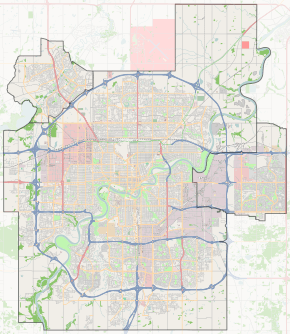
 Dovercourt Location of Dovercourt in Edmonton | |
| Coordinates: 53°34′26″N 113°33′29″W / 53.574°N 113.558°W | |
| Country |
|
| Province |
|
| City | Edmonton |
| Quadrant[1] | NW |
| Ward[1] | 2 |
| Sector[2] | Mature area |
| Government[3] | |
| • Administrative body | Edmonton City Council |
| • Councillor | Bev Esslinger |
| Area[4] | |
| • Total | 1 km2 (0.4 sq mi) |
| Elevation | 676 m (2,218 ft) |
| Population (2012)[5] | |
| • Total | 2,048 |
| • Density | 2,048/km2 (5,300/sq mi) |
| • Change (2009–12) |
|
| • Dwellings | 900 |
Dovercourt is a residential neighbourhood in north west Edmonton, Alberta, Canada. While the area was originally annexed by the City of Edmonton in 1913, residential development didn't occur until after the end of World War II.[6]
The neighbourhood is bounded on the west by 142 Street, on the east by St. Albert Trail, on the north by Yellowhead Trail, and on the south by 118 Avenue. Dovercourt Avenue passes through the neighbourhood.
Demographics
In the City of Edmonton's 2012 municipal census, Dovercourt had a population of 2,048 living in 900 dwellings,[5] a -0.7% change from its 2009 population of 2,063.[7] With a land area of 1 km2 (0.39 sq mi),[4] it had a population density of 2,048 people/km2 in 2012.[4][5]
Residential development

According to the 2001 federal census, eight out of every ten (79.3%) residences in the neighbourhood were built between the end of World War II and 1960. Most of the remainder (13%) were built during the 1960s with residential development in the neighbourhood being substantially complete by 1970.[8]
The most common type or residence in the neighbourhood, accounting for nine out of every ten (88%) of all residences according to the 2005 municipal census, is the single-family dwelling. Another one in ten (9%) are row houses. There are also a few duplexes[9] in the neighbourhood.[10] Four out of five residences (80%) are owner-occupied with only one residence in five being rented.
Schools
There were two schools in the neighbourhood. Only one is operating as of November 2012. Dovercourt Elementary School is operated by the Edmonton Public School System. St. Rita Catholic School was operated by the Edmonton Catholic School System.
Ross Sheppard High School is located a short distance to the south of the neighbourhood.
Shopping and services
Residents have access to shopping and recreational facilities in the adjoining neighbourhood of Woodcroft to the south. This includes shopping, entertainment and services at Westmount Centre.
Located within Coronation Park in Woodcroft is the Telus World of Science (formerly called the Edmonton Space and Sciences Centre), a major swimming pool, an ice arena, a small football stadium and a lawn bowling facility.
St. Albert Trail provides access, via Groat Road, to destinations on the south side, including the University of Alberta and Whyte Avenue.
Surrounding neighbourhoods
 |
Brown Industrial | Brown Industrial | Hagmann Estate Industrial |  |
| Dominion Industrial | |
Sherbrooke | ||
| ||||
| | ||||
| Huff Bremner Estate Industrial | Woodcroft | Inglewood |
References
- 1 2 "City of Edmonton Wards & Standard Neighbourhoods" (PDF). City of Edmonton. Retrieved February 13, 2013.
- ↑ "Edmonton Developing and Planned Neighbourhoods, 2011" (PDF). City of Edmonton. Retrieved February 13, 2013.
- ↑ "City Councillors". City of Edmonton. Retrieved February 13, 2013.
- 1 2 3 "Neighbourhoods (data plus kml file)". City of Edmonton. Retrieved February 22, 2013.
- 1 2 3 "Municipal Census Results – Edmonton 2012 Census". City of Edmonton. Retrieved February 22, 2013.
- ↑ Neighbourhood description in the City of Edmonton Map Utility.
- ↑ "2009 Municipal Census Results". City of Edmonton. Retrieved February 22, 2013.
- ↑ http://censusdocs.edmonton.ca/DD23/FEDERAL%202001/Neighbourhood/DOVERCOURT.pdf
- ↑ Duplexes include triplexes and fourplexes.
- ↑ http://censusdocs.edmonton.ca/C05002/MUNICIPAL%202005/Neighbourhood/DOVERCOURT.pdf