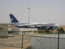
Dongola Airport
| Dongola Airport | |||||||||||
|---|---|---|---|---|---|---|---|---|---|---|---|
 | |||||||||||
| IATA: DOG – ICAO: HSDN | |||||||||||
| Summary | |||||||||||
| Airport type | Public | ||||||||||
| Serves | Dongola, Sudan | ||||||||||
| Elevation AMSL | 773 ft / 236 m | ||||||||||
| Coordinates | 19°09′13″N 030°25′48″E / 19.15361°N 30.43000°ECoordinates: 19°09′13″N 030°25′48″E / 19.15361°N 30.43000°E | ||||||||||
| Map | |||||||||||
 HSDN Location of airport in Sudan (Northern state highlighted) | |||||||||||
| Runways | |||||||||||
| |||||||||||
Dongola Airport (IATA: DOG, ICAO: HSDN; Arabic: مطار دنقلا) is an airport serving Dongola,[1] the capital city of the Northern state in Sudan.
Facilities
The airport resides at an elevation of 773 feet (236 m) above mean sea level. It has one runway designated 17/35 with an asphalt surface measuring 3,000 by 45 metres (9,843 ft × 148 ft).[1]
Airlines and destinations
Template:SUDAN AIRWAYS
References
- 1 2 3 Airport information for HSDN from DAFIF (effective October 2006)
- ↑ Airport information for DOG at Great Circle Mapper. Source: DAFIF (effective October 2006).
External links
This article is issued from Wikipedia - version of the 12/4/2016. The text is available under the Creative Commons Attribution/Share Alike but additional terms may apply for the media files.