Districts of Sri Lanka
| District දිස්ත්රික්ක மாவட்டம் | |
|---|---|
 | |
| Category | Second level administrative division |
| Location | Sri Lanka |
| Number | 25 (as of February 1984) |
| Populations | 92,238–2,324,349 |
| Areas | 699–7,179 km² |
| Government | District secretariat |
| Subdivisions | DS Division |
| Administrative divisions of Sri Lanka |
|---|
| First level |
| Provinces |
| Second level |
| Districts |
| Third level |
| Municipalities |
| Fourth level |
| Wards |
| Fifth level |
|
 |
| This article is part of a series on the politics and government of Sri Lanka |
|
|
Political parties |
|
|
|
|
Foreign policy |
|
Related issues
|
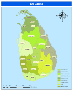
In Sri Lanka, districts (Sinhalese: දිස්ත්රික්ක, Tamil: மாவட்டம்) are the second-level administrative divisions, and are included in a province. There are 25 districts organized into 9 provinces.[1] Each district is administered under a District Secretary,[2] who is appointed by the central government.[3] The main tasks of the District Secretariat involve coordinating communications and activities of the central government and Divisional Secretariats. The District Secretariat is also responsible for implementing and monitoring development projects at the district level and assisting lower-level subdivisions in their activities,[4] as well as revenue collection and coordination of elections in the district.[5] A district is divided into a number of Divisional Secretary's Divisions (commonly known as DS divisions), which are in turn subdivided into 14,022 Grama Niladhari Divisions.[6] There are 231 DS divisions in the country.[7]
History
The country was first divided into several administrative units during the Anuradhapura Kingdom. The kingdom was divided into three provinces; Rajarata, Ruhuna and Malaya Rata. These were further subdivided into smaller units called rata.[8] Over time, the number of provinces increased, but the second-level administrative division continued to be the rata. However, with the country eventually being divided into more than one kingdom and with foreign colonial missions landing and taking parts of the country under their control, this structure began to change. The territory of the Kotte Kingdom was organized into four disavas, which were further subdivided into forty korales. The korales had their own civil and military officials with a small militia. The Jaffna kingdom appears to have had a similar administrative structure to this with four provinces.[9]
When the Portuguese took over parts of the country after their arrival in 1505,[10] they maintained more or less the same administrative structure followed by Sri Lankan rulers.[11] During the Dutch rule in the country, the terrain under their control was divided into three administrative divisions. These were subdivided into disavas as in earlier systems.[12] The British initially continued this system,[13] but following reforms in 1796 to 1802, the country was divided according to ethnic composition.[14][15] This was abolished by the Colebrook–Cameron reforms in 1833 and a legislative council was created,[16] making the island a politically and administratively single unit. Five provinces were created, later expanded into nine, and these were subdivided into twenty-one districts. These districts were administered by officials known as Government Agents or Assistant Government Agents.[14]
In 1955, the district replaced the province as the country's main administrative unit.[17] Ampara District was created in April 1961,[18][19] followed by the creation of Mullaitivu and Gampaha districts in September 1978[20] through a new constitution, which also reintroduced the province as the main administrative unit.[21] The last district to be created was Kilinochchi in February 1984,[22] and the current constitution (that of 1978) states that the territory of Sri Lanka consists of 25 administrative districts. These districts may be subdivided or amalgamated by a resolution of the Parliament of Sri Lanka.[23]
Districts
All population data are from the most recent census of Sri Lanka, in 2012.
| District | Area map | Province | District capital |
Land area in km2 (mi2)[24] |
Inland water area in km2 (mi2)[24] |
Total area in km2 (mi2)[24] |
Population (2012)[25] |
Population density per km2 (per mi2)[lower-alpha 1] |
|---|---|---|---|---|---|---|---|---|
| Ampara | 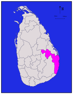 |
Eastern | Ampara | 4,222 (1,630) | 193 (75) | 4,415 (1,705) | 649,402 | 154 (400) |
| Anuradhapura | 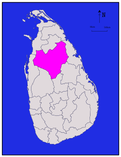 |
North Central | Anuradhapura | 6,664 (2,573) | 515 (199) | 7,179 (2,772) | 860,575 | 129 (330) |
| Badulla |  |
Uva | Badulla | 2,827 (1,092) | 34 (13) | 2,861 (1,105) | 815,405 | 288 (750) |
| Batticaloa |  |
Eastern | Batticaloa | 2,610 (1,010) | 244 (94) | 2,854 (1,102) | 526,567 | 202 (520) |
| Colombo |  |
Western | Colombo | 676 (261) | 23 (8.9) | 699 (270) | 2,324,349 | 3,438 (8,900) |
| Galle | 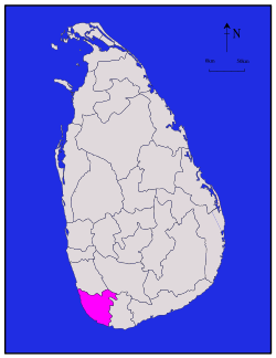 |
Southern | Galle | 1,617 (624) | 35 (14) | 1,652 (638) | 1,063,334 | 658 (1,700) |
| Gampaha |  |
Western | Gampaha | 1,341 (518) | 46 (18) | 1,387 (536) | 2,304,833 | 1,719 (4,450) |
| Hambantota |  |
Southern | Hambantota | 2,496 (964) | 113 (44) | 2,609 (1,007) | 599,903 | 240 (620) |
| Jaffna | 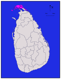 |
Northern | Jaffna | 929 (359) | 96 (37) | 1,025 (396) | 583,882 | 629 (1,630) |
| Kalutara | 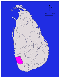 |
Western | Kalutara | 1,576 (608) | 22 (8.5) | 1,598 (617) | 1,221,948 | 775 (2,010) |
| Kandy | 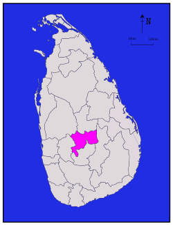 |
Central | Kandy | 1,917 (740) | 23 (8.9) | 1,940 (750) | 1,375,382 | 716 (1,850) |
| Kegalle | 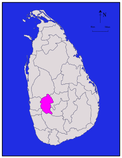 |
Sabaragamuwa | Kegalle | 1,685 (651) | 8 (3.1) | 1,693 (654) | 840,648 | 499 (1,290) |
| Kilinochchi |  |
Northern | Kilinochchi | 1,205 (465) | 74 (29) | 1,279 (494) | 113,510 | 94 (240) |
| Kurunegala | 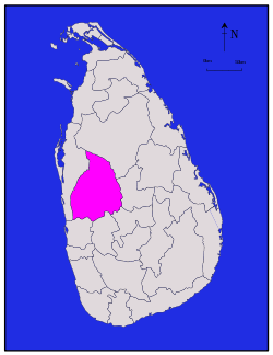 |
North Western | Kurunegala | 4,624 (1,785) | 192 (74) | 4,816 (1,859) | 1,618,465 | 350 (910) |
| Mannar | 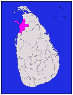 |
Northern | Mannar | 1,880 (730) | 116 (45) | 1,996 (771) | 99,570 | 53 (140) |
| Matale | 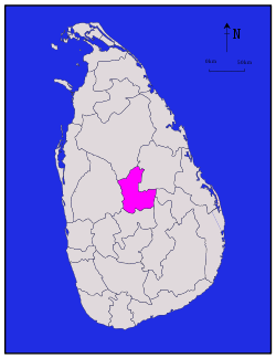 |
Central | Matale | 1,952 (754) | 41 (16) | 1,993 (770) | 484,531 | 248 (640) |
| Matara | 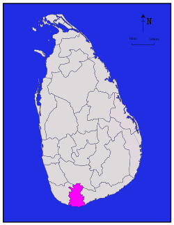 |
Southern | Matara | 1,270 (490) | 13 (5.0) | 1,283 (495) | 814,048 | 641 (1,660) |
| Monaragala | 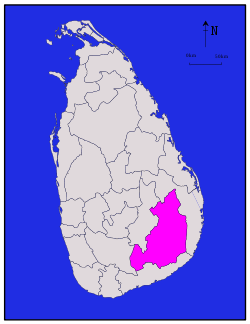 |
Uva | Monaragala | 5,508 (2,127) | 131 (51) | 5,639 (2,177) | 451,058 | 82 (210) |
| Mullaitivu |  |
Northern | Mullaitivu | 2,415 (932) | 202 (78) | 2,617 (1,010) | 92,238 | 38 (98) |
| Nuwara Eliya | 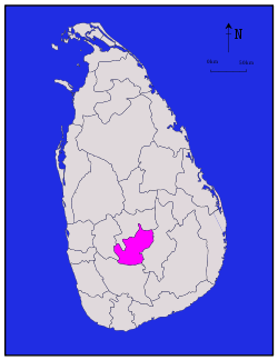 |
Central | Nuwara Eliya | 1,706 (659) | 35 (14) | 1,741 (672) | 711,644 | 417 (1,080) |
| Polonnaruwa | 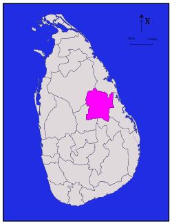 |
North Central | Polonnaruwa | 3,077 (1,188) | 216 (83) | 3,293 (1,271) | 406,088 | 132 (340) |
| Puttalam | 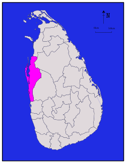 |
North Western | Puttalam | 2,882 (1,113) | 190 (73) | 3,072 (1,186) | 762,396 | 265 (690) |
| Ratnapura |  |
Sabaragamuwa | Ratnapura | 3,236 (1,249) | 39 (15) | 3,275 (1,264) | 1,088,007 | 336 (870) |
| Trincomalee |  |
Eastern | Trincomalee | 2,529 (976) | 198 (76) | 2,727 (1,053) | 379,541 | 150 (390) |
| Vavuniya | 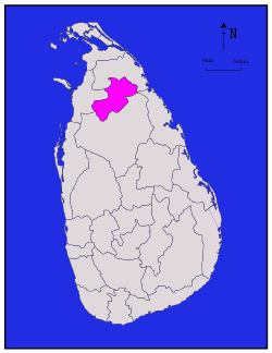 |
Northern | Vavuniya | 1,861 (719) | 106 (41) | 1,967 (759) | 172,115 | 92 (240) |
| Total | 62,705 (24,211) | 2,905 (1,122) | 65,610 (25,330) | 20,359,439 | 325 (840) |
See also
Notes
- ↑ Population density has been calculated using the land area rather than the total area.
Citations
- ↑ "At a Glance". Sri Lanka in Brief. Government of Sri Lanka. Retrieved 21 July 2009.
- ↑ "Vision & Mission". District Secretariats Portal. Ministry of Public Administration & Home Affairs, Sri Lanka. Archived from the original on 13 May 2009. Retrieved 21 July 2009.
- ↑ "Kilinochchi a brief look". Daily News (Sri Lanka). 27 April 2009. Retrieved 1 August 2009.
- ↑ "About Us". Vavuniya District Secretariat. Archived from the original on 12 November 2010. Retrieved 29 July 2009.
- ↑ "Performs Report and Accounts—2008" (PDF). District and Divisional Secretariats Portal—Ministry of Public Administration and Home Affairs. Retrieved 2009-07-29.
- ↑ "Identification of DS Divisions of Sri Lanka Vulnerable for food insecurity" (PDF). World Food Programme. Retrieved 21 July 2009.
- ↑ "Grama Niladhari Administration Division". Retrieved 23 June 2016.
- ↑ Siriweera 2004, p. 91.
- ↑ Yogasundaram 2006, p. 170.
- ↑ Hewavissenti, Panchamee (3 February 2008). "Episodes of colonised history". Sunday Observer (Sri Lanka). Retrieved 21 July 2009.
- ↑ Yogasundaram 2006, p. 168.
- ↑ Yogasundaram 2006, p. 195.
- ↑ Yogasundaram 2006, p. 214.
- 1 2 Yogasundaram 2006, p. 258.
- ↑ Peebles 2006, p. 48.
- ↑ Peebles 2006, p. 52.
- ↑ Peebles 2006, p. 110.
- ↑ "Overview". Ampara District Secretariat.
- ↑ Mohideen, M. I. M. (27 December 2007). "Sinhalisation of East: A reply to Minister Champika Ranawaka". The Island (Sri Lanka).
- ↑ "Population by sex and district, census years" (PDF). Statistical Abstract 2011. Department of Census & Statistics, Sri Lanka.
- ↑ Schmiegelow, Michèle (1997). Democracy in Asia. Palgrave Macmillan. p. 425. ISBN 0-312-16495-5.
- ↑ Karalliyadda, S. B. (9 June 2013). "Awakening Jaffna Uthuru Wasanthaya". The Nation (Sri Lanka).
- ↑ "Chapter 1: The People, The State and Sovereignty". The Constitution of Sri Lanka. Government of Sri Lanka. Retrieved 21 July 2009.
- 1 2 3 "Table 1.1: Area of Sri Lanka by province and district" (PDF). Statistical Abstract 2014. Department of Census and Statistics, Sri Lanka.
- ↑ "Census of Population and Housing of Sri Lanka, 2012 - Table A1: Population by district,sex and sector" (PDF). Department of Census & Statistics, Sri Lanka.
References
- "Administrative Districts and Main Towns of Sri Lanka". International Centre for Ethnic Studies. Retrieved 2009-07-18.
- Siriweera, W. I. (2004). History of Sri Lanka: From Earliest Times Up to the Sixteenth Century. Dayawansa Jayakodi & Company. ISBN 955-551-257-4.
- Yogasundaram, Nath (2006). A Comprehensive History of Sri Lanka from Prehistory to Tsunami. Vijitha Yapa Publishers. ISBN 978-955-665-002-0.
- Peebles, Patrick (2006). The History of Sri Lanka. Greenwood Publishing Group. ISBN 0-313-33205-3.
External links
| Wikimedia Commons has media related to Districts of Sri Lanka. |
- "Provinces of Sri Lanka". Statoids.
| ||