Didcot, Queensland
| Didcot Queensland | |
|---|---|
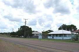 Didcot, 2008 | |
 Didcot | |
| Coordinates | 25°28′04″S 151°51′49″E / 25.46778°S 151.86361°ECoordinates: 25°28′04″S 151°51′49″E / 25.46778°S 151.86361°E |
| Population | 287 (2011 census)[1] |
| Postcode(s) | 4621 |
| Location |
|
| LGA(s) | North Burnett Region |
Didcot is a locality in the North Burnett Region, Queensland, Australia.[2] In the 2011 census, Didcot had a population of 287 people.[1]
Geography
The Mungar-Monto railway line passes through Didcot from west to east with two stations, Didcot in the west of the locality (25°28′26″S 151°52′04″E / 25.47389°S 151.86778°E) and Chowey in the east (25°27′52″S 151°56′14″E / 25.46444°S 151.93722°E).[3][4]
Heritage listings
Didcot has a number of heritage-listed sites, including:
- on the Mungar-Monto railway line: Deep Creek Railway Bridge[5]
References
- 1 2 Australian Bureau of Statistics (31 October 2012). "Didcot (SSC)". 2011 Census QuickStats. Retrieved 19 August 2016.
- ↑ "Didcot (entry 45342)". Queensland Place Names. Queensland Government. Retrieved 19 August 2016.
- ↑ "Didcot - railway station (entry 9921)". Queensland Place Names. Queensland Government. Retrieved 20 August 2016.
- ↑ "Chowey - railway station (entry 7167)". Queensland Place Names. Queensland Government. Retrieved 20 August 2016.
- ↑ "Deep Creek Railway Bridge, Chowey (entry 600031)". Queensland Heritage Register. Queensland Heritage Council. Retrieved 12 July 2013.
External links
![]() Media related to Didcot, Queensland at Wikimedia Commons
Media related to Didcot, Queensland at Wikimedia Commons
This article is issued from Wikipedia - version of the 8/20/2016. The text is available under the Creative Commons Attribution/Share Alike but additional terms may apply for the media files.