Dez Dam
| Dez Dam | |
|---|---|
|
The Dez Dam | |
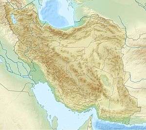 Location of Dez Dam in Iran | |
| Country | Iran |
| Location | Khuzestan-Andimeshk |
| Coordinates | 32°36.3′N 48°27.8′E / 32.6050°N 48.4633°ECoordinates: 32°36.3′N 48°27.8′E / 32.6050°N 48.4633°E |
| Status | Operational |
| Construction began | 1959 |
| Opening date | 1963 |
| Owner(s) | Khuzestan Water & Power Authority |
| Dam and spillways | |
| Type of dam | Concrete arch dam |
| Impounds | Dez River |
| Height | 203 m (666 ft) |
| Length | 380 m (1,247 ft) |
| Width (crest) | 27 m (89 ft) |
| Spillway capacity | 600 m3/s (21,000 cu ft/s) |
| Reservoir | |
| Total capacity | 3.34 km3 (2,710,000 acre·ft) |
| Surface area | 64.9 km2 (25.1 sq mi)[1] |
| Power station | |
| Commission date | 1962-1970 |
| Turbines | 8 x 65 MW[1] |
| Installed capacity | 520 MW[1] |
| Annual generation | 1,783 GWh [1] |
|
Website dezdam | |

The Dez Dam (Persian: سد دز) is an arch dam on the Dez River in the southwestern province of Khuzestan, Iran. It is about 26 km (16 mi) north of Andimeshk. It was built between 1959 and 1963 by an Italian consortium and is owned by the Khuzestan Water & Power Authority. The dam is 203 metres (666 ft) high, making it one of the highest in the country, and has a reservoir capacity of 3,340,000,000 m3 (2,710,000 acre·ft). At the time of construction the Dez Dam was Iran's biggest development project. The primary purpose of the dam is hydroelectric power production and irrigation. It has an associated 520 MW power station and its reservoir helps irrigate up to 80,500 ha (199,000 acres) of farmland. US$42 million of the cost to construct the dam came from the World Bank.[2][3]
Background
Impregilo was involved with building the Dez Dam. Plans for the dam were finalized in 1957 and construction began in 1959. In 1962 the first generator was commissioned. In 1963 the dam was complete with two of the eight 65 MW Francis turbine generators commissioned. The remaining six were commissioned by 1970. In the late 1970s the irrigation of the project had reached 80,500 ha (199,000 acres) of its 110,000 ha (270,000 acres) goal.[2][3][4]
The dam's current problem is the annual loss of reservoir capacity due to the erosion of soil in upstream areas. By 2006, the reservoir volume was estimated to be 2,600,000,000 m3 (2,100,000 acre·ft)[5]

References
- 1 2 3 4 http://www.khpimc.com/sample-project.htm Archived July 13, 2011, at the Wayback Machine.
- 1 2 "Hydroelectric Power Plants in Iran". IndustCards. Retrieved 13 January 2015.
- 1 2 "The Dez Multipuropose Dam Project in Iran". San Jose State University. Retrieved 13 January 2015.
- ↑ "The dez multi-purpose dam scheme, Khuzestan a socio-economic analysis". Durham University. 1977. Retrieved 13 January 2015.
- ↑ Kiani, M. (May 2006). "Sedimentation Issues in the Dez Dam Reservoir" (PDF). The Role of Dams in the 21st Century. an Antonio River Authority: 409–411.
| Wikimedia Commons has media related to Dez Dam. |
| Capital | 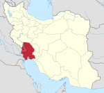 | ||||||||||||||||||||||||||||||||||||||||||||||||||||||||||||||||||
|---|---|---|---|---|---|---|---|---|---|---|---|---|---|---|---|---|---|---|---|---|---|---|---|---|---|---|---|---|---|---|---|---|---|---|---|---|---|---|---|---|---|---|---|---|---|---|---|---|---|---|---|---|---|---|---|---|---|---|---|---|---|---|---|---|---|---|---|
| Counties (A-K) and cities | |||||||||||||||||||||||||||||||||||||||||||||||||||||||||||||||||||
| Counties (L-Z) and cities | |||||||||||||||||||||||||||||||||||||||||||||||||||||||||||||||||||
| Sights |
| ||||||||||||||||||||||||||||||||||||||||||||||||||||||||||||||||||
| populated places | |||||||||||||||||||||||||||||||||||||||||||||||||||||||||||||||||||