Decota, West Virginia
| Decota, West Virginia | |
|---|---|
| Unincorporated community | |
 Decota, West Virginia | |
| Coordinates: 38°01′04″N 81°25′14″W / 38.01778°N 81.42056°WCoordinates: 38°01′04″N 81°25′14″W / 38.01778°N 81.42056°W | |
| Country | United States |
| State | West Virginia |
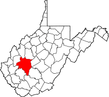
| County | Kanawha |
| Elevation | 1,125 ft (343 m) |
| Time zone | Eastern (EST) (UTC-5) |
| • Summer (DST) | EDT (UTC-4) |
| Area code(s) | 304 & 681 |
| GNIS feature ID | 1538099[1] |
Decota is an unincorporated community in Kanawha County, West Virginia, United States. Decota is 7 miles (11 km) northeast of Whitesville along Cabin Creek.[2]
Decota is a name derived from the Dakota language meaning "allies".[3]
References
- ↑ "US Board on Geographic Names". United States Geological Survey. 2007-10-25. Retrieved 2008-01-31.
- ↑ The National Map, accessed 19 October 2016.
- ↑ Kenny, Hamill (1945). West Virginia Place Names: Their Origin and Meaning, Including the Nomenclature of the Streams and Mountains. Piedmont, WV: The Place Name Press. p. 203.
This article is issued from Wikipedia - version of the 10/19/2016. The text is available under the Creative Commons Attribution/Share Alike but additional terms may apply for the media files.