Decatur Heights Historic District
|
Decatur Heights Historic District | |
 | |
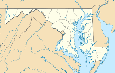  | |
| Location | Roughly along Baltimore Ave., Decatur St., Davidson St., Frederick St. and Linden St., Cumberland, Maryland |
|---|---|
| Coordinates | 39°39′29″N 78°45′22″W / 39.65806°N 78.75611°WCoordinates: 39°39′29″N 78°45′22″W / 39.65806°N 78.75611°W |
| Area | 77 acres (31 ha) |
| Architect | Butler, Wright; Biddle, T.W. |
| Architectural style | Federal, Greek Revival |
| NRHP Reference # | 05001478[1] |
| Added to NRHP | December 28, 2005 |
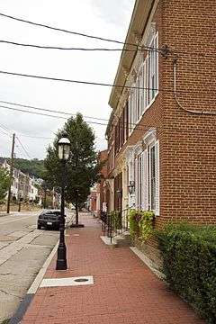
The Decatur Heights Historic District is a national historic district in Cumberland, Allegany County, Maryland. It a mixed-use district of 77 acres (310,000 m2) located on the northeast side of Cumberland. It contains a total of 377 residential / commercial / industrial historic resources, including five properties previously listed on the National Register of Historic Places. Approximately 50 percent of the resources in the district predate 1890, approximately 40 percent date were constructed between 1890 and 1930, and the remaining approximately 10 percent post-date 1930. It is significant because: 1) its association with the history of African-American education in Cumberland; 2) its association with the exploration and settlement of the region, with its location along the National Road; and 3) the dense concentration of primarily residential buildings built between about 1820 and the 1940s.[2]
It was listed on the National Register of Historic Places in 2005.[1]
References
- 1 2 National Park Service (2010-07-09). "National Register Information System". National Register of Historic Places. National Park Service.
- ↑ David L. Taylor (August 2004). "National Register of Historic Places Registration: Decatur Heights Historic District" (PDF). Maryland Historical Trust. Retrieved 2016-01-01.
External links
- Decatur Heights Historic District, Allegany County, including photo in 2004, at Maryland Historical Trust
- Boundary Map of the Decatur Heights Historic District, Allegany County, at Maryland Historical Trust
| Topics |   | |
|---|---|---|
| Lists by county | ||
| Lists by city | ||
| Other lists | ||
| ||