DeSoto Parish, Louisiana
| DeSoto Parish, Louisiana | ||
|---|---|---|
|
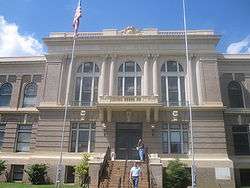
DeSoto Parish Courthouse in Mansfield | ||
| ||
 Location in the U.S. state of Louisiana | ||
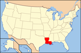 Louisiana's location in the U.S. | ||
| Founded | 1843 | |
| Named for | settler, Marcel DeSoto | |
| Seat | Mansfield | |
| Largest city | Mansfield | |
| Area | ||
| • Total | 895 sq mi (2,318 km2) | |
| • Land | 876 sq mi (2,269 km2) | |
| Population | ||
| • (2010) | 26,656 | |
| • Density | 30/sq mi (12/km²) | |
| Congressional district | 4th | |
| Time zone | Central: UTC-6/-5 | |
| Website |
www | |

DeSoto Parish (French: Paroisse DeSoto) is a parish located in the U.S. state of Louisiana. As of the 2010 census, the population was 26,656.[1] Its seat is Mansfield.[2] The parish was formed in 1843.[3]
DeSoto Parish is part of the Shreveport–Bossier City, LA Metropolitan Statistical Area.
History
It is a typical misconception that the parish was named after Hernando de Soto, the Spaniard who explored the future southeastern United States and discovered and named the Mississippi River.[4] The parish was in fact named after the unrelated Marcel DeSoto, who led the first group of European settlers there, to a settlement historically known as Bayou Pierre.[5] The parish's name is also commonly misspelled following the explorer's name as "De Soto Parish," but it is properly spelled following the settler's name as "DeSoto Parish."[6]
The Battle of Mansfield was fought in DeSoto Parish on April 8, 1864. General Alfred Mouton was killed in the fighting, but his position was carried forward by Prince de Polignac, a native of France. The battle is commemorated at the Mansfield State Historic Site four miles south of Mansfield off Louisiana Highway 175. The Confederate victory prevented a planned Union invasion thereafter of Texas.[7] Mansfield, also known as the Battle of Sabine Crossroads, a Confederate victory, occurred with one year and one day left in the duration of the war. Mansfield was quickly followed by the Battle of Pleasant Hill to the south.[8]
Geography
According to the U.S. Census Bureau, the parish has a total area of 895 square miles (2,320 km2), of which 876 square miles (2,270 km2) is land and 19 square miles (49 km2) (2.1%) is water.[9]
Major highways
 Interstate 49
 Future Interstate 69
 U.S. Highway 84
 U.S. Highway 171
 U.S. Highway 371
 Louisiana Highway 5
Adjacent parishes
- Caddo Parish (north)
- Red River Parish (east)
- Natchitoches Parish (southeast)
- Sabine Parish (south)
- Shelby County, Texas (southwest)
- Panola County, Texas (west)
National protected area
Demographics
| Historical population | |||
|---|---|---|---|
| Census | Pop. | %± | |
| 1850 | 8,023 | — | |
| 1860 | 13,298 | 65.7% | |
| 1870 | 14,962 | 12.5% | |
| 1880 | 15,603 | 4.3% | |
| 1890 | 19,860 | 27.3% | |
| 1900 | 25,063 | 26.2% | |
| 1910 | 27,689 | 10.5% | |
| 1920 | 29,376 | 6.1% | |
| 1930 | 31,016 | 5.6% | |
| 1940 | 31,803 | 2.5% | |
| 1950 | 24,398 | −23.3% | |
| 1960 | 24,248 | −0.6% | |
| 1970 | 22,764 | −6.1% | |
| 1980 | 25,727 | 13.0% | |
| 1990 | 25,346 | −1.5% | |
| 2000 | 25,494 | 0.6% | |
| 2010 | 26,656 | 4.6% | |
| Est. 2015 | 27,052 | [10] | 1.5% |
| U.S. Decennial Census[11] 1790-1960[12] 1900-1990[13] 1990-2000[14] 2010-2013[1] | |||
As of the census[15] of 2010, there were 32,000 people, 12,562 households, and 7,012 families residing in the parish. The population density was 29 people per square mile (11/km²). There were 11,204 housing units at an average density of 13 per square mile (5/km²). The racial makeup of the parish was 56.97% White, 38.16% Black or African American, 0.82% Native American, 0.41% Asian, 0.15% Pacific Islander, 0.54% from other races, and 0.66% from two or more races. 2.85% of the population were Hispanic or Latino of any race.
There were 9,691 households out of which 33.50% had children under the age of 18 living with them, 48.70% were married couples living together, 18.60% had a female householder with no husband present, and 28.10% were non-families. 25.40% of all households were made up of individuals and 11.60% had someone living alone who was 65 years of age or older. The average household size was 2.60 and the average family size was 3.11.
In the parish the population was spread out with 28.40% under the age of 18, 8.30% from 18 to 24, 26.30% from 25 to 44, 23.00% from 45 to 64, and 14.10% who were 65 years of age or older. The median age was 36 years. For every 100 females there were 90.80 males. For every 100 females age 18 and over, there were 87.00 males.
The median income for a household in the parish was $28,252, and the median income for a family was $33,196. Males had a median income of $30,780 versus $20,182 for females. The per capita income for the parish was $13,606. About 21.00% of families and 25.10% of the population were below the poverty line, including 33.80% of those under age 18 and 24.90% of those age 65 or over.
Education
Public schools in DeSoto Parish are operated by the DeSoto Parish School Board.
Communities

City
- Mansfield (parish seat)
Towns
Villages
Unincorporated communities
Notable people
- Larry Bagley (1949- ), incoming Republican member of the Louisiana House of Representatives for Caddo, Desoto, and Sabine parishes
- Terry Bradshaw (1948-), professional football player, sportscaster, singer, and actor
- Richard Burford (1946-), current Louisiana state representative
- Vida Blue (1949-), professional baseball player
- C.L. Bryant (born 1956), Baptist minister and radio talk show host
- Riemer Calhoun (1909-1994), state senator from 1944 to 1952 for DeSoto and Caddo parishes
- Joe T. Cawthorn (1911-1967), state senator from 1940 to 1944 for DeSoto and Caddo parishes
- Sherri Smith Cheek Buffington (1966-), Louisiana State Senator
- Joe Henry Cooper (1920–1980), Louisiana state representative
- Kenny Ray Cox (born 1957), Louisiana state representative and former United States Army officer
- Milton Joseph Cunningham (1842-1916), Natchitoches and New Orleans lawyer, state senator from Natchitoches and DeSoto parishes from 1880 to 1884; state attorney general for three nonconsecutive terms ending in 1900, born in what became DeSoto Parish
- George Dement (1922-2014), mayor of Bossier City
- John H. Eastman (1861-1938), mayor of Shreveport
- Joseph Barton Elam (1821–1885), United States Representative from Louisiana's 4th congressional district
- William J. Fleniken (1908-1979), U.S. attorney and state 1st Judicial District Court judge in Shreveport; born in DeSoto Parish[16]
- William Pike Hall, Sr. (1896-1945), state senator for Caddo and DeSoto parishes, 1924-1932, Shreveport attorney[17]
- John Spencer Hardy (1913-2012), United States Air Force lieutenant general
- Albert Lewis (1960-), professional football player
- Walter M. Lowrey (1921-1980), historian at Centenary College of Louisiana
- Garnie W. McGinty (1900-1984), historian at Louisiana Tech University and school principal
- O. E. Price (1924-2006), state appeals court judge
- Mack Charles Reynolds (1935–1991), professional football player
- B. H. "Johnny" Rogers (1905-1977), politician
- C. O. Simpkins, Sr. (born 1925 in Mansfield), African-American state representative, dentist, and civil rights activist in Shreveport[18]
- O.C. Smith (1932–2001), singer
- Curtis W. McCoy City Of Mansfield Mayor
See also
References
- 1 2 "State & County QuickFacts". United States Census Bureau. Retrieved August 9, 2013.
- ↑ "Find a County". National Association of Counties. Retrieved 2011-06-07.
- ↑ "DeSoto Parish". http://www.sfasu.edu. Center for Regional Heritage Research. Retrieved September 3, 2014. External link in
|website=(help) - ↑ Gannett, Henry (1905). The Origin of Certain Place Names in the United States. Govt. Print. Off. p. 105.
- ↑ Means, Emilia Gay Griffith, and Liz Chrysler. DeSoto Parish. Arcadia Publishing, 2011, p. 8.
- ↑ http://www.desotoparishclerk.org/
- ↑ Brochure, Mansfield State Historic Site, 15149 Highway 175, Mansfield, Louisiana 71052
- ↑ John D. Winters, The Civil War in Louisiana, Baton Rouge: Louisiana State University Press, 1963, ISBN 0-8071-0834-0, pp. 340-347
- ↑ "2010 Census Gazetteer Files". United States Census Bureau. August 22, 2012. Retrieved August 27, 2014.
- ↑ "County Totals Dataset: Population, Population Change and Estimated Components of Population Change: April 1, 2010 to July 1, 2015". Retrieved July 2, 2016.
- ↑ "U.S. Decennial Census". United States Census Bureau. Retrieved August 27, 2014.
- ↑ "Historical Census Browser". University of Virginia Library. Retrieved August 27, 2014.
- ↑ "Population of Counties by Decennial Census: 1900 to 1990". United States Census Bureau. Retrieved August 27, 2014.
- ↑ "Census 2000 PHC-T-4. Ranking Tables for Counties: 1990 and 2000" (PDF). United States Census Bureau. Retrieved August 27, 2014.
- ↑ "American FactFinder". United States Census Bureau. Retrieved 2008-01-31.
- ↑ "Retired Caddo district judge dies at 70, The Shreveport Times, May 6, 1979, p. 16-A
- ↑ "Funeral for Pike Hall at 11 A.M. Today – Prominent Attorney, Civic Leader Succumbs After Brief Illness". The Shreveport Times. December 17, 1945. pp. 1, 6. Retrieved March 26, 2015.
- ↑ "C. O. Simpkins, Sr.: Civil Rights Champion". cosimpkins.com. Retrieved September 1, 2015.
Further reading
- De Vries, Mark Leon, “Between Equal Justice and Racial Terror: Freedpeople and the District Court of DeSoto Parish during Reconstruction,” Louisiana History, 56 (Summer 2015), 261–93.
- Water Resources of De Soto Parish, Louisiana United States Geological Survey
External links
 |
Caddo Parish | | ||
| Panola County, Texas | |
Red River Parish | ||
| ||||
| | ||||
| Shelby County, Texas | Sabine Parish | Natchitoches Parish |
Municipalities and communities of DeSoto Parish, Louisiana, United States | ||
|---|---|---|
| City | | |
| Towns | ||
| Villages | ||
| CDPs | ||
| Other unincorporated communities | ||
Coordinates: 32°04′N 93°44′W / 32.06°N 93.74°W