Dayton, Texas
| City of Dayton | |
|---|---|
| City | |
 Location in the state of Texas | |
 | |
| Coordinates: 30°03′23″N 94°53′44″W / 30.05639°N 94.89556°WCoordinates: 30°03′23″N 94°53′44″W / 30.05639°N 94.89556°W | |
| Country | United States |
| State | Texas |
| County | Liberty |
| Incorporated | May 3, 1911 |
| Government | |
| • Mayor | Jeff Lambright |
| Area | |
| • Total | 11 sq mi (28.6 km2) |
| • Land | 11.0 sq mi (28.6 km2) |
| • Water | 0.0 sq mi (0.0 km2) |
| Elevation | 73 ft (22.3 m) |
| Population (2010)[1] | |
| • Total | 7,242 |
| • Density | 517.1/sq mi (199.7/km2) |
| Time zone | CST (UTC-6) |
| • Summer (DST) | CDT (UTC-5) |
| ZIP code | 77535 |
| Area code(s) | 936 |
| FIPS code | 48-19432[2] |
| GNIS feature ID | 1334116[3] |
Dayton is a city in Liberty County, Texas, United States. The population was 7,242 at the 2010 census.
Geography
According to the United States Census Bureau, the city has a total area of 11.0 square miles (28 km2), all land.
Demographics
| Historical population | |||
|---|---|---|---|
| Census | Pop. | %± | |
| 1880 | 348 | — | |
| 1930 | 1,207 | — | |
| 1940 | 1,279 | 6.0% | |
| 1950 | 1,820 | 42.3% | |
| 1960 | 3,367 | 85.0% | |
| 1970 | 3,804 | 13.0% | |
| 1980 | 4,908 | 29.0% | |
| 1990 | 5,151 | 5.0% | |
| 2000 | 5,709 | 10.8% | |
| 2010 | 7,242 | 26.9% | |
| Est. 2015 | 7,575 | [4] | 4.6% |
As of the census[2] of 2010, there were 7,242 people, 2,663 households and 1,893 families in the city. The racial makeup of the population was 70.4% white, 18.2% black or African American, 1.3% Asian, 7.9% from other races and 2.2% from two or more races. 13.8% of the population was Hispanic or Latino of any race.[6]
As of the census[2] of 2000, there were 5,709 people, 2,129 households, and 1,517 families residing in the city. The population density was 517.1 people per square mile (199.7/km²). There were 2,371 housing units at an average density of 214.8 per square mile (82.9/km²). The racial makeup of the city was 71.08% White, 19.69% African American, 0.44% Native American, 0.68% Asian, 0.04% Pacific Islander, 6.67% from other races, and 1.40% from two or more races. Hispanic or Latino of any race were 10.53% of the population.
There were 2,129 households out of which 37.4% had children under the age of 18 living with them, 50.5% were married couples living together, 16.4% had a female householder with no husband present, and 28.7% were non-families. 25.2% of all households were made up of individuals and 12.1% had someone living alone who was 65 years of age or older. The average household size was 2.66 and the average family size was 3.18.
In the city the population was spread out with 30.0% under the age of 18, 9.7% from 18 to 24, 28.2% from 25 to 44, 20.2% from 45 to 64, and 12.0% who were 65 years of age or older. The median age was 33 years. For every 100 females there were 89.3 males. For every 100 females age 18 and over, there were 87.4 males.
The median income for a household in the city was $37,401, and the median income for a family was $47,250. Males had a median income of $39,075 versus $21,068 for females. The per capita income for the city was $16,139. About 16.3% of families and 21.3% of the population were below the poverty line, including 33.6% of those under age 18 and 15.8% of those age 65 or over.
History
Dayton, on U.S. Highway 90 six miles west of Liberty in southwestern Liberty County, was first called West Liberty and was considered part of the original town of Liberty, founded in 1831. The Trinity River divided the two parts of the town: Liberty was on its east bank, and West Liberty was on a hill three miles west of the river. A new road and a ferry directly connected the two. Both parts of the town were located on the four-league Mexican land grant appropriated for the capital of the old municipality of Santísima Trinidad de la Libertad, which later became known as Liberty. The postmaster of West Liberty from March 25, 1839, through September 15, 1841, was A. Thouvenin, probably the same man as Arnold Thouvenin, who obtained a quarter-league Mexican land grant in Polk County in April 1835. The West Liberty post office was apparently discontinued after a few years. Land was designated for a school in 1847. The schoolhouse was accepted on December 31, 1853, by the board of trustees of the Corporation of the Town of Liberty. Also in 1853, A. N. B. Thompson was authorized to survey and plat the town of West Liberty. During the Civil War, thirty-three ladies of West Liberty wrote to Governor Francis R. Lubbock in January 1863, petitioning him to relieve Mr. Sol Andrews of his military duties so that he might continue his vocation of manufacturer of looms and spinning wheels, as cloth for clothing was desperately needed.
Sometime after 1854, West Liberty also became known as Day's Town, for I. C. Day, a wealthy landowner who resided just to the south of the town on the Munson league. The flag stop for the Texas and New Orleans Railroad, completed in 1860, was known variously as West Liberty, Days Station, and Dayton Station. The name Dayton was applied to the local post office in 1877, though the official name of the town remained West Liberty until the mid-1880s. In 1885 Dayton reported a population of sixty, and in 1890 a post office, a school, and two churches served its 239 residents. The single room schoolhouse has been preserved by the historical society.

Lumbering and cattle raising were the chief industries until James E. Berry helped establish a drainage system to make rice a major crop. American Rice Growers Association, and Seaberg Rice Industrial campus still harvest rice crops coming from as far as the Anahuac areas of SouthEast Texas.
Texas governor Marion Price Daniel, Sr., was born in Dayton on October 10, 1910; his brother Bill Daniel, governor of the United States Territory of Guam from 1961 through 1963, was born in Dayton on November 20, 1915. The Daniel brothers were grandsons of General Sam Houston[7] who had led victory for the Republic of Texas independence in 1836. By 1910, the town had a bank, two cotton gins, a weekly newspaper, and 2,500 inhabitants. Dayton was recorded as an incorporated municipality on May 3, 1911. The mayor was W. M. Babcock, and aldermen were W. T. Jamison, J. H. Marshall, J. A. Coleman, and J. D. Spear. Town records indicate that the community was reincorporated in 1925. Oil development during the 1920s brought new industries. By 1940 Dayton reported 1,207 residents and seventy businesses and was listed as a railroad center. The population increased steadily from 3,367 in 1965 to 6,201 in 1988. In 1989 the largest school population in the county made the Dayton Independent School District the major employer in the city. At that time Dayton operated under a mayor-council form of city government. In 1990 Dayton had a population of 5,151, and in 2000 the population was 5,709.

Government and infrastructure
The Texas Department of Criminal Justice (TDCJ) operates the Dayton District Parole Office in Dayton.[8] In addition, the TDCJ operates some correctional facilities in the City limits of Dayton. The L.V. Hightower Unit prison and the Dempsie Henley Unit and Lucille G. Plane Unit jails are 4 miles (6.4 km) north of the downtown area of Dayton.[9][10][11]
The United States Postal Service operates the Dayton Post Office.[12]
The District 18 seat in the Texas House of Representatives has been held since 2005 by the Republican John Otto, a Certified Public Accountant from Dayton.
Transportation
Highways
The major route passing through Dayton is U.S. Highway 90, traveling west towards Crosby and Houston and east into East Texas to Beaumont and onward to Louisiana. SH 321 connects Dayton to Cleveland. Within the city of Dayton, SH 321 is referred to as North Cleveland Street, passing through residential Dayton as a four-lane urban highway, before narrowing back down to a two-lane rural State Highway going north to Cleveland. SH 146 provides Dayton with a connection to Baytown, and FM 1960 connects Dayton to the northern reaches of Houston as well as Humble and Huffman.
Railroads
Dayton is the meeting point of two rail lines. One is a north/south Union Pacific (UP) line that comes out of Baytown called the UP Baytown Subdivision. The other is the east/west UP Lafayette Subdivision line that roughly follows US 90. The BNSF has authority to operate its trains on the Baytown Subdivision from Dayton to just west of Baytown and has a rail yard just south of Dayton. Another rail line runs through the northern edge of the city, called the UP Beaumont Subdivision. A study is being performed by the Texas Department of Transportation regarding a Dayton-to-Cleveland single mainline rail corridor consisting of approximately 40 miles of track connecting the UP Lufkin Subdivision and the BNSF Conroe Subdivision near Cleveland to the UPRR Baytown Subdivision south of Dayton.
Education
The city of Dayton is served by the Dayton Independent School District.
UFO incident
Dayton was the site of a reported UFO incident on December 29, 1980 at 9:00 p.m. local time in which three people insist they were irradiated by a UFO.
Climate
The climate in this area is characterized by hot, humid summers and generally mild to cool winters. According to the Köppen Climate Classification system, Dayton has a humid subtropical climate, abbreviated "Cfa" on climate maps.[13]
References
- ↑ "US Census Bureau Population Finder: Baytown city, TX". factfinder.census.gov. Retrieved 2007-07-01.
- 1 2 3 "American FactFinder". United States Census Bureau. Retrieved 2008-01-31.
- ↑ "US Board on Geographic Names". United States Geological Survey. 2007-10-25. Retrieved 2008-01-31.
- ↑ "Annual Estimates of the Resident Population for Incorporated Places: April 1, 2010 to July 1, 2015". Retrieved July 2, 2016.
- ↑ "Census of Population and Housing". Census.gov. Retrieved June 4, 2015.
- ↑ 2010 general profile of population and housing characteristics from the US census for Dayton
- ↑ "Texas Giant: The Life of Price Daniel", by Dan Murph ISBN 978-1-57168-571-1
- ↑ "Parole Division Region III." Texas Department of Criminal Justice. Retrieved on May 15, 2010.
- ↑ "Hightower Unit." Texas Department of Criminal Justice. Retrieved on May 10, 2010.
- ↑ "Henley Unit." Texas Department of Criminal Justice. Retrieved on May 10, 2010.
- ↑ "Plane Unit." Texas Department of Criminal Justice. Retrieved on May 10, 2010.
- ↑ "Post Office Location - DAYTON." United States Postal Service. Retrieved on May 16, 2010.
- ↑ Climate Summary for Dayton, Texas
External links
- www.dayton-online.com - Dayton's Online Community.
- www.unsolved.com/Unexplained/UFO - Television show that had shown this UFO Incident.
- www.texasmonthly.com/ranch/ufo/dayton.php - More on this UFO incident.
- http://ufo.whipnet.org/xdocs/Cash.Landrum/Piney.Woods.html - another source concerning this UFO incident.
| Counties | 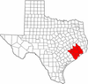 | |
|---|---|---|
| "Principal" cities | ||
| Other cities |
For a complete listing, see list of cities and towns in Houston–The Woodlands–Sugar Land MSA | |
| Unincorporated areas | ||
| Bodies of water | ||
Municipalities and communities of Liberty County, Texas, United States | ||
|---|---|---|
| Cities |  | |
| Town | ||
| CDPs |
| |
| Other unincorporated communities | ||
| Footnotes | ‡This populated place also has portions in an adjacent county or counties | |