Darlington Covered Bridge
|
Darlington Covered Bridge | |
|
Darlington Covered Bridge, March 2008 | |
  | |
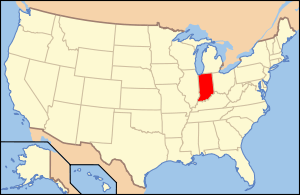
| Location | County Roads 500N and 500E over Sugar Creek, west of Darlington, Franklin Township, Montgomery County, Indiana |
|---|---|
| Coordinates | 40°6′29″N 86°47′37″W / 40.10806°N 86.79361°WCoordinates: 40°6′29″N 86°47′37″W / 40.10806°N 86.79361°W |
| Area | less than one acre |
| Built | 1868 |
| Built by | Smith Bridge Co.; Et al. |
| Architectural style | Howe truss |
| NRHP Reference # | 90001782[1] |
| Added to NRHP | November 28, 1990 |
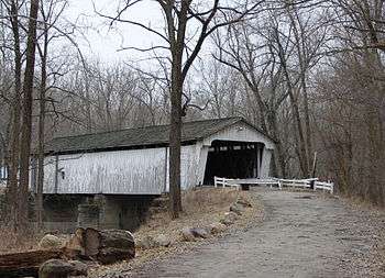
Darlington Covered Bridge is a historic covered bridge located in Franklin Township, Montgomery County, Indiana. It was built in 1868, and is a single span, Howe truss covered bridge that spans Sugar Creek. It measures 166 feet long and has an overall width of 22 feet.[2]:2
It was listed on the National Register of Historic Places in 1990.[1]
References
- 1 2 National Park Service (2010-07-09). "National Register Information System". National Register of Historic Places. National Park Service.
- ↑ "Indiana State Historic Architectural and Archaeological Research Database (SHAARD)" (Searchable database). Department of Natural Resources, Division of Historic Preservation and Archaeology. Retrieved 2016-05-01. Note: This includes Nancy Carol Crull (October 1989). "National Register of Historic Places Inventory Nomination Form: Darlington Covered Bridge" (PDF). Retrieved 2016-05-01. and Accompanying photographs.

This article is issued from Wikipedia - version of the 12/2/2016. The text is available under the Creative Commons Attribution/Share Alike but additional terms may apply for the media files.