Damascus, Georgia
| Damascus, Georgia | |
|---|---|
| City | |
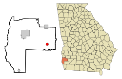 Location in Early County and the state of Georgia | |
| Coordinates: 31°17′55″N 84°43′3″W / 31.29861°N 84.71750°WCoordinates: 31°17′55″N 84°43′3″W / 31.29861°N 84.71750°W | |
| Country | United States |
| State | Georgia |
| County | Early |
| Area | |
| • Total | 1.77 sq mi (4.58 km2) |
| • Land | 1.76 sq mi (4.56 km2) |
| • Water | 0.008 sq mi (0.02 km2) |
| Elevation | 220 ft (67 m) |
| Population (2010) | |
| • Total | 254 |
| • Density | 144/sq mi (55.7/km2) |
| Time zone | Eastern (EST) (UTC-5) |
| • Summer (DST) | EDT (UTC-4) |
| ZIP codes | 31741, 39841 |
| Area code(s) | 229 |
| FIPS code | 13-21436[1] |
| GNIS feature ID | 0355426[2] |
Damascus is a city in Early County, Georgia, United States. The population was 254 at the 2010 census.[3]
Geography
Damascus is located in eastern Early County at 31°17′55″N 84°43′3″W / 31.29861°N 84.71750°W (31.298580, -84.717429).[4] Georgia State Route 45 passes through the community, leading north 10 miles (16 km) to Arlington and south 9 miles (14 km) to Colquitt. Georgia State Route 200 also passes through the center of town, leading east 24 miles (39 km) to Newton and northwest 15 miles (24 km) to Blakely, the Early County seat.
According to the United States Census Bureau, Damascus has a total area of 1.8 square miles (4.6 km2), of which 0.01 square miles (0.02 km2), or 0.48%, is water.[3]
Demographics
| Historical population | |||
|---|---|---|---|
| Census | Pop. | %± | |
| 1910 | 413 | — | |
| 1920 | 373 | −9.7% | |
| 1930 | 436 | 16.9% | |
| 1940 | 477 | 9.4% | |
| 1950 | 402 | −15.7% | |
| 1960 | 297 | −26.1% | |
| 1970 | 272 | −8.4% | |
| 1980 | 403 | 48.2% | |
| 1990 | 290 | −28.0% | |
| 2000 | 277 | −4.5% | |
| 2010 | 254 | −8.3% | |
| Est. 2015 | 238 | [5] | −6.3% |
As of the census[1] of 2000, there were 277 people, 100 households, and 74 families residing in the town. The population density was 157.6 people per square mile (60.8/km²). There were 115 housing units at an average density of 65.4 per square mile (25.2/km²). The racial makeup of the town was 36.10% White, 63.54% African American, and 0.36% from two or more races.
There were 100 households out of which 31.0% had children under the age of 18 living with them, 41.0% were married couples living together, 24.0% had a female householder with no husband present, and 26.0% were non-families. 19.0% of all households were made up of individuals and 12.0% had someone living alone who was 65 years of age or older. The average household size was 2.77 and the average family size was 3.16.
In the town the population was spread out with 30.3% under the age of 18, 8.3% from 18 to 24, 27.8% from 25 to 44, 21.7% from 45 to 64, and 11.9% who were 65 years of age or older. The median age was 34 years. For every 100 females there were 93.7 males. For every 100 females age 18 and over, there were 87.4 males.
The median income for a household in the town was $28,333, and the median income for a family was $19,318. Males had a median income of $31,500 versus $19,286 for females. The per capita income for the town was $12,583. About 31.4% of families and 23.5% of the population were below the poverty line, including 20.3% of those under the age of eighteen and 61.9% of those 65 or over.
Entertainment
Damascus is home to the Briar Patch Music Festival, started by Jeb Tabb in 2010. The first festival was attended by an estimated 300 people and has grown to feature national acts and close to 700 attendants. The festival usually occurs the last weekend in May.
Damascus is also home to the Powerline Bar and Grill, which features bands almost every weekend from all parts of the eastern US.
Education
Damascus is home to Southwest Georgia Academy, which began in 1970 and participates in the Georgia Independent School Association.
References
- 1 2 "American FactFinder". United States Census Bureau. Archived from the original on September 11, 2013. Retrieved 2008-01-31.
- ↑ "US Board on Geographic Names". United States Geological Survey. 2007-10-25. Retrieved 2008-01-31.
- 1 2 "Geographic Identifiers: 2010 Demographic Profile Data (G001): Damascus city, Georgia". American Factfinder. U.S. Census Bureau. Retrieved January 26, 2016.
- ↑ "US Gazetteer files: 2010, 2000, and 1990". United States Census Bureau. 2011-02-12. Retrieved 2011-04-23.
- ↑ "Annual Estimates of the Resident Population for Incorporated Places: April 1, 2010 to July 1, 2015". Retrieved July 2, 2016.
- ↑ "Census of Population and Housing". Census.gov. Archived from the original on May 11, 2015. Retrieved June 4, 2015.
External links
- Blakely-Early County Chamber of Commerce Includes the City of Damascus and other cities in Early County
- Southwest Georgia Academy(SGA) a Private School in this Community and its Adjoining Counties by Georgia Independent School Association (GISA)
- Centerville United Methodist Church historical marker (side 1)
- Centerville United Methodist Church historical marker (side 2)
Municipalities and communities of Early County, Georgia, United States | ||
|---|---|---|
| Cities | 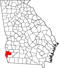 | |
| CDP | ||
| Unincorporated community | ||
| Footnotes | ‡This populated place also has portions in an adjacent county or counties | |