ad-Dhahiriya
| ad-Dhahiriya | |
|---|---|
| Other transcription(s) | |
| • Arabic | الظاهرية |
| • Also spelled |
al-Dhahiriya (official) az-Zahiriya (unofficial) |
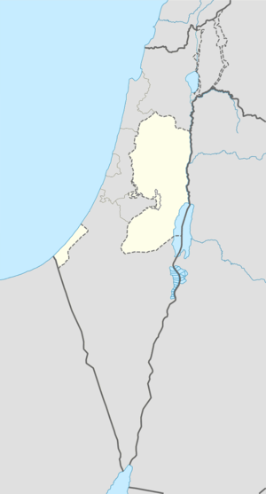 ad-Dhahiriya Location of ad-Dhahiriya within the Palestinian territories | |
| Coordinates: 31°24′27.44″N 34°58′20.28″E / 31.4076222°N 34.9723000°ECoordinates: 31°24′27.44″N 34°58′20.28″E / 31.4076222°N 34.9723000°E | |
| Palestine grid | 147/090 |
| Governorate | Hebron |
| Government | |
| • Type | City |
| Population (2016) | |
| • Jurisdiction | 38,002 |
| Name meaning | "The village on the ridge"[1] |
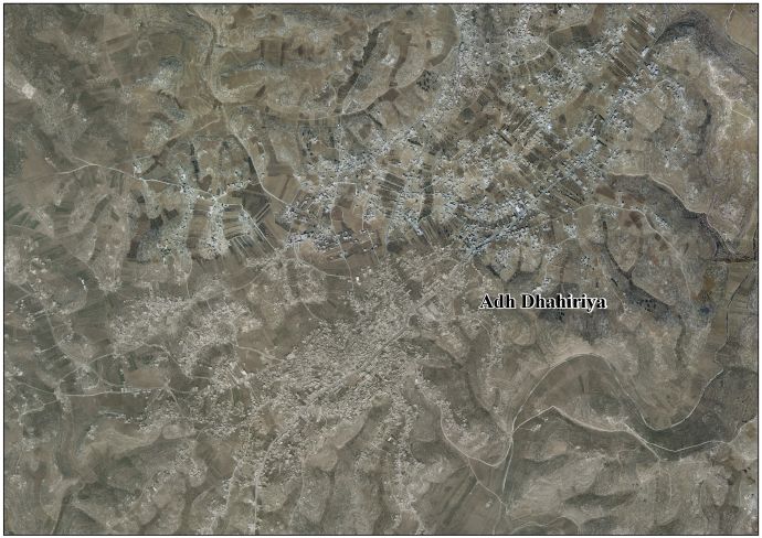
ad-Dhahiriya (also az-Zahiriya) (Arabic: الظاهرية) is a Palestinian city in the Hebron Governorate, 23 km southwest of the city of Hebron in the southern West Bank. According to the Palestinian Central Bureau of Statistics, ad-Dhahiriya had a population of 38.002 in 2016.[2]
History

According to Conder and Kitchener Ad-Dhahiriya was probably the site of the ancient biblical town of Debir.[3] They found the village undermined by caves. In the centre of Ad-Dhahiriya was a tower, which appeared to be from before the Crusader era, possibly from early Christian or Roman period.[4]
Local tradition, supported by archaeology, have that ad-Dhahiriya was founded by Baibars (†1277).[5]
Ottoman period
In 1856, a Scottish clergyman, Horatius Bonar described the village and its ruined castle: "Suddenly, at an abrupt elbow of the ravine, we are relieved by seeing the old castle, perched on its rocky height well in the setting sun; the poor village, which seems to hang about it, with its square yellow huts, rather helps, at this distance, to improve its appearance, and to give dignity to its towers and broken ramparts. From this point it looks much bolder and substantial than it is; not so isolated as El-Aujeh, which we passed some days ago, but well-set upon yon craggy perch. Like most of its fellow castles in the east and border “peels” in the north, it has seen better days, and has at one time, been a noble stronghold for Romans, or Crusaders, or Turks…"[6]
In 1863 the French explorer Victor Guérin visited the place, and found that many of the men had fled, mostly further south in tents, in order to avoid conscription. He noted one building, measuring sixteen steps on each side which was built in beautiful stone. It contained several vaulted chambers, and was the home of one of the sheikhs of the village. Several other private houses were also built with fine materials, from old buildings; some even seemed to date, either entirely or only in their lower courses from the Roman period.[7]
According to the Palestine Exploration Fund's Survey of Western Palestine, the village had a population of 300-400 in 1874. In 1877, it was deserted due to "encroachment of the Arabs into the country of the fellahin".[3]
British Mandate era
In a census conducted in 1922 by the British Mandate authorities, Ad-Dhahiriya (called: AI Dahriyeh) had an entirely Muslim population of 2,266 inhabitants.[8] increasing in the 1931 census to 2930, still all Muslim, in 603 houses.[9]
In 1945 the population of Ad-Dhahiriya was 3,760, all Arabs, who owned 60,585 dunams of land according to an official land and population survey.[10] 166 dunams were plantations and irrigable land, 54,205 for cereals,[11] while 284 dunams were built-up (urban) land.[12]
Modern era
In the wake of the 1948 Arab–Israeli War, and after the 1949 Armistice Agreements, Ad-Dhahiriya came under Jordanian rule.The first village council was established in 1963.
Since the Six-Day War in 1967, Ad-Dhahiriya has been under Israeli occupation. The population in the 1967 census conducted by the Israeli authorities was 4,875.[13]
In 1996, the Palestinian Authority appointed a municipal council. In 2004, a 13-member council was elected with paid employees.[14]
The primary health care facilities for the municipality are designated by the Ministry of Health as level 3.[15]
According to the Office for the Coordination of Humanitarian Affairs (OCHA), the entrance to the village was closed by an IDF earth mound on 14 April 2005, forcing all Palestinians in the area to travel via Dura.[16]
References
- ↑ Palmer, 1881, p. 429
- ↑ 'Localities in Hebron Governorate by Type of Locality and Population Estimates, 2007-2016 ,' Palestinian Central Bureau of Statistics, 2016.
- 1 2 Conder and Kitchener, 1883, SWP III, p. 402
- ↑ Conder and Kitchener, 1883, SWP III, pp. 406-408
- ↑ Pringle, 1997, p. 47
- ↑ Bonar, 1858, p. 32
- ↑ Guérin, 1869, pp. 361, 367-368
- ↑ Barron, 1923, Table V, p. 10
- ↑ Mills, 1932, p. 28.
- ↑ Government of Palestine, Department of Statistics. Village Statistics, April, 1945. Quoted in Hadawi, 1970, p. 50
- ↑ Government of Palestine, Department of Statistics. Village Statistics, April, 1945. Quoted in Hadawi, 1970, p. 93
- ↑ Government of Palestine, Department of Statistics. Village Statistics, April, 1945. Quoted in Hadawi, 1970, p. 143
- ↑ Perlmann, Joel (November 2011 – February 2012). "The 1967 Census of the West Bank and Gaza Strip: A Digitized Version" (PDF). Levy Economics Institute. Retrieved 24 June 2016.
- ↑ The priorities and needs for development in Adh Dhahiriya town based on the community and local authorities’ assessment
- ↑ West Bank Health care
- ↑ OCHA Weekly Briefing Notes Update for oPt (13–19 April 2005)
Bibliography
| Wikimedia Commons has media related to Ad-Dhahiriya. |
- Barron, J. B., ed. (1923). Palestine: Report and General Abstracts of the Census of 1922. Government of Palestine.
- Bonar, Horatius (1858). The land of promise; notes of a Spring-journey from Beersheba to Sidon. New York: R. Carter & Brothers.
- Conder, Claude Reignier; Kitchener, H. H. (1883). The Survey of Western Palestine: Memoirs of the Topography, Orography, Hydrography, and Archaeology. 3. London: Committee of the Palestine Exploration Fund. (+special papers p. 36)
- Guérin, Victor (1869). Description Géographique Historique et Archéologique de la Palestine (in French). 1: Judee, pt. 3. Paris: L'Imprimerie Nationale.
- Hadawi, Sami (1970). Village Statistics of 1945: A Classification of Land and Area ownership in Palestine. Palestine Liberation Organization Research Center.
- Mills, E., ed. (1932). Census of Palestine 1931. Population of Villages, Towns and Administrative Areas. Jerusalem: Government of Palestine.
- Palmer, E. H. (1881). The Survey of Western Palestine: Arabic and English Name Lists Collected During the Survey by Lieutenants Conder and Kitchener, R. E. Transliterated and Explained by E.H. Palmer. Committee of the Palestine Exploration Fund.
- Pringle, Denys (1997). Secular buildings in the Crusader Kingdom of Jerusalem: an archaeological Gazetter. Cambridge University Press. ISBN 0521 46010 7.
- Rajab, Jehan S. (1989). Palestinian Costume, London: Kegan Paul International. ISBN 0-7103-0283-5 contains several striking costumes from Ad-Dhahiriya reproduced from the Rajab Collection, Kuwait.
External links
- Welcome To The City of al-Dhahiriya
- Survey of Western Palestine, Map 25: IAA, Wikimedia commons
- Adh Dhahiriya Town (Fact Sheet)
- Dhahiriya Town Profile
- Dhahiriya aerial photo
- The priorities and needs for development in Adh Dhahiriya town based on the community and local authorities’ assessment
| Cities |
|  |
|---|---|---|
| Towns |
| |
| Villages |
| |
| Refugee camps | ||