Crown Prince Frederick Range
| Crown Prince Frederick Range | |
|---|---|
| Kronprins Frederik Bjerge | |
 Defense Mapping Agency map of Greenland detail showing the area of the range. | |
| Highest point | |
| Elevation | 3,256 m (10,682 ft) |
| Dimensions | |
| Length | 120 km (75 mi) NE/SW |
| Width | 40 km (25 mi) NW/SE |
| Geography | |
 Location | |
| Country | Greenland |
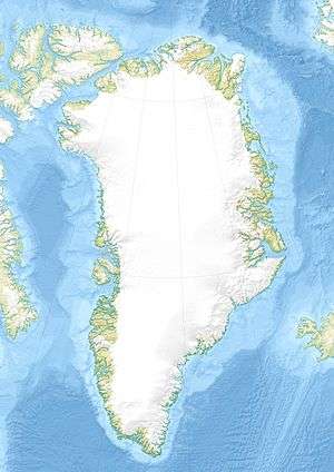
| Range coordinates | 67°30′N 34°40′W / 67.5°N 34.67°WCoordinates: 67°30′N 34°40′W / 67.5°N 34.67°W |
The Crown Prince Frederick Range (Danish: Kronprins Frederik Bjerge)[1] is a large mountain range in King Christian IX Land, eastern Greenland. Administratively this range is part of the Sermersooq Municipality.
History
The Crown Prince Frederick Range was first surveyed by Sir Martin Lindsay in 1934 during the British Trans-Greenland Expedition and was named after the Crown Prince Frederick of Denmark (1899 – 1972) who would be crowned King Frederick IX in 1947.[2][3] The expedition crossed Greenland from west to east, and succeeded in fixing the positions of many other important features including Gunnbjørnsfjeld, the highest point in Greenland. On the return journey the team headed south-west to Amassalik and on their journey discovered the extent of the Crown Prince Frederick Range. Lindsay's expedition set a new world record after travelling 1,050 mi (1,690 km) on sleds, 700 of which were through hitherto unexplored territory.[2][4]
Following Martin Lindsay's pioneering venture few expeditions visited the range which remained neglected for many decades.[5] Finally in 1995 the first guided icecap journey through the range was organized[6][7] and the following year, in July and August 1996, a number of the main summits of the range were climbed for the first time by members of the Tangent British East Greenland Expedition, including Paul Walker. The expedition set up its base camp at 67°11′56″N 35°6′30″W / 67.19889°N 35.10833°W and from there climbed a total of 55 peaks.[8][7][9]
Geography
The Crown Prince Frederick Range extends for about 120 km (75 mi) in a northeast-southwest direction between the 67th and the 68th parallel north. It is a vast group of nunataks scattered between the Greenland Ice Sheet and the coast, to the northeast of Mont Forel and southwest of Kangerlussuaq Fjord. The level expanses between the nunatak clusters of the range are permanently covered with ice and snow. The average height of the intermontane areas is between 1,600 m (5,200 ft) and 2,000 m (6,600 ft).[10]
The region of the Crown Prince Frederick Mountains is uninhabited, the nearest settlement being Tasiilaq, located about 175 km to the SSW of the southern end of the range.[1][10]
Mountains
Quite a number of the nunataks have summits that are higher than 3,000 m (9,800 ft). Owing to its remote location the Crown Prince Frederick Range has been somewhat neglected by mountaineers, despite some impressive peaks of good granite, and many peaks are yet unnamed. Redkammen and Panorama Nunatak, located at the northern end, are sometimes included as part of the range.[11]
- Peak (3,256 m) and highest point at 67°3′57″N 35°34′50″W / 67.06583°N 35.58056°W[10]
- Peak (3,153 m) at 67°7′5″N 36°14′8″W / 67.11806°N 36.23556°W[10]
- Peak (3,127 m) at 67°0′15″N 35°52′13″W / 67.00417°N 35.87028°W, highest rocky peak of a massive nunatak with many peaks, including a 3,069 m high summit 1.3 km to the west.[10]
- Peak (3,108 m) at 67°3′3″N 35°44′47″W / 67.05083°N 35.74639°W, the spectacular central summit of a nunatak with three peaks.[10]
- Peak (3,092 m) at 67°9′23″N 35°36′9″W / 67.15639°N 35.60250°W[10]
- Peak (3,088 m) at 67°8′39″N 35°44′33″W / 67.14417°N 35.74250°W[10]
- Peak (3,075 m) at 67°4′22″N 36°2′31″W / 67.07278°N 36.04194°W[10]
- Peak (3,056 m) at 67°4′17″N 36°12′59″W / 67.07139°N 36.21639°W[10]
- Peak (3,021 m) at 66°59′20″N 35°34′8″W / 66.98889°N 35.56889°W[10]
- Peak (2,996 m) at 67°6′35″N 35°8′3″W / 67.10972°N 35.13417°W[10]
- Peak (2,995 m) at 67°2′48″N 35°29′4″W / 67.04667°N 35.48444°W[10]
- Peak (2,990 m) at 67°3′52″N 35°55′16″W / 67.06444°N 35.92111°W[10]
- Peak (2,961 m) at 67°4′38″N 35°58′39″W / 67.07722°N 35.97750°W[10]
- Peak (2,948 m) at 67°12′31″N 35°52′23″W / 67.20861°N 35.87306°W[10]
- Peak (2,945 m) at 67°10′18″N 35°26′50″W / 67.17167°N 35.44722°W[10]
- Peak (2,904 m) at 67°6′11″N 35°0′48″W / 67.10306°N 35.01333°W[10]
- Peak (2,897 m) at 67°3′3″N 35°47′6″W / 67.05083°N 35.78500°W[10]
- Peak (2,891 m) at 67°2′16″N 35°43′12″W / 67.03778°N 35.72000°W[10]
- Peak near TBEGE base camp (2,882 m) at 67°13′21″N 35°15′48″W / 67.22250°N 35.26333°W[10]
- Peak (2,830 m) at 66°55′43″N 36°12′14″W / 66.92861°N 36.20389°W[10]
- Peak (2,824 m) at 67°11′22″N 34°59′16″W / 67.18944°N 34.98778°W[10]
- Peak (2,777 m) at 67°0′3″N 35°47′36″W / 67.00083°N 35.79333°W[10]
- Peak (2,542 m) at 67°56′41″N 33°58′45″W / 67.94472°N 33.97917°W[10]
- Peak (2,691 m) at 67°0′15″N 35°48′48″W / 67.00417°N 35.81333°W[10]
- Peak (2,473 m) at 67°56′7″N 33°38′49″W / 67.93528°N 33.64694°W[10]
- Peak (2,465 m) at 67°25′8″N 34°45′38″W / 67.41889°N 34.76056°W[10]
- Peak (2,446 m) at 67°58′10″N 33°50′16″W / 67.96944°N 33.83778°W[10]
- Anniversary Peak (2,440 m)[7]
- Peak (2,425 m) at 68°6′14″N 33°32′23″W / 68.10389°N 33.53972°W[10]
- Peak (2,370 m) at 67°50′40″N 34°10′37″W / 67.84444°N 34.17694°W[10]
- Peak (2,093 m) at 67°24′23″N 34°31′18″W / 67.40639°N 34.52167°W[10]
- Peak (1,831 m) at 67°14′23″N 34°13′25″W / 67.23972°N 34.22361°W[10]
Climate
From the north and from the west the range is fully exposed to the boundless open-sky surface of Greenland’s huge inner ice sheet.[9] As there is no barrier to the shrieking cold winds of the icy expanse, Polar climate prevails in the region.
The average annual temperature in the area of the Crown Prince Frederick Range is -14 °C. The warmest month is July when the average temperature reaches -2 °C and the coldest is March when the temperature sinks to -20 °C.[12]
See also
Further reading
- Lindsay, Martin (1946). Three got through: Memoirs of an Arctic explorer. Falcon Press. p. 262. ASIN B0006ARCC8.
References
- 1 2 "Kronprins Frederik Bjerge". Mapcarta. Retrieved 27 July 2016.
- 1 2 "French Honour For British Explorer", The Times, 12 April 1935.
- ↑ The Development of Mountaineering in East and North-East Greenland An Outline History
- ↑ Sr Martin Lindsay's granddaughter's adventure - The Sunday Times
- ↑ Philip Bartlett, Undiscovered Mountains of the Kronprins Frederiks Bjerge - Alpine Journal
- ↑ Tangent Expedition - Greenland Icecap Crossings
- 1 2 3 1997 American Alpine Journal, p. 222-225
- ↑ Tangent Expedition Reports
- 1 2 North America, Greenland, Kronprins Frederik Bjerge, Various Ascents
- 1 2 3 4 5 6 7 8 9 10 11 12 13 14 15 16 17 18 19 20 21 22 23 24 25 26 27 28 29 30 31 32 33 Google Earth
- ↑ American Alpine Journal, 1991, Volume 33 p. 374
- ↑ "NASA Earth Observations Data Set Index". NASA. Retrieved 30 January 2016.
External links
- Picture of Kronprins Frederik Bjerge Area
- Status of the endangered ivory gull, Pagophila eburnea, in Greenland