Garnedd Ugain
| Garnedd Ugain | |
|---|---|
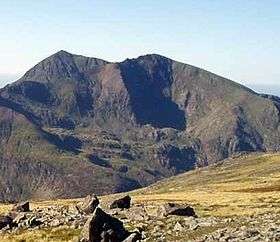 Garnedd Ugain (right) and Snowdon (left) | |
| Highest point | |
| Elevation | 1,065 m (3,494 ft) |
| Prominence | 72 m (236 ft) |
| Parent peak | Snowdon |
| Listing | Hewitt, Welsh 3000s, Nuttall |
| Naming | |
| Translation | Cairn of the Twenty (Welsh) |
| Pronunciation | Welsh: [ˈɡarnɛð ˈɨɡain] |
| Geography | |
| Location | Gwynedd, Wales |
| Parent range | Snowdonia |
| OS grid | SH610551 |
| Topo map | OS Landranger 115 |
| Listed summits of Garnedd Ugain | ||||
| Name | Grid ref | Height | Status | |
|---|---|---|---|---|
| Llechog | 718 m (2,356 ft) | sub Hewitt, Nuttall | ||
Garnedd Ugain, often referred to as "Crib-y-Ddysgl", is a mountain in Wales that forms part of the Snowdon Horseshoe. It is the second highest peak in Wales, and lies just under one kilometre north of Snowdon itself.
Both Garnedd Ugain and Crib-y-Ddysgl appear on the Ordnance Survey's maps of the area. The name Crib-y-Ddysgl refers to the east ridge [1] whilst the summit is Garnedd or Carnedd Ugain.
Crib-y-Ddysgl (meaning "ridge of the dish" in Welsh) is the name used by Alan Dawson for the peak's listing as a Hewitt.
Carnedd Ugain in Welsh means "Cairn of the Twenty" (the form Garnedd is the result of soft mutation). This was named after the Roman legion based in Caernarfon.
The web pages of the Welsh Mountaineering Club suggest that the name could also be a corruption of "Carnedd Wgon", and so named after the prince Wgon sung of by Dafydd ap Gwilym or possibly after the 13th-century poet Gwgon Brydydd.[2]
References
Coordinates: 53°04′30″N 4°04′35″W / 53.07499°N 4.07633°W