Cratfield
| Cratfield | |
 Church of St Mary, Cratfield |
|
 Cratfield |
|
| Population | 292 (2011)[1] |
|---|---|
| OS grid reference | TM 315 755 GB Grid |
| Shire county | Suffolk |
| Region | East |
| Country | England |
| Sovereign state | United Kingdom |
| Post town | Halesworth |
| Postcode district | IP19 0D |
| Dialling code | 01986 |
| EU Parliament | East of England |
Coordinates: 52°19′35″N 1°23′26″E / 52.326475°N 1.390479°E
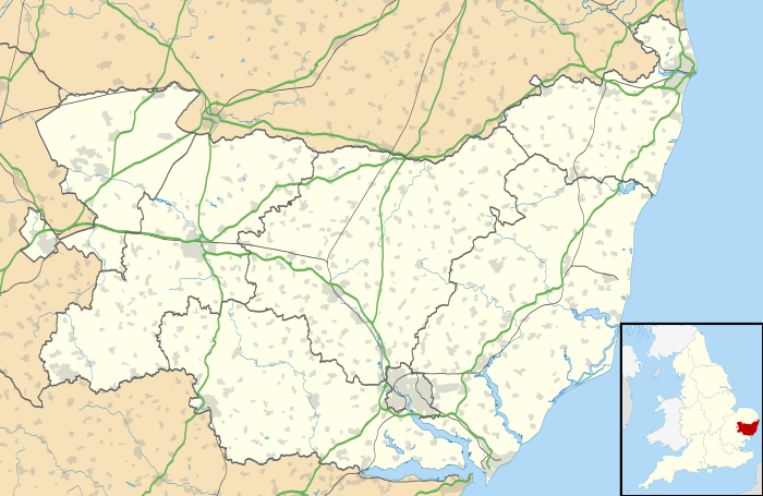
Cratfield is a village in northern Suffolk, England. "It has a population of 292 according to the 2011 census."[2] Neighbouring villages include Laxfield, Metfield, Cookley, Huntingfield, Heveningham. The nearest town, Halesworth, is approximately 6.7 miles (10.7 km) away. Southwold is a popular, nearby coastal town. The market town of Framlingham is also close by.
Cratfield is a small farming and residential community. It currently has no shop, but has a pub, The Cratfield Poacher, and several bed and breakfast hotels. Cratfield is also home to St Mary's Church (14th/15th/16th century) – built of flint and with a square tower,[3] mainly Perpendicular and noted particularly for its very fine font. Cratfield has had two churches and three cemeteries in the past, however in the current day it only has one church (St Mary's) and two cemeteries (St Mary's and Burial ground).[4] The oldest part of the church is from the 14th century, however the tower is from the 15th century. In 1547 under Edward VI, "the parish sold all its silver rather than let it fall into government hands and therefore spent the proceeds on decorating the tower, for which they are to be commended and remembered."[5] Crafield means 'Craeta open land' which refers to open country, land without trees, level ground , land without buildings) and arable land (from late tenth century).[6]
Statistics
The Index of Multiple Deprivation (IMD) ranks Cratfield as 13,041 out of 32,844 in England. Its believed that employment is better than 65% of areas in England, Health is better than 86%, education is better than 53%, crime is better than 74% and overall better than 39% of the country.[7] Cratfield's population shows that it is one that is neither significantly of old age, but neither is it a youth population. The largest age group is the 45 to 59 and the second largest is 30 to 44, this shows that it is very middle aged and for people with family which explains the 70 people under the age of 19 living in Cratfield.[8] An explanation to why the population is slightly more popular with the elder side could be to do with the population density being at only 0.3 persons per hectare[9] and therefore not congested.
According to the 2011 census there is not a large difference of people working full time and people working part- time (full time 170 and part- time 112).[10] However for the people who are in full time work, the highest number of people have to travel between 10 kilometres and 20 kilometres (between 6.2 and 12.4 miles) to get to work, furthermore according to the census 7 people have to travel over 60 kilometres ( 37.3 miles and over).[11] This shows that Cratfield is a distance from most businesses and industrial areas, which are located in bigger towns such as Halesworth which is approximately 6.7 miles away.
Geography
Cratfield is approximately 115 miles North East from London, 29 miles north of Ipswich and equally 29 miles south of Norwich.[12] Furthermore it is 7.5 miles from the coast line and lies 49 metres above sea level.[13] In addition to this the area is built on a mixture of London Clay (which is very dense) and chalk and believed to be aged between 1.5 and 3.5 million years old, this is also mixed in with volcanic ash which proves that there must have been volcanic activity in the past.[14]
History
"In 1870–72, John Marius Wilson's Imperial Gazetteer of England and Wales described Cratfield like this: Cratfield, a parish in Blything district, Suffolk; 6 miles WSW of Halesworth r. station. It has a post office under Halesworth. Acres, 2, 085. Real property, £3, 964. P, 604. Houses, 139. The property is divided among a few. Part of the land is common. The living is a vicarage in the diocese of Norwich. Value, £116.* Patron, the Rev. E. Hollond. The church is later English, with square tower, and good; and there is an Independent chapel. A school has £9 from endowment; and other charities £171.[15]"

John Laney from Cratfield was an important politician, lawyer and member of parliament during Queen Elizabeth1 reign and especially in the years between 1586–1589 as he was occasionally made of use by the Privy Council to settle disputed in the Suffolk area as he was a trusted source.[16]
The 1881 Occupation structure census shows that a large proportion of people worked in agriculture or construction of carriages. This is because, as explained in the name Cratfield (Craeta open land), there is arable land which can and is used for farming and agricultural needs. As well as this, there is a noticeable number of domestic servants which shows that there must have been a few wealthy people living in this area during this time period.
Demography
According to the Census report for Cratfield, the biggest decline in population took part between the years of 1891 and 1901 with the village decreasing by 75 people, 47 of whom were males and 28 who were females.[17] this would have been due to a mixture of the elderly dying and poor health through diseases. On the other hand the biggest increase in population across the time scale was from 1801 to 1811 with an increase of 100 people, 35 were male and 65 were female.[18] The population has stayed fairly consistent between males and females across the time series, however there has been a few anomalies such as in 1951 there was 32 more males (172 males to 140 females) and in 1811 where there was 2 more females (313 males to 338 females).[19] Cratfield's area (in acres) has also expanded from 1,930 in 1831 to 2,127[20] which isn't a huge difference but still an expansion nevertheless.


Economy
According to the 1831 occupation census in Cratfield, there was 22 professionals, 43 middling sorts, 103 servants and then 6 'others'.[21] The 43 middling sorts were the middle class and meant that they were either craftsmen or farmers. In the case of Cratfield due to its open, arable land, most or all of them were small scale farmers. To add to this, the 22 professionals that were in the area made up the upper class to which whom would have employed a large amount of the servants in the area.[22]
According to the 2011 census, the amount of people currently in employment in Cratfield between 16 and 74 is 141. To break down the 141 people employed in Cratfield, 18 of them are managers, directors, or senior officials. 20 of them are technical occupants which covers jobs in the public sector such as health and teaching. 13 have administrative jobs, 34 have skilled trades which include jobs such as plumbers and builders. 12 are employed in care, leisure, 2 are in sales, 7 are in machine operations and 18 are in elementary occupations.[23]
Current day
Cratfield currently has 26 listed buildings within it, 25 of them Grade 2 listed and St Mary's church being Grade 1 listed.[24] Cratfield has a village hall called Manse Lane (social club) which can hold up to 100 people at one time whereas the small hall can only hold up to 48 people, and complimented by 50 parking spaces.[25] The nearest primary school is All Saints Church of England primary school in Laxfield and the nearest secondary school is Halesworth Middle school. In addition to this Cratfield has a very limited bus service with two pick up points being Bell Green and Chestnut view. As well as this Cratfield has two cottages that are available to stay in (School farm cottages and Holly tree barns). The area also has a fairly high car and van count with the number being at 252, adding to the 77,473 other vehicles based in the Suffolk Coastal region.[26] Cratfield doesn't have much cultural diversity according to the 2011 census report with 201 of its population being of a Christian background and another 86 with non-or not stated their religion, we must note that there was one Buddhist and two of Jewish religion.[27] This shows that Cratfield has not been culturally diversified, this could be to do with its lack of job prospects and homing.
References
- ↑ "Parish population 2011". Retrieved 17 September 2015.
- ↑ ""Cratfield (parish): Key Figures for 2011 Census: Key Statistics"". Neighbourhood Statistics. Office for National Statistics. Retrieved 8 February 2016.
- ↑ "Cratfield". GENUKI. GENUKI. Retrieved 25 February 2016.
- ↑ "Cratfield". GENUKI. GENUKI. Retrieved 25 February 2016.
- ↑ "St Mary's, Cratfield". Suffolk Churches. Retrieved 29 March 2016.
- ↑ "Key to English place names". University of Nottingham. Retrieved 15 March 2016.
- ↑ "Suffolk Coastal". UK Local Area. Retrieved 15 March 2016.
- ↑ "Cratfield Age Structure, 2001". Neighbourhood Statistics. Office for National Statistics. Retrieved 12 April 2016.
- ↑ "Cratfield population density". Neighbourhood Statistics. Office for National Statistics. Retrieved 18 April 2016.
- ↑ "Cratfield, Hours Worked, 2011". Neighbourhood Statistics. Office for National Statistics. Retrieved 20 April 2016.
- ↑ "Cratfield Distance Travelled to Work, 2001". Neighbourhood statistics. Office for National Statistics. Retrieved 21 April 2016.
- ↑ "Cratfield". Google Maps. Google. Retrieved 21 April 2016.
- ↑ "Cratfield sea level data". Street list. Street list. Retrieved 21 April 2016.
- ↑ "Suffolk coast geology". Suffolk coast and heaths. One Suffolk. Retrieved 24 April 2016.
- ↑ "Cratfield". A Vision of Britain through time. Retrieved March 16, 2016.
- ↑ "History of Parliament online". History of Parliament online. History of Parliament trust. Retrieved 8 March 2016.
- ↑ "Cratfield males and females". A Vision of Britain through time. GB historical GIS/ University of Portsmouth. Retrieved 23 March 2016.
- ↑ "Cratfield CP/AP through time/industry statistics/males and females". A Vision of Britain through time. GB historical GIS/Portsmouth university. Retrieved 23 March 2016.
- ↑ "Cratfield males and females". A Vision of Britain through time. GB historical GIS/Portsmouth university. Retrieved 23 March 2016.
- ↑ "Cratfield area". A Vision of Britain through time. GB historical GIS/Portsmouth university. Retrieved 23 March 2016.
- ↑ "Cratfield social status". A Vision of Britain through time. GB historical GIS/Portsmouth university. Retrieved 23 March 2016.
- ↑ "Cratfield social status". A Vision of Britain through time. GB historical GIS/Portsmouth university. Retrieved 23 March 2016.
- ↑ "Cratfield occupation, 2011". Neighbourhood Statistics. Office for National Statistics. Retrieved 23 March 2016.
- ↑ "Listed buildings in Cratfield". British listed buildings. Retrieved 8 March 2016.
- ↑ "Cratfield village hall, Manse Lane". Suffolk county council. Suffolk county council. Retrieved 24 April 2016.
- ↑ "Neighbourhood Statistics car and van ownership". Neighbourhood Statistics. Retrieved 16 March 2016.
- ↑ "Cratfield Religion, 2011". Neighbourhood Statistics. Office for National Statistics. Retrieved 12 April 2016.
External links
![]() Media related to Cratfield at Wikimedia Commons
Media related to Cratfield at Wikimedia Commons