Cradle Mountain
| Cradle Mountain | |
|---|---|
|
Cradle Mountain as seen from the north, across Dove Lake | |
| Highest point | |
| Elevation | 1,545 m (5,069 ft) [1][2] |
| Prominence | 355 m (1,165 ft) [2] |
| Isolation | 4.95 km (3.08 mi) [2] |
| Listing | 5th highest mountain in Tasmania[2] |
| Coordinates | 41°40′48″S 145°56′24″E / 41.68000°S 145.94000°ECoordinates: 41°40′48″S 145°56′24″E / 41.68000°S 145.94000°E [3] |
| Geography | |
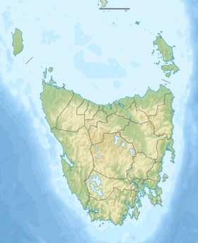 Cradle Mountain Location in Tasmania | |
| Location | Central Highlands, Tasmania, Australia |
| Parent range | Cradle Cirque - Bluff Cirque |
| Geology | |
| Age of rock | Jurassic |
| Mountain type | Dolerite |
| Climbing | |
| Normal route | Walk / hike via the Overland Track |

The Cradle Mountain is a mountain in the Central Highlands region of Tasmania, Australia. The mountain is situated in the Cradle Mountain-Lake St Clair National Park.
At 1,545 metres (5,069 ft) above sea level, it is the fifth highest mountain in Tasmania,[2] and is one of the principal tourist sites in Tasmania, owing to its natural beauty. The Cradle Mountain is composed of dolerite columns, similar to many of the other mountains in the area.
Access
The area around the mountain has a large number of day walks, as well as being one terminus of the Overland Track.[4][5] The Overland Track winds through a variety of landscapes to its opposite end – 80.8 kilometres (50.2 mi) to the south – at Lake St Clair, Australia’s deepest lake.[6]
The mountain is climbed by walkers virtually year round. It is a strenuous return hike from the Dove Lake car park with a recommended allotted time of 6.5 hours. The climb up the rocky part of the mountain involves scrambling over large boulders for several hundred meters. The entire climb is exposed to any bad weather that may arrive quickly, while climbing the upper slopes in winter can be dangerous due to slick ice on the rocks and heavy snow covering holes and other hazards. From the summit, there is a spectacular view, encompassing Dove Lake, Barn Bluff and Mount Ossa.
Features
The mountain rises above the glacially formed Dove Lake (934 metres (3,064 ft)), Lake Wilks, and Crater Lake.
The mountain has four named summits. In order of height they are Cradle Mountain (1,545 m (5,069 ft)); Smithies Peak (1,527 m (5,010 ft)); Weindorfers Tower (1,459 metres (4,787 ft)); and Little Horn (1,355 m (4,446 ft)).[1][7]
The mountain itself is named after its resemblance to a gold mining cradle.
Flora, fauna and fungi
Flora
The area is covered in a wide variety of alpine and sub-alpine vegetation, including the colourful deciduous beech, itself an anomaly given that most Australian native flora is evergreen. Alpine coral fern and button grass dominate the alpine wet sedgelands near the mountain summit. Stands of Tasmanian snow gum can be found at slightly lower elevations alongside Tasmanian eyebright, scoparia heath, mountain rocket, waratah, Cheshunt pine and pencil pine. Within the valleys surrounding the mountain, species such as myrtle beech, pandani, sassafras, King Billy pine and celery top pine form thick temperate rainforest with dense, mossy undergrowth.
Fauna
Wombats are a common sight throughout the area, while pademelons, Tasmanian devils and echidnas can also be seen. Numerous bird species can be found, including green rosellas, black currawongs, pink robins and Tasmanian scrubwrens, while peregrine falcons and wedge-tailed eagles nest on the mountains cliffs. Tiger snakes are a highly venomous snake species known to be found in the area.
Fungi
Fungi are also a part of the Park's biodiversity. While the Management Plan for Cradle Mountain–Lake St Clair National Park only mentions fungi in the context of their destructive effects (Phytophthora cinnamomi and Chalara australis), the Park has a great variety of fungi that perform beneficial ecological roles. In fact, most fungi perform positive rather than negative roles. Even parasitic fungi – often regarded only negatively – are a vital part of healthy ecosystems, regulating ecosystem functions.

As primary recyclers of organic matter, saprobic fungi break down fallen branches and leaf litter, making vital nutrients available to other organisms. Other fungi form symbiotic relationships with other organisms. Although rarely acknowledged, the great majority of plants in Cradle Mountain–Lake St Clair National Park (indeed in the world) form mutually beneficial mycorrhizal relationships with fungi.
Given the great diversity of plants, specialist habitats and micro-climates in the park, a great diversity of fungi, including lichens, is also expected to occur Several hundred species have already been recorded by field naturalists and interested individuals and can be found in the Atlas of Living Australia.
Despite their essential roles in underpinning terrestrial ecosystems, fungi are barely recognised as a vital part of Australia's biodiversity. Although Australia has national and state level biodiversity conservation strategies and has ratified international conventions, most overlook fungi, including Tasmania's Natural Heritage Strategy, which only makes one generic reference to fungi.
One of the more a conspicuous species found in the wetter parts of the park is the strawberry bracket fungus (Aurantiporus pulcherrimus). It is a Gondwanan species (also found in New Zealand and southern Brazil) that grows on myrtle beech (Nothofagus cunninghammii) and snow gums. The Australian citizen-science organisation, Fungimap is documenting and mapping the distribution of fungi including those that occur in National Parks.
Gallery
 Panorama from west, showing Cradle Mountain and, in the distance, Barn Bluff
 The summit ridge of Cradle Mountain
 The summit ridge of Cradle Mountain
 Cradle Mountain seen from neighboring Barn Bluff
 View over Dove Lake; The boat shed was built in the 1940s
See also
References
- 1 2 "LISTmap (Cradle Mountain)". Department of Primary Industries and Water. Government of Tasmania. Retrieved 19 June 2007.
- 1 2 3 4 5 "Cradle Mountain, Australia". Peakbagger.com. Retrieved 7 June 2015.
- ↑ "Cradle Mountain (TAS)". Gazetteer of Australia online. Geoscience Australia, Australian Government.
- ↑ Holbeck, Megan. "Top 10 Australian Walks". Australian Geographic Online. Retrieved 10 April 2011.
- ↑ "Overland Track". Tasmanian Parks & Wildlife Service, Department of Primary Industries and Water. Retrieved 4 March 2011.
- ↑ Dub, Tim. "Cradle Mountain: past and present". Australian Geographic. AG Online. Retrieved 7 August 2010.
- ↑ "LISTmap (Cradle Mountain minor peaks)". Department of Primary Industries and Water. Government of Tasmania. Retrieved 19 June 2007.
External links
- Tasmanian Parks and Wildlife Page
- Photojournal covering Cradle Mountain as part of The Overland Track
- Cradle Mountain Tourist Attraction
- Webcam
- Parks and Wildlife Service Webcams
Public transport access
- Tassielink have buses to/from Devonport and Queenstown/Strahan.
- McDermott's run buses between Cradle Mountain and Launceston (not every day)