County of Vermilion River
| County of Vermilion River | |
|---|---|
| Municipal district | |
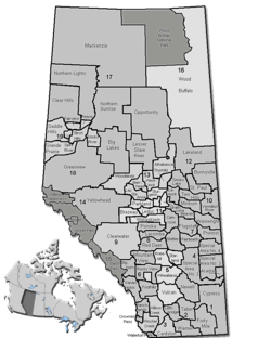 Location of Vermilion River County in Alberta | |
| Coordinates: 53°20′14″N 110°19′59″W / 53.33722°N 110.33306°WCoordinates: 53°20′14″N 110°19′59″W / 53.33722°N 110.33306°W | |
| Country |
|
| Province |
|
| Region | Central Alberta |
| Census division | No. 10 |
| Established | 1944 |
| Incorporated | 1964 (County) |
| Government[1] | |
| • Reeve | Daryl Watt |
| • Governing body |
County of Vermilion River Council
|
| • CAO | Rhonda King |
| • Office location | Kitscoty |
| Area (2011)[2] | |
| • Total | 5,518.18 km2 (2,130.58 sq mi) |
| Population (2011)[2] | |
| • Total | 7,905 |
| • Density | 1.4/km2 (4/sq mi) |
| • Dwellings | 2,796 |
| Time zone | MST (UTC-7) |
| Website |
vermilion-river |
The County of Vermilion River is a municipal district located in the eastern part of central Alberta, Canada in Census Division #10. The municipal district was formerly named the County of Vermilion River No. 24 prior to an official name change that became effective on September 13, 2006.
The administrative offices of the County of Vermilion River are located at Kitscoty. The Vermilion River flows through the County and is the namesake of the region.
The Yellowhead Highway and Buffalo Trail are major transportation routes in the County. Several communities in the County such as Vermilion and Kitscoty are serviced by CN Rail.
Demographics
The population of the County of Vermilion River according to its 2015 municipal census is 8,116,[3] a 2.7% change from its 2008 municipal census population of 7,900.[4]
In the 2011 Census, the County of Vermilion River had a population of 7,905 living in 2,801 of its 3,008 total dwellings, a 5.9% change from its 2006 adjusted population of 7,462. With a land area of 5,518.18 km2 (2,130.58 sq mi), it had a population density of 1.4/km2 (3.7/sq mi) in 2011.[2]
In 2006, the County of Vermilion River had a population of 7,467 living in 2,796 dwellings, a 0.8% decrease from 2001. The county has a land area of 5,518.71 km2 (2,130.79 sq mi) and a population density of 1.4/km2 (3.6/sq mi).[5]
In 2001, the County of Vermilion River had a population of 7,524 in 2,754 dwellings, a 0.4% decrease from 1996. On a surface of 5,518.54 km² it had a density of 1.4 inhabitant per km².[6]
Communities and localities
|
The following urban municipalities are surrounded by the County of Vermilion River:[7][8]
The following hamlets are located within the County of Vermilion River:[8] |
The following localities are located within the County of Vermilion River:[9]
|
|
Attractions
Several golf courses are located in the county, among them Lloydminster Golf and Country Club, Lea Park Golf Club, Rolling Green Fairways Golf Course & Campground, Paradise Valley Golf Course and Vermilion Golf Course.
Campgrounds are found at Jubilee Regional Park, Vermilion Provincial Park, Nothing Barred Ranch and Iron River Ranch.
The Vermilion Heritage Museum[10] is located in the town of Vermilion. Other museums include Climbing Through Time Museum in Paradise Valley, Dewberry Valley Museum in Dewberry and Morrison Museum of the Country School in Islay.
The Lea Park Professional Rodeo is held every yer in June.
Other recreational activities are hiking in the Vermilion Provincial Park and Nothing Barred Ranch (cross-country skiing in winter), fishing for rainbow trout at the Vermilion Provincial Park Trout Pond or pike and perch at Raft Lake.
See also
References
- ↑ "Municipal Officials Search". Alberta Municipal Affairs. November 18, 2016. Retrieved November 21, 2016.
- 1 2 3 "Population and dwelling counts, for Canada, provinces and territories, and census subdivisions (municipalities), 2011 and 2006 censuses (Alberta)". Statistics Canada. 2012-02-08. Retrieved 2012-02-08.
- ↑ "Preliminary Census Results" (PDF). County of Vermilion River. July 22, 2015. Retrieved July 23, 2015.
- ↑ "Alberta 2009 Official Population List" (PDF). Alberta Municipal Affairs. September 15, 2009. Retrieved September 12, 2010.
- ↑ Statistics Canada. "Canada 2006 Census: County of Vermilion River - Community Profile". Retrieved 2007-06-09.
- ↑ County of Vermilion River community profile - Statistics Canada. 2002. 2001 Community Profiles. Released June 27, 2002. Last modified: 2005-11-30. Statistics Canada Catalogue no. 93F0053XIE.
- ↑ "Lloydminster (Part), City (Census Subdivision), Alberta". Statistics Canada. 2012-06-20. Retrieved 2012-08-13.
- 1 2 "Specialized and Rural Municipalities and Their Communities" (PDF). Alberta Municipal Affairs. 2012-03-01. Retrieved 2012-08-12.
- ↑ "Standard Geographical Classification (SGC) 2006, Economic Regions: 4810036 - Vermilion River County No. 24, geographical codes and localities, 2006". Statistics Canada. 2010-03-05. Retrieved 2012-08-12.
- ↑ Vermilion Heritage Museum
External links

| Subdivisions | |||||||||||
|---|---|---|---|---|---|---|---|---|---|---|---|
| Communities | |||||||||||
| Cities and urban service areas | |||||||||||
| Rural municipalities |
| ||||||||||
| Specialized municipalities | |||||||||||
| |||||||||||