New York State Route 176
| ||||
|---|---|---|---|---|
|
Map of central New York with NY 176 highlighted in red | ||||
| Route information | ||||
| Maintained by NYSDOT and the city of Fulton | ||||
| Length: | 13.75 mi[1] (22.13 km) | |||
| Existed: | 1930[2] – present | |||
| Major junctions | ||||
| South end: |
| |||
| North end: |
| |||
| Location | ||||
| Counties: | Cayuga, Oswego | |||
| Highway system | ||||
| ||||


New York State Route 176 (NY 176) is a north–south state highway located in the central part of New York, in the United States, that connects Cayuga County with Oswego County. The southern terminus of the route is at an intersection with NY 370 in the northeast part of the town of Cato, east of Meridian. Its northern terminus is at a junction with NY 48 in the city of Fulton.
The route used to extend north from its current northern terminus to NY 3 three-quarters of a mile to the north and, earlier, to a northern terminus at County Route 4 (CR 4) in the town of Scriba, east of the city of Oswego.
Route description

NY 176 begins at an intersection with NY 370 in the town of Cato. NY 176 proceeds northwest through Cato as a two-lane rural roadway, passing several farms in each direction, along with a large pond. A short distance later, NY 176 crosses the town line out of Cato into Ira, remaining the two-lane farm road, but turning northeast. NY 176 runs near the shore of a large pond in Ira, crossing an intersection with County Route 38 (CR 38; Ira Hill Road / Lysander Road). NY 176 continues north through Ira, crossing several farms before crossing the county line into Oswego County.[3]
Now in Oswego County, NY 176 is in the town of Hannibal and immediately into the hamlet of South Hannibal. In South Hannibal, the route makes a gradual bend to the east at a junction with CR 7. South Hannibal consists of a few homes along NY 176 and CR 7, until NY 176 leaves the hamlet eastbound. Continuing through Hannibal, NY 176 becomes residential before crossing over a large pond, where it bends to the northeast. NY 176 continues northeast through Hannibal, intersecting with several local roads before entering the town of Granby. In Granby, the route turns eastward once again, entering the hamlet of Bowens Corners. In Bowens Corners, NY 176 proceeds eastward as a two-lane residential street, intersecting with CR 8 (Minetto–Lysander Road), which runs concurrent along NY 176 for a short distance to the north.[3]
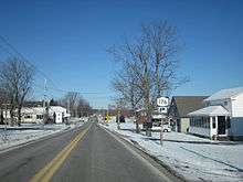
At the northern end of Bowens Corners, NY 176 bends east off the right-of-way of CR 8, which continues north towards Minetto. NY 176 meanwhile, proceeds east out of Bowens Corners, crossing a large farm in the town of Granby, where it turns to the northeast. The route becomes primarily residential after Chipper Road, while intersecting with the northern terminus of CR 55 (Jacksonville Road). After this intersection, the route becomes rural again, continuing northeast through Granby. Intersecting with the northern terminus of CR 14 (Ley Creek Road), NY 176 crosses a railroad grade and enters the city of Fulton. In Fulton, NY 176 gains the moniker of Curtis Street, becoming a two-lane residential street. NY 176 passes through four city blocks before intersecting with NY 48 (West First Street) on the shores of the Oswego River. This intersection serves as the northern terminus of NY 176.[3]
History
When NY 176 was originally assigned as part of the 1930 renumbering of state highways in New York, it encompassed only its modern routing between NY 370 near Meridian and NY 48 in Fulton.[2] The route was extended north through Fulton c. 1932 on NY 48, NY 3, 7th Street, and Whittaker Road to the Scriba hamlet of South Scriba, where it ended at a simple four-way intersection with modern CR 4.[4][5] The northward extension of NY 176 was eliminated on April 1, 1980, as part of a highway maintenance swap between the state of New York and Oswego County. In the swap, ownership and maintenance of NY 176 north of the Fulton city line was transferred from the state to the county in exchange for maintenance of the portions of NY 3 and NY 34 between the Cayuga–Oswego County line and NY 104.[6] NY 176 was truncated to its junction with NY 48 south of Fulton following the swap while the former routing of NY 176 between the Fulton city line and CR 4 in South Scriba became CR 176.[7][8]
Major intersections
| County | Location | mi[1] | km | Destinations | Notes |
|---|---|---|---|---|---|
| Cayuga | Town of Cato | 0.00 | 0.00 | ||
| Oswego | Fulton | 13.75 | 22.13 | ||
| 1.000 mi = 1.609 km; 1.000 km = 0.621 mi | |||||
See also
References
- 1 2 "2008 Traffic Volume Report for New York State" (PDF). New York State Department of Transportation. June 16, 2009. p. 179. Retrieved January 29, 2010.
- 1 2 Automobile Legal Association (ALA) Automobile Green Book, 1930–31 and 1931–32 editions, (Scarborough Motor Guide Co., Boston, 1930 and 1931). The 1930–31 edition shows New York state routes prior to the 1930 renumbering
- 1 2 3 Microsoft; Nokia (May 5, 2012). "overview map of NY 176" (Map). Bing Maps. Microsoft. Retrieved May 5, 2012.
- ↑ New York (Map). Cartography by H.M. Gousha Company. Kendall Refining Company. 1931.
- ↑ Texaco Road Map – New York (Map). Cartography by Rand McNally and Company. Texas Oil Company. 1932.
- ↑ New York State Legislature. "New York State Highway Law § 341". Retrieved January 29, 2010.
- ↑ "Oswego County traffic counts" (PDF). New York State Department of Transportation. 2003. Retrieved January 29, 2010.
- ↑ Fulton Digital Raster Quadrangle (Map). 1:24,000. New York State Department of Transportation. 1993. Retrieved January 29, 2010.
External links
| Wikimedia Commons has media related to New York State Route 176. |
- New York State Route 176 at New York Routes • New York State Highway Termini