Concepción, Sololá
| Concepción | |
|---|---|
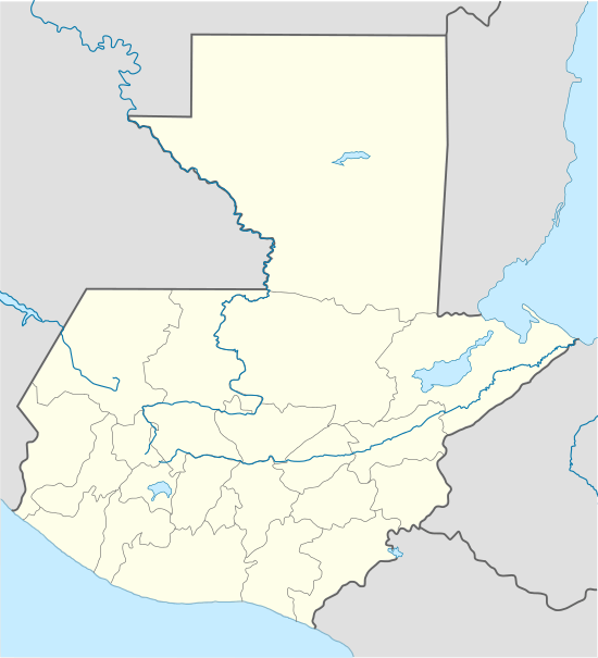 Concepción Location in Guatemala | |
| Coordinates: 14°47′00″N 91°09′00″W / 14.78333°N 91.15000°W | |
| Country |
|
| Department |
|
| Municipality | Concepción |
| Government | |
| • Acting Mayor (2015-2016) | Pedro Juracán Lopic[1][lower-alpha 1] |
| Population (Census 2002) | |
| • Religions | Roman Catholicism, Evangelicalism, Maya |
| Climate | Csb |
Concepción (Spanish pronunciation: [konsepˈsjon]) is a municipality in the Sololá department of Guatemala. The outstanding characteristic of the municipality is that 100% of its inhabitants are native people.[3]
History
Spanish Colony
There is not any exact record of the exact foundation date of the town; it is known, however, that there was a time that it was called "Concepción Quechelaj" and "Concepción Paquixalá" according to several documents form the Spanish Colony era. The word "Quechelaj" is from the kakchikel language and means "River of thorns". After the Spanish conquest of Guatemala the town was called "Nuestra Señora de La Concepción" after the Our Lady of the Immaculate Conception.[4] However, the town changed name several times after that.
During the Spanish Colony it was part of the Tecpán Atitlán district and when Tecpán became an "alcaldía mayor" (English:Major municipality) of Sololá Nuestra Señora de La Concepción became part of it, as reported in 1749. Documents from 1765 show it name as "Nuestra Señora de la Concepción Pajixolá". And in 1770, archbishop Pedro Cortés y Larraz described the town as "Concepción Kixalá, part of San Francisco Panajachel parish".[5]
After Independence from Spain
According to a record from 1892, Concepción is reported as a municipality of Sololá Department.
21st century
On 11 October 2015, a little over a month after the municipal elections for the 2016–20 mayoral term, an angry mob lynched and murdered re-elected Mayor Basilio Juracán, from the LIDER party, accusing him of allegedly ordering a hit against his former competitor for the mayor office from the Unidad Nacional de la Esperanza party —UNE—; the mob burned two vehicles and three houses, among those the one where the deceased mayor was hiding.[2]
Climate
Concepción has temperate climate (Köppen: Csb).
| Climate data for Concepción | |||||||||||||
|---|---|---|---|---|---|---|---|---|---|---|---|---|---|
| Month | Jan | Feb | Mar | Apr | May | Jun | Jul | Aug | Sep | Oct | Nov | Dec | Year |
| Average high °C (°F) | 20.8 (69.4) |
21.5 (70.7) |
22.9 (73.2) |
23.6 (74.5) |
23.2 (73.8) |
21.4 (70.5) |
21.9 (71.4) |
22.4 (72.3) |
21.7 (71.1) |
21.5 (70.7) |
21.4 (70.5) |
20.8 (69.4) |
21.92 (71.46) |
| Daily mean °C (°F) | 14.5 (58.1) |
14.8 (58.6) |
16.2 (61.2) |
17.3 (63.1) |
17.9 (64.2) |
17.0 (62.6) |
17.1 (62.8) |
17.0 (62.6) |
16.8 (62.2) |
16.6 (61.9) |
15.6 (60.1) |
14.6 (58.3) |
16.28 (61.31) |
| Average low °C (°F) | 8.3 (46.9) |
8.2 (46.8) |
9.5 (49.1) |
11.1 (52) |
12.6 (54.7) |
12.7 (54.9) |
12.4 (54.3) |
11.7 (53.1) |
12.0 (53.6) |
11.7 (53.1) |
9.8 (49.6) |
8.5 (47.3) |
10.71 (51.28) |
| Average precipitation mm (inches) | 0 (0) |
3 (0.12) |
5 (0.2) |
22 (0.87) |
76 (2.99) |
273 (10.75) |
205 (8.07) |
208 (8.19) |
339 (13.35) |
152 (5.98) |
42 (1.65) |
2 (0.08) |
1,327 (52.25) |
| Source: Climate-Data.org[6] Instituto Nacional de Sismología, Vulcanología, Meteorología e Hidrología de Guatemala[7] | |||||||||||||
Geographic location
The municipal capital is 6 km away from Sololá and 146 km away of Guatemala City.
 |
Chichicastenango, Quiché Department municipality | | ||
| Panajachel and Sololá, Sololá Department municipalities | |
Chichicastenango, Quiché Department municipality[8] | ||
| ||||
| | ||||
| San Andrés Semetabaj, Sololá Department municipality[8] |
See also
-
 Guatemala portal
 -
 Geography portal
 - List of places in Guatemala
Notes and references
References
- ↑ "Alcaldes electos en el departamento de Sololá". Municipalidades de Guatemala (in Spanish). Guatemala. 12 October 2015. Archived from the original on October 12, 2015. Retrieved 12 October 2015.
- 1 2 "Turba mata a alcalde en Concepción, Sololá tras ataque a exrival". Siglo 21 (in Spanish). Guatemala. 11 October 2015. Archived from the original on October 12, 2015. Retrieved 11 October 2015.
- ↑ Escalante Herrera, Marco Antonio (2007). "Municipio de Concepción, Sololá". Pbase (in Spanish). Guatemala. Archived from the original on June 18, 2010. Retrieved 18 June 2010.
- ↑ "Municipio de Concepción, Sololá" (PDF). Ejercicio Profesional Supervisado (in Spanish). Guatemala: Facultad de Ciencias Económicas de la Universidad de San Carlos de Guatemala.
- ↑ Cortés y Larraz 1770.
- ↑ "Climate: Concepción". Climate-Data.org. Retrieved 11 October 2015.
- ↑ Departamento de Investigación y servicios meteorológicos. "Isotermas de temperatura mínima absoluta anual" (in Spanish). Archived from the original on May 17, 2012.; "Isotermas de temperatura máxima absoluta anual". Archived from the original on May 24, 2012.; "Isotermas de temperatura máxima promedio anual". Archived from the original on May 15, 2012.; "Isotermas de temperature mínima promedio annual". Archived from the original on May 29, 2012.; "Sumatoria de días con lluvia promedio anual". Instituto Nacional de Sismología, Vulcanología, Metereología e Hidrología (in Spanish). Guatemala. Archived from the original on May 15, 2012. Retrieved 23 October 2015.
- 1 2 SEGEPLAN. "Municipios del departamento de Sololá". SEGEPLAN (in Spanish). Guatemala. Archived from the original on July 7, 2015. Retrieved 7 July 2015.
Bibliography
- Cortés y Larraz, Pedro (1770). Descripción Geográfico-Moral de la Diócesis de Goathemala (in Spanish). Guatemala: Diócesis de Guatemala.

Coordinates: 14°47′00″N 91°09′00″W / 14.7833°N 91.15°W