Colwich, Kansas
| Colwich, Kansas | |
|---|---|
| City | |
|
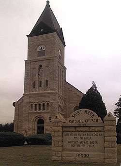
St. Mark Catholic Church (2012) | |
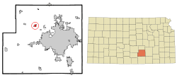 Location within Sedgwick County and Kansas | |
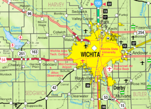 KDOT map of Sedgwick County (legend) | |
| Coordinates: 37°46′50″N 97°32′26″W / 37.78056°N 97.54056°WCoordinates: 37°46′50″N 97°32′26″W / 37.78056°N 97.54056°W | |
| Country | United States |
| State | Kansas |
| County | Sedgwick |
| Area[1] | |
| • Total | 1.33 sq mi (3.44 km2) |
| • Land | 1.33 sq mi (3.44 km2) |
| • Water | 0 sq mi (0 km2) |
| Elevation | 1,385 ft (422 m) |
| Population (2010)[2] | |
| • Total | 1,327 |
| • Estimate (2015)[3] | 1,378 |
| • Density | 1,000/sq mi (390/km2) |
| Time zone | Central (CST) (UTC-6) |
| • Summer (DST) | CDT (UTC-5) |
| ZIP code | 67030 |
| Area code | 316 |
| FIPS code | 20-15100 [4] |
| GNIS feature ID | 0473814 [5] |
| Website | colwichks.org |
Colwich is a city in Sedgwick County, Kansas, United States. It is five miles northwest of Wichita. As of the 2010 census, the city population was 1,327.[6]
History
Colwich was founded in 1887.[7] The name is a portmanteau of Colorado and Wichita, or the Colorado & Wichita Railroad.[8]
Geography
Colwich is located at 37°46′50″N 97°32′26″W / 37.78056°N 97.54056°W (37.780480, -97.540420).[9] According to the United States Census Bureau, the city has a total area of 1.33 square miles (3.44 km2), all of it land.[1]
Demographics
| Historical population | |||
|---|---|---|---|
| Census | Pop. | %± | |
| 1890 | 212 | — | |
| 1900 | 225 | 6.1% | |
| 1910 | 258 | 14.7% | |
| 1920 | 262 | 1.6% | |
| 1930 | 260 | −0.8% | |
| 1940 | 284 | 9.2% | |
| 1950 | 339 | 19.4% | |
| 1960 | 703 | 107.4% | |
| 1970 | 879 | 25.0% | |
| 1980 | 935 | 6.4% | |
| 1990 | 1,091 | 16.7% | |
| 2000 | 1,229 | 12.6% | |
| 2010 | 1,327 | 8.0% | |
| Est. 2015 | 1,378 | [3] | 3.8% |
| U.S. Decennial Census | |||
Colwich is part of the Wichita, KS Metropolitan Statistical Area.
2010 census
As of the census[2] of 2010, there were 1,327 people, 466 households, and 348 families residing in the city. The population density was 997.7 inhabitants per square mile (385.2/km2). There were 480 housing units at an average density of 360.9 per square mile (139.3/km2). The racial makeup of the city was 97.4% White, 0.2% African American, 0.5% Native American, 1.1% from other races, and 0.9% from two or more races. Hispanic or Latino of any race were 2.5% of the population.
There were 466 households of which 44.6% had children under the age of 18 living with them, 59.7% were married couples living together, 9.9% had a female householder with no husband present, 5.2% had a male householder with no wife present, and 25.3% were non-families. 22.3% of all households were made up of individuals and 10.7% had someone living alone who was 65 years of age or older. The average household size was 2.85 and the average family size was 3.38.
The median age in the city was 32.7 years. 34.3% of residents were under the age of 18; 7.7% were between the ages of 18 and 24; 25.9% were from 25 to 44; 21.1% were from 45 to 64; and 11.1% were 65 years of age or older. The gender makeup of the city was 50.1% male and 49.9% female.
2000 census
As of the census[4] of 2000, there were 1,229 people, 376 households, and 315 families residing in the city. The population density was 1,652.5 people per square mile (641.2/km²). There were 392 housing units at an average density of 527.1 per square mile (204.5/km²). The racial makeup of the city was 98.62% White, 0.57% Asian, 0.24% from other races, and 0.57% from two or more races. Hispanic or Latino of any race were 0.81% of the population.
There were 376 households out of which 47.3% had children under the age of 18 living with them, 69.9% were married couples living together, 9.0% had a female householder with no husband present, and 16.2% were non-families. 14.9% of all households were made up of individuals and 8.0% had someone living alone who was 65 years of age or older. The average household size was 3.13 and the average family size was 3.49.
In the city the population was spread out with 34.9% under the age of 18, 6.8% from 18 to 24, 27.9% from 25 to 44, 14.5% from 45 to 64, and 15.9% who were 65 years of age or older. The median age was 32 years. For every 100 females there were 99.2 males. For every 100 females age 18 and over, there were 91.8 males.
The median income for a household in the city was $51,346, and the median income for a family was $58,068. Males had a median income of $41,667 versus $28,676 for females. The per capita income for the city was $19,588. About 2.0% of families and 2.3% of the population were below the poverty line, including 2.9% of those under age 18 and 1.4% of those age 65 or over.
See also
References
- 1 2 "US Gazetteer files 2010". United States Census Bureau. Archived from the original on 2012-07-14. Retrieved 2012-07-06.
- 1 2 "American FactFinder". United States Census Bureau. Retrieved 2012-07-06.
- 1 2 "Annual Estimates of the Resident Population for Incorporated Places: April 1, 2010 to July 1, 2015". Retrieved July 2, 2016.
- 1 2 "American FactFinder". United States Census Bureau. Archived from the original on 2013-09-11. Retrieved 2008-01-31.
- ↑ "US Board on Geographic Names". United States Geological Survey. 2007-10-25. Retrieved 2008-01-31.
- ↑ "2010 City Population and Housing Occupancy Status". U.S. Census Bureau. Archived from the original on July 21, 2011. Retrieved March 6, 2011.
- ↑ Blackmar, Frank Wilson (1912). Kansas: A Cyclopedia of State History, Embracing Events, Institutions, Industries, Counties, Cities, Towns, Prominent Persons, Etc. Standard Publishing Company. p. 392.
- ↑ Temple, Robert D. Edge Effects: The Border-Name Places, (2nd edition, 2009), iUniverse, ISBN 978-0-595-47758-6, page 324.
- ↑ "US Gazetteer files: 2010, 2000, and 1990". United States Census Bureau. 2011-02-12. Retrieved 2011-04-23.
External links
| Wikimedia Commons has media related to Colwich, Kansas. |
- City
- Schools
- USD 267, local school district
- Maps
- Colwich City Map, KDOT
Municipalities and communities of Sedgwick County, Kansas, United States | ||
|---|---|---|
| Cities | 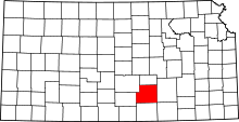 | |
| CDPs | ||
| Unincorporated communities | ||
| Townships | ||
| Footnotes | ‡This populated place also has portions in an adjacent county or counties | |