Columbia County, Arkansas
Coordinates: 33°14′28″N 93°13′06″W / 33.24111°N 93.21833°W
| Columbia County, Arkansas | |
|---|---|
 Columbia County Courthouse in Magnolia | |
 Location in the U.S. state of Arkansas | |
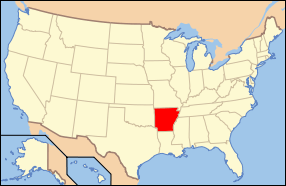 Arkansas's location in the U.S. | |
| Founded | December 17, 1852 |
| Named for | Christopher Columbus |
| Seat | Magnolia |
| Largest city | Magnolia |
| Area | |
| • Total | 767 sq mi (1,987 km2) |
| • Land | 766 sq mi (1,984 km2) |
| • Water | 0.7 sq mi (2 km2), 0.1% |
| Population (est.) | |
| • (2015) | 24,114 |
| • Density | 32/sq mi (12/km²) |
| Congressional district | 4th |
| Time zone | Central: UTC-6/-5 |
| Website |
www |
Columbia County is a county located in the U.S. state of Arkansas. As of the 2010 census, the population was 24,552.[1] The county seat is Magnolia.[2] The county was formed on December 17, 1852, and was named for Christopher Columbus. It was an alcohol prohibition or dry county. However, the voters of Columbia County voted on November 4, 2014 to make it legal to buy, sell, and manufacture alcohol within the county. The county will no longer be dry.
The Magnolia, AR Micropolitan Statistical Area includes all of Columbia County.
Geography

According to the U.S. Census Bureau, the county has a total area of 767 square miles (1,990 km2), of which 766 square miles (1,980 km2) is land and 0.7 square miles (1.8 km2) (0.1%) is water.[3] Columbia County is in South Arkansas. Columbia County, along with Union County, is home to the largest Bromine reserve in the United States.
Dorcheat Bayou flows through Columbia County from its origin in Nevada County southward into Webster Parish, Louisiana, before emptying into Lake Bistineau.
Adjacent counties
- Nevada County (north)
- Ouachita County (northeast)
- Union County (east)
- Claiborne Parish, Louisiana (southeast)
- Webster Parish, Louisiana (south)
- Lafayette County (west)
Demographics
| Historical population | |||
|---|---|---|---|
| Census | Pop. | %± | |
| 1860 | 12,449 | — | |
| 1870 | 11,397 | −8.5% | |
| 1880 | 14,090 | 23.6% | |
| 1890 | 19,893 | 41.2% | |
| 1900 | 22,077 | 11.0% | |
| 1910 | 23,820 | 7.9% | |
| 1920 | 27,670 | 16.2% | |
| 1930 | 27,320 | −1.3% | |
| 1940 | 29,822 | 9.2% | |
| 1950 | 28,770 | −3.5% | |
| 1960 | 26,400 | −8.2% | |
| 1970 | 25,952 | −1.7% | |
| 1980 | 26,644 | 2.7% | |
| 1990 | 25,691 | −3.6% | |
| 2000 | 25,603 | −0.3% | |
| 2010 | 24,552 | −4.1% | |
| Est. 2015 | 24,114 | [4] | −1.8% |
| U.S. Decennial Census[5] 1790–1960[6] 1900–1990[7] 1990–2000[8] 2010–2015[1] | |||

As of the 2000 United States Census,[10] there were 25,603 people, 9,981 households, and 6,747 families residing in the county. The population density was 33 people per square mile (13/km²). There were 11,566 housing units at an average density of 15 per square mile (6/km²). The racial makeup of the county was 62.08% White, 36.06% Black or African American, 0.26% Native American, 0.34% Asian, 0.03% Pacific Islander, 0.46% from other races, and 0.77% from two or more races. 1.05% of the population were Hispanic or Latino of any race.
There were 9,981 households out of which 30.10% had children under the age of 18 living with them, 48.90% were married couples living together, 15.10% had a female householder with no husband present, and 32.40% were non-families. 29.20% of all households were made up of individuals and 13.80% had someone living alone who was 65 years of age or older. The average household size was 2.45 and the average family size was 3.03.
In the county the population was spread out with 25.10% under the age of 18, 12.30% from 18 to 24, 25.30% from 25 to 44, 21.40% from 45 to 64, and 15.90% who were 65 years of age or older. The median age was 36 years. For every 100 females there were 90.90 males. For every 100 females age 18 and over, there were 86.70 males.
The median income for a household in the county was $27,640, and the median income for a family was $36,271. Males had a median income of $31,313 versus $20,099 for females. The per capita income for the county was $15,322. About 15.80% of families and 21.10% of the population were below the poverty line, including 28.70% of those under age 18 and 20.00% of those age 65 or over.
Transportation

Major highways
-
 U.S. Highway 79
 -
 U.S. Highway 82
 -
 U.S. Highway 371
 -
 Highway 19
 -
 Highway 98
 -
 Highway 160
 -
 Future Interstate 69
Airports
Magnolia Municipal Airport is a public-use airport in Columbia County. It is owned by the city of Magnolia and located three nautical miles (6 km) southeast of its central business district.[11]
Government
| Year | GOP | DNC | Others |
|---|---|---|---|
| 2016 | 61.4% 5,456 | 35.3% 3,140 | 3.3% 291 |
| 2012 | 61.3% 5,790 | 37.6% 3,557 | 1.1% 108 |
| 2008 | 61.3% 5,861 | 37.2% 3,554 | 1.5% 143 |
| 2004 | 57.8% 5,729 | 41.5% 4,108 | 0.7% 72 |
| 2000 | 53.9% 5,018 | 43.0% 4,003 | 3.1% 286 |
Communities
Cities
- Magnolia (county seat)
Towns
Unincorporated community
Townships

Townships in Arkansas are the divisions of a county. Each township includes unincorporated areas; some may have incorporated cities or towns within part of their boundaries. Arkansas townships have limited purposes in modern times. However, the United States Census does list Arkansas population based on townships (sometimes referred to as "county subdivisions" or "minor civil divisions"). Townships are also of value for historical purposes in terms of genealogical research. Each town or city is within one or more townships in an Arkansas county based on census maps and publications. The townships of Columbia County are listed below; listed in parentheses are the cities, towns, and/or census-designated places that are fully or partially inside the township. [13][14]
See also
- List of lakes in Columbia County, Arkansas
- National Register of Historic Places listings in Columbia County, Arkansas
References
- 1 2 "State & County QuickFacts". United States Census Bureau. Retrieved May 20, 2014.
- ↑ "Find a County". National Association of Counties. Archived from the original on 2011-05-31. Retrieved 2011-06-07.
- ↑ "2010 Census Gazetteer Files". United States Census Bureau. August 22, 2012. Retrieved August 25, 2015.
- ↑ "County Totals Dataset: Population, Population Change and Estimated Components of Population Change: April 1, 2010 to July 1, 2015". Retrieved July 2, 2016.
- ↑ "U.S. Decennial Census". United States Census Bureau. Archived from the original on May 11, 2015. Retrieved August 25, 2015.
- ↑ "Historical Census Browser". University of Virginia Library. Retrieved August 25, 2015.
- ↑ Forstall, Richard L., ed. (March 27, 1995). "Population of Counties by Decennial Census: 1900 to 1990". United States Census Bureau. Retrieved August 25, 2015.
- ↑ "Census 2000 PHC-T-4. Ranking Tables for Counties: 1990 and 2000" (PDF). United States Census Bureau. April 2, 2001. Retrieved August 25, 2015.
- ↑ Based on 2000 census data
- ↑ "American FactFinder". United States Census Bureau. Archived from the original on 2013-09-11. Retrieved 2011-05-14.
- ↑ FAA Airport Master Record for AGO (Form 5010 PDF). Federal Aviation Administration. Effective 11 February 2010.
- ↑ "Dave Leip's Atlas of U.S. Presidential Elections". Retrieved November 18, 2016.
- ↑ 2011 Boundary and Annexation Survey (BAS): Columbia County, AR (PDF) (Map). U. S. Census Bureau. Retrieved 2011-08-06.
- ↑ "Arkansas: 2010 Census Block Maps - County Subdivision". United States Census Bureau. Retrieved May 27, 2014.
External links
 |
Nevada County | Ouachita County | | |
| Lafayette County | |
Union County | ||
| ||||
| | ||||
| Webster Parish, Louisiana | Claiborne Parish, Louisiana |
Municipalities and communities of Columbia County, Arkansas, United States | ||
|---|---|---|
| Cities | | |
| Town | ||
| Unincorporated communities | ||