Colognac
| Colognac | ||
|---|---|---|
|
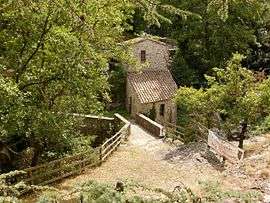
The Mouleyrette mill | ||
| ||
 Colognac | ||
|
Location within Occitanie region  Colognac | ||
| Coordinates: 44°01′46″N 3°49′22″E / 44.0294°N 3.8228°ECoordinates: 44°01′46″N 3°49′22″E / 44.0294°N 3.8228°E | ||
| Country | France | |
| Region | Occitanie | |
| Department | Gard | |
| Arrondissement | Le Vigan | |
| Canton | Lasalle | |
| Intercommunality | Cévennes-Garrigues | |
| Government | ||
| • Mayor (2008–2014) | Rémy Menviel | |
| Area1 | 12.3 km2 (4.7 sq mi) | |
| Population (2008)2 | 205 | |
| • Density | 17/km2 (43/sq mi) | |
| Time zone | CET (UTC+1) | |
| • Summer (DST) | CEST (UTC+2) | |
| INSEE/Postal code | 30087 / 30460 | |
| Elevation |
318–997 m (1,043–3,271 ft) (avg. 569 m or 1,867 ft) | |
|
1 French Land Register data, which excludes lakes, ponds, glaciers > 1 km² (0.386 sq mi or 247 acres) and river estuaries. 2 Population without double counting: residents of multiple communes (e.g., students and military personnel) only counted once. | ||
.svg.png)
Colognac is a commune in the Gard department in southern France.
Population
| Historical population | ||
|---|---|---|
| Year | Pop. | ±% |
| 1962 | 77 | — |
| 1968 | 142 | +84.4% |
| 1975 | 154 | +8.5% |
| 1982 | 164 | +6.5% |
| 1990 | 167 | +1.8% |
| 1999 | 169 | +1.2% |
| 2008 | 205 | +21.3% |
See also
References
| Wikimedia Commons has media related to Colognac. |
This article is issued from Wikipedia - version of the 11/7/2016. The text is available under the Creative Commons Attribution/Share Alike but additional terms may apply for the media files.