Colman, South Dakota
| Colman | |
|---|---|
| City | |
 Location in Moody County and the state of South Dakota | |
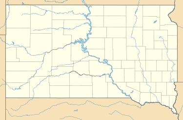 Colman Location of Colman in South Dakota | |
| Coordinates: 43°59′1″N 96°48′48″W / 43.98361°N 96.81333°WCoordinates: 43°59′1″N 96°48′48″W / 43.98361°N 96.81333°W | |
| Country | United States |
| State | South Dakota |
| County | Moody |
| Founded | 1880[1] |
| Government | |
| • Mayor | Gloria Van Duyn |
| Area[2] | |
| • Total | 1.88 sq mi (4.87 km2) |
| • Land | 1.88 sq mi (4.87 km2) |
| • Water | 0 sq mi (0 km2) |
| Elevation | 1,693 ft (516 m) |
| Population (2010)[3] | |
| • Total | 594 |
| • Estimate (2015)[4] | 576 |
| • Density | 320/sq mi (120/km2) |
| Time zone | CST (UTC-6) |
| • Summer (DST) | CDT (UTC-5) |
| ZIP Code | 57017 |
| Area code(s) | 605 |
| FIPS code | 46-13220[5] |
| GNIS feature ID | 1254433[6] |
Colman is a city in Moody County, South Dakota, United States. The population was 594 at the 2010 census.
History
Colman was first named Allentown, and under the latter name had its start in 1890 by the building of the Milwaukee Railroad through that territory.[7]
Geography
Colman is located at 43°59′1″N 96°48′48″W / 43.98361°N 96.81333°W (43.983633, -96.813349).[8]
According to the United States Census Bureau, the city has a total area of 1.88 square miles (4.87 km2), all of it land.[2]
Colman has been assigned the ZIP code 57017 and the FIPS place code 13220.
Demographics
| Historical population | |||
|---|---|---|---|
| Census | Pop. | %± | |
| 1900 | 213 | — | |
| 1910 | 362 | 70.0% | |
| 1920 | 535 | 47.8% | |
| 1930 | 488 | −8.8% | |
| 1940 | 462 | −5.3% | |
| 1950 | 509 | 10.2% | |
| 1960 | 505 | −0.8% | |
| 1970 | 456 | −9.7% | |
| 1980 | 501 | 9.9% | |
| 1990 | 482 | −3.8% | |
| 2000 | 572 | 18.7% | |
| 2010 | 594 | 3.8% | |
| Est. 2015 | 576 | [9] | −3.0% |
| U.S. Decennial Census[10] 2015 Estimate[4] | |||
2010 census
As of the census[3] of 2010, there were 594 people, 237 households, and 160 families residing in the city. The population density was 316.0 inhabitants per square mile (122.0/km2). There were 263 housing units at an average density of 139.9 per square mile (54.0/km2). The racial makeup of the city was 94.4% White, 0.3% African American, 1.7% Native American, 0.8% Asian, 0.8% from other races, and 1.9% from two or more races. Hispanic or Latino of any race were 1.7% of the population.
There were 237 households of which 38.0% had children under the age of 18 living with them, 50.6% were married couples living together, 12.7% had a female householder with no husband present, 4.2% had a male householder with no wife present, and 32.5% were non-families. 29.5% of all households were made up of individuals and 13.1% had someone living alone who was 65 years of age or older. The average household size was 2.51 and the average family size was 3.11.
The median age in the city was 35.7 years. 30.8% of residents were under the age of 18; 7.1% were between the ages of 18 and 24; 25.5% were from 25 to 44; 23% were from 45 to 64; and 13.8% were 65 years of age or older. The gender makeup of the city was 51.9% male and 48.1% female.
2000 census
As of the census[5] of 2000, there were 572 people, 242 households, and 156 families residing in the city. The population density was 344.0 people per square mile (133.0/km²). There were 259 housing units at an average density of 155.7 per square mile (60.2/km²). The racial makeup of the city was 96.85% White, 0.35% Native American, 1.22% Asian, and 1.57% from two or more races. Hispanic or Latino of any race were 1.22% of the population.
There were 242 households out of which 34.7% had children under the age of 18 living with them, 53.3% were married couples living together, 8.7% had a female householder with no husband present, and 35.5% were non-families. 32.2% of all households were made up of individuals and 14.5% had someone living alone who was 65 years of age or older. The average household size was 2.36 and the average family size was 3.03.
In the city the population was spread out with 28.5% under the age of 18, 7.3% from 18 to 24, 30.6% from 25 to 44, 20.3% from 45 to 64, and 13.3% who were 65 years of age or older. The median age was 35 years. For every 100 females there were 86.9 males. For every 100 females age 18 and over, there were 92.0 males.
The median income for a household in the city was $32,143, and the median income for a family was $44,000. Males had a median income of $32,212 versus $21,442 for females. The per capita income for the city was $16,772. About 6.1% of families and 7.7% of the population were below the poverty line, including 7.7% of those under age 18 and 7.2% of those age 65 or over.
References
- ↑ "SD Towns" (PDF). South Dakota State Historical Society. Archived from the original (PDF) on 2010-02-10. Retrieved 2010-02-11.
- 1 2 "US Gazetteer files 2010". United States Census Bureau. Archived from the original on 2012-06-26. Retrieved 2012-06-21.
- 1 2 "American FactFinder". United States Census Bureau. Retrieved 2012-06-21.
- 1 2 "Population Estimates". United States Census Bureau. Retrieved June 13, 2016.
- 1 2 "American FactFinder". United States Census Bureau. Archived from the original on 2013-09-11. Retrieved 2008-01-31.
- ↑ "US Board on Geographic Names". United States Geological Survey. 2007-10-25. Retrieved 2008-01-31.
- ↑ Federal Writers' Project (1940). South Dakota place-names, v.1-3. University of South Dakota. p. 32.
- ↑ "US Gazetteer files: 2010, 2000, and 1990". United States Census Bureau. 2011-02-12. Retrieved 2011-04-23.
- ↑ "Annual Estimates of the Resident Population for Incorporated Places: April 1, 2010 to July 1, 2015". Retrieved July 2, 2016.
- ↑ United States Census Bureau. "Census of Population and Housing". Archived from the original on May 11, 2015. Retrieved June 13, 2016.
Municipalities and communities of Moody County, South Dakota, United States | ||
|---|---|---|
| Cities |  | |
| Towns | ||
| Indian reservations | ||