Collins View, Portland, Oregon
| Collins View | |
|---|---|
| Neighborhood | |
 Collins View | |
|
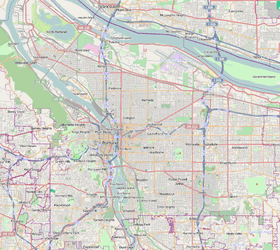
Coordinates: 45°27′10″N 122°40′35″W / 45.45290°N 122.67631°WCoordinates: 45°27′10″N 122°40′35″W / 45.45290°N 122.67631°W PDF map | |
| Country | United States |
| State | Oregon |
| City | Portland |
| Government | |
| • Association | Collins View Neighborhood Association |
| • Coalition | Southwest Neighborhoods, Inc. |
| Area | |
| • Total | 0.87 sq mi (2.25 km2) |
| Population (2000)[1] | |
| • Total | 2,055 |
| • Density | 2,360/sq mi (913/km2) |
| Housing[1] | |
| • No. of households | 728 |
| • Occupancy rate | 96% occupied |
| • % households renting | 22% renting |
| • Avg. household size | 2.82 persons |
Collins View is a neighborhood in the Southwest section of Portland, Oregon. It borders the neighborhoods of Marshall Park and Arnold Creek to the west, Tryon Creek State Natural Area to the south, Dunthorpe (in unincorporated Multnomah County) and River View Cemetery to the east, and the South Burlingame neighborhood to the north. The campus of Lewis and Clark College is in the southeastern portion of the neighborhood.
References
External links
- Guide to Collins View Neighborhood (PortlandNeighborhood.com)
- Rainfall at Collins View (Riverdale High School) Raingage (water.USGS.gov)
This article is issued from Wikipedia - version of the 9/4/2016. The text is available under the Creative Commons Attribution/Share Alike but additional terms may apply for the media files.