Col de Menté
| Col de Menté | |
|---|---|
|
The summit of the Col de Menté | |
| Elevation | 1,349 m (4,426 ft)[1] |
| Traversed by | D44 |
| Location | Haute-Garonne, France |
| Range | Pyrenees |
| Coordinates | 42°55′9.7″N 0°45′42.1″E / 42.919361°N 0.761694°ECoordinates: 42°55′9.7″N 0°45′42.1″E / 42.919361°N 0.761694°E |
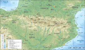 Col de Menté Location of Col de Menté | |

The Col de Menté (elevation 1,349 m (4,426 ft)) is a mountain pass in the central Pyrenees in the department of Haute-Garonne in France. It is situated on the D44 road between Saint-Béat and the D618 (at the bottom of the Col de Portet d'Aspet) and connects the Ger and Garonne valleys. Le Mourtis ski-station is located 1 km. south of the col.
A stele in memory of Serge Lapébie (son of Guy) is situated at the summit.
Details of climb
Starting from Pont de l'Oule (east) (at the foot of the Col de Portet d'Aspet), the climb is 10.9 km (6.8 mi) long. Over this distance, the climb is 716 m (2,349 ft) (an average gradient of 6.6%). The climb proper starts at Ger-de-Boutx, 7 km (4.3 mi) from the summit (at 7.8%), with the steepest sections being at 10.5%.[2][3]
Starting from Saint-Béat (west), the climb is 9.3 km (5.8 mi) long. Over this distance, the climb is 849 m (2,785 ft) (an average gradient of 9.1%) with several sections in excess of 11%.[4]
At the summit there is a road that loops up and over the Col de Menté-Le Mourtis (1,409 m (4,623 ft)), via the ski-station, returning to the Col de Menté.[5]
Appearances in Tour de France
The Col de Menté was first used in the Tour de France in 1966 and has appeared frequently since. The leader over the summit in 1966 was Joaquim Galera.[6]
The Col has featured 18 times, including crossing the Col de Menté-Le Mourtis in 1979 and 1995.[5]
Luis Ocaña
On stage 14 of the 1971 Tour de France Spanish cyclist Luis Ocaña was in the Maillot Jaune with an overall lead of 7 minutes on Eddy Merckx and they crossed the summit of the Col de Menté together in a storm, with streams of mud running across the road. Merckx, an excellent descender, attacked as he descended dangerously down the mountain road. To stay in contact with Merckx, Ocaña took risks descending. Flying through the corners, Merckx lost control and skidded into a low retaining wall at the side of the road. Ocaña trailing close behind could not avoid the fallen Merckx and fell himself. Merckx was up quickly and sped away. Ocaña struggled to release his cleats from the toe clips and was struck by the pursuing Joop Zoetemelk. Ocaña lay on the ground screaming with pain. Help arrived quickly and Ocaña was rushed by helicopter to the hospital in St. Gaudens. He recovered from his injuries, but his 1971 Tour dreams had come to an end.[7] The following day Merckx refused to wear the yellow jersey in order to pay tribute to Ocaña. There is now a memorial plaque at the scene of the accident on the eastern side of the Col de Menté (at 42°54′55.9″N 0°44′37.7″E / 42.915528°N 0.743806°E).
References
- ↑ IGN map
- ↑ "Col de Menté: Pont de l'Oule". www.climbbybike.com. Retrieved 19 July 2012.
- ↑ "Col de Menté: Ger-de-Boutx". www.climbbybike.com. Retrieved 19 July 2012.
- ↑ "Col de Menté: Saint-Béat". www.climbbybike.com. Retrieved 19 July 2012.
- 1 2 "Le col de Menté-Le Mourtis dans le Tour de France" (in French). ledicodutour. Retrieved 19 July 2012.
- ↑ "Le col de Menté dans le Tour de France" (in French). ledicodutour. Retrieved 10 July 2013.
- ↑ Boyce, Barry. "Top 25 All Time Tours: 1971 – Unbeatable Merckx Gets a Major Scare". Cycling Revealed. Retrieved 17 July 2012.
External links
| Wikimedia Commons has media related to Col de Menté. |