Col, Ajdovščina
| Col Podvelb (archaic) | |
|---|---|
 | |
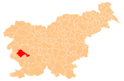
 Col Location in Slovenia | |
| Coordinates: 45°52′48.44″N 14°0′7″E / 45.8801222°N 14.00194°ECoordinates: 45°52′48.44″N 14°0′7″E / 45.8801222°N 14.00194°E | |
| Country |
|
| Traditional region | Littoral |
| Statistical region | Gorizia |
| Municipality | Ajdovščina |
| Area | |
| • Total | 2.62 km2 (1.01 sq mi) |
| Elevation | 611.3 m (2,005.6 ft) |
| Population (2002) | |
| • Total | 498 |
| [1] | |
Col (pronounced [ˈtsɔu̯]; archaic Podvelb,[2] Italian: Zolla,[3] German: Zoll[2]) is a settlement on the edge of a karst plateau overlooking the Vipava Valley in the Municipality of Ajdovščina in the Littoral region of Slovenia. A Roman road led through the settlement. Its location overlooking the valley on the main route leading inland was used in the Middle Ages and later as a checkpoint between the Littoral region and Carniola.
Name
The settlement was first attested in written sources as Zoll oder Podgweld and Zoll oder Podgwelb in 1763–1787. The Slovene name Col is borrowed from Middle High German zol (modern German Zoll) 'toll' or 'customs duty'.[3][4] Col is located on the border between the historical Habsburg crown lands of Carniola and Gorizia and was a collection point for tolls.[3] Col was originally known as Podvelb (German: Podgwelb; literally, 'below the arch') in reference to a castle that formerly stood near Saint Leonard's Church.[2][5]
Church
The parish church in the settlement is dedicated to Saint Leonard and belongs to the Diocese of Koper.[6]
References
- ↑ Statistical Office of the Republic of Slovenia
- 1 2 3 Intelligenzblatt zur Laibacher Zeitung, no. 141. 24 November 1849, p. 24.
- 1 2 3 Snoj, Marko. 2009. Etimološki slovar slovenskih zemljepisnih imen. Ljubljana: Modrijan and Založba ZRC, p. 91.
- ↑ Ajdovščina municipal site
- ↑ Savnik, Roman, ed. 1968. Krajevni leksikon Slovenije, vol. 1. Ljubljana: Državna založba Slovenije, p. 21.
- ↑ Koper Diocese list of churches Archived March 6, 2009, at the Wayback Machine.
External links
 Media related to Col, Ajdovščina at Wikimedia Commons
- Col at Geopedia
| Settlements | Administrative centre: Ajdovščina
|  | ||||||
|---|---|---|---|---|---|---|---|---|
| Landmarks |
| |||||||
| Notable people |
| |||||||