Coarsegold, California
| Coarsegold | |
|---|---|
| census-designated place | |
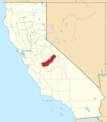
 Coarsegold  Coarsegold Location in California | |
| Coordinates: 37°15′44″N 119°42′04″W / 37.26222°N 119.70111°WCoordinates: 37°15′44″N 119°42′04″W / 37.26222°N 119.70111°W | |
| Country |
|
| State |
|
| County | Madera County |
| Area[1] | |
| • Total | 10.988 sq mi (28.459 km2) |
| • Land | 10.988 sq mi (28.459 km2) |
| • Water | 0 sq mi (0 km2) 0% |
| Elevation[2] | 2,218 ft (676 m) |
| Population (2010) | |
| • Total | 1,840 |
| • Density | 170/sq mi (65/km2) |
| Time zone | Pacific (PST) (UTC-8) |
| • Summer (DST) | PDT (UTC-7) |
| ZIP Code | 93614 |
| GNIS feature IDs | 258494; 2628719 |
| U.S. Geological Survey Geographic Names Information System: Coarsegold, California; U.S. Geological Survey Geographic Names Information System: Coarsegold, California | |
Coarsegold is a census-designated place[3] in Madera County, California.[2] The population was 1,840 at the 2010 census.[4] The Picayune Rancheria of Chukchansi Indians, a federally recognized tribe, is headquartered in Coarsegold.[5]
History
Coarsegold has previously had several names, including Coarse Gold, Gold Gulch, Michaels, Oro Grosso, Texas Flat,[6] and Coarse Gold Gulch.[7] The place was first called Texas Flat after miners from Texas discovered gold there in 1849.[7] By 1874, the name had changed to Michaels, honoring Charles Michaels, a local merchant.[7] A rival mining camp inhabited by Mexicans there was called Oro Grosso.[7]
The current name derives from the California Gold Rush of the mid-19th century, when prospectors discovered coarse nuggets of gold in a nearby creek.[8] At one time, several dozen gold mines operated in the area.
The Coarse Gold Gulch post office opened in 1878, changed the name to Goldgulch in 1895 and to Coarsegold in 1899.[7]
Geography
Coarsegold is located on Highway 41 between Fresno and the southern entrance to Yosemite National Park, at an elevation of 2,218 ft (676 m).[2] Nearby communities include Oakhurst, around 7 miles (11 km) away, Yosemite Lakes Park, and Indian Lakes Estates.
Climate
Coarsegold has a Mediterranean climate (Csa according to the Köppen climate classification system) with hot, dry summers and cool, wet winters.[9] Its average annual precipitation is 27.29 in (693 mm).[10] It is located in hardiness zone 8b.[11]
| Coarsegold | ||||||||||||||||||||||||||||||||||||||||||||||||||||||||||||
|---|---|---|---|---|---|---|---|---|---|---|---|---|---|---|---|---|---|---|---|---|---|---|---|---|---|---|---|---|---|---|---|---|---|---|---|---|---|---|---|---|---|---|---|---|---|---|---|---|---|---|---|---|---|---|---|---|---|---|---|---|
| Climate chart (explanation) | ||||||||||||||||||||||||||||||||||||||||||||||||||||||||||||
| ||||||||||||||||||||||||||||||||||||||||||||||||||||||||||||
| ||||||||||||||||||||||||||||||||||||||||||||||||||||||||||||
Demographics
The 2010 United States Census[4] reported that Coarsegold had a population of 1,840. The population density was 167.5 people per square mile (64.7/km²). The racial makeup of Coarsegold was 1,617 (87.9%) White, 11 (0.6%) African American, 50 (2.7%) Native American, 32 (1.7%) Asian, 6 (0.3%) Pacific Islander, 47 (2.6%) from other races, and 77 (4.2%) from two or more races. Hispanic or Latino of any race were 156 persons (8.5%).
The Census reported that 1,840 people (100% of the population) lived in households, 0 (0%) lived in non-institutionalized group quarters, and 0 (0%) were institutionalized.
There were 766 households, out of which 184 (24.0%) had children under the age of 18 living in them, 452 (59.0%) were opposite-sex married couples living together, 70 (9.1%) had a female householder with no husband present, 28 (3.7%) had a male householder with no wife present. There were 29 (3.8%) unmarried opposite-sex partnerships, and 4 (0.5%) same-sex married couples or partnerships. 186 households (24.3%) were made up of individuals and 104 (13.6%) had someone living alone who was 65 years of age or older. The average household size was 2.40. There were 550 families (71.8% of all households); the average family size was 2.79.
The population was spread out with 338 people (18.4%) under the age of 18, 116 people (6.3%) aged 18 to 24, 295 people (16.0%) aged 25 to 44, 585 people (31.8%) aged 45 to 64, and 506 people (27.5%) who were 65 years of age or older. The median age was 52.3 years. For every 100 females there were 91.1 males. For every 100 females age 18 and over, there were 88.0 males.
There were 864 housing units at an average density of 78.6 per square mile (30.4/km²), of which 617 (80.5%) were owner-occupied, and 149 (19.5%) were occupied by renters. The homeowner vacancy rate was 2.8%; the rental vacancy rate was 5.7%. 1,492 people (81.1% of the population) lived in owner-occupied housing units and 348 people (18.9%) lived in rental housing units.
Culture
Chukchansi language classes have been taught at the elementary school in Coarsegold since 2008.[13] As of 2012, Chukchansi classes are available for children and adults.[14]
Every year from mid-October to mid-November, tarantula mating season takes place and the town is full of tarantulas. Locals go out of their way to protect and respect the arachnids during this time. A Coarsegold Tarantula Festival is held in late October, traditionally the Saturday before Halloween, including tarantula racing, a competition for the hairiest legs of both men and women, and a pumpkin dessert contest.[15]
Notable residents
- Creed Bratton – Actor and musician was raised in Coarsegold
- Richard Kiel – Actor lived in Coarsegold from 1980–2002 when he moved to Clovis, California for medical reasons[16]
- Lee Newton – Actress raised in Coarsegold until moving to Pasadena, California after high school to pursue an acting career[17]
- Billy Vukovich III – Indianapolis 500 1988 rookie of the year grew up in Yosemite Lakes Park
- Grace Lee Whitney – Actress lived in Coarsegold from 1993 until her death on May 1, 2015[18]
Media
The 1993 computer-based adventure game Freddy Pharkas: Frontier Pharmacist, is set in a fictionalized Coarsegold, California in the 1880s. The game was published by Sierra On-Line which was, at the time, based in nearby Oakhurst; the same company, under its prior name On-Line Systems, in 1981 published On-Line Adventure #3: Cranston Manor, also set in Coarsegold.
Coarsegold is the destination for stars Joel McCrea and Randolph Scott in the 1962 film Ride the High Country.
References
- ↑ U.S. Census Archived 2012-06-26 at WebCite
- 1 2 3 U.S. Geological Survey Geographic Names Information System: Coarsegold, California
- ↑ U.S. Geological Survey Geographic Names Information System: Coarsegold, California
- 1 2 "2010 Census Interactive Population Search: CA - Coarsegold CDP". U.S. Census Bureau. Retrieved July 12, 2014.
- ↑ "Contact Information." Picayune Rancheria of Chukchansi Indians. Retrieved 26 Nov 2012.
- ↑ All U.S. Geological Survey Geographic Names Information System: Coarsegold, California
- 1 2 3 4 5 Durham, David L. (1998). California's Geographic Names: A Gazetteer of Historic and Modern Names of the State. Clovis, Calif.: Word Dancer Press. p. 760. ISBN 1-884995-14-4.
- ↑ Gannett, Henry (1905). The Origin of Certain Place Names in the United States. Govt. Print. Off. p. 85.
- ↑ Weatherbase climate summary for Coarsegold
- ↑ Western Regional Climate Center: NCDC 1981-2010 Normals for Coarsegold
- ↑ Plantmaps hardiness zone for Coarsegold
- ↑ Weather.com monthly averages for Coarsegold
- ↑ Carmen George (2011-09-01). "Saving a Language". Sierra Star. Oakhurst CA. Retrieved 2012-09-01.
- ↑ Onishi, Norimitsu (17 June 2012). "With Casino Revenues, Tribes Push to Preserve Languages, and Cultures". The New York Times. p. 14.
- ↑ http://www.coarsegold.com/coarsegold-oakhurst-events.htm
- ↑ "Richard Kiel dies at 74; actor played 'Jaws' in Bond movies". LA Times. September 11, 2014.
- ↑ "Ep. 55 Lee Newton - Ear Biscuits". Retrieved January 8, 2016.
- ↑ "Grace Lee Whitney, original 'Star Trek' cast member, dies in Coarsegold". Fresno Bee. May 3, 2015.