Clay County, Georgia
| Clay County, Georgia | |
|---|---|
 Clay County Courthouse in Fort Gaines | |
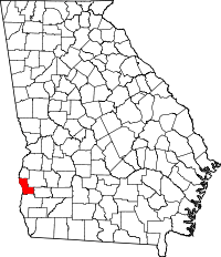 Location in the U.S. state of Georgia | |
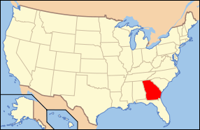 Georgia's location in the U.S. | |
| Founded | 1854 |
| Named for | Henry Clay |
| Seat | Fort Gaines |
| Largest city | Fort Gaines |
| Area | |
| • Total | 217 sq mi (562 km2) |
| • Land | 195 sq mi (505 km2) |
| • Water | 22 sq mi (57 km2), 10.1% |
| Population | |
| • (2010) | 3,183 |
| • Density | 16/sq mi (6/km²) |
| Congressional district | 2nd |
| Time zone | Eastern: UTC-5/-4 |
| Website |
www |
Clay County is a county located in the U.S. state of Georgia. As of the 2010 census, the population was 3,183,[1] making it the fifth-least populous county in Georgia. The county seat is Fort Gaines.[2]
History
This area was historically occupied by the Creek Indians until Indian Removal in the 1830s. European Americans pushed them out and developed the land for cotton, bringing in thousands of African slaves to work the land.
The county is named in honor of Henry Clay,[3] famous American statesman, member of the United States Senate from Kentucky and United States Secretary of State in the 19th century. Part of what became the Black Belt of Georgia, prior to the American Civil War the county's chief commodity crop was cotton, cultivated and processed by farmers and African-American slaves. After the war, the economy continued to be agricultural, but timber was also harvested.
Clay was created by a February 16, 1854, act of the Georgia General Assembly, and organized from portions of Early and Randolph counties.
Geography
According to the U.S. Census Bureau, the county has a total area of 217 square miles (560 km2), of which 195 square miles (510 km2) is land and 22 square miles (57 km2) (10.1%) is water.[4]
The central and southwestern portions of Clay County, from west of Bluffton to northwest of Coleman, are located in the Lower Chattahoochee River sub-basin of the ACF River Basin (Apalachicola-Chattahoochee-Flint River Basin). The county's northwestern corner, which is bisected by State Route 39 running north from Fort Gaines, is located in the Middle Chattahoochee River-Walter F. George Lake sub-basin of the same ACF River Basin. Just the very southeastern corner of Clay County is located in the Spring Creek sub-basin of the same larger ACF River Basin.[5]
Major highways
Adjacent counties
- Quitman County, Georgia - north
- Randolph County, Georgia - northeast
- Calhoun County, Georgia - east
- Early County, Georgia - south
- Henry County, Alabama - west (CST)
- Barbour County, Alabama - northwest (CST)
Demographics
| Historical population | |||
|---|---|---|---|
| Census | Pop. | %± | |
| 1860 | 4,893 | — | |
| 1870 | 5,493 | 12.3% | |
| 1880 | 6,650 | 21.1% | |
| 1890 | 7,817 | 17.5% | |
| 1900 | 8,568 | 9.6% | |
| 1910 | 8,960 | 4.6% | |
| 1920 | 7,557 | −15.7% | |
| 1930 | 6,943 | −8.1% | |
| 1940 | 7,064 | 1.7% | |
| 1950 | 5,844 | −17.3% | |
| 1960 | 4,551 | −22.1% | |
| 1970 | 3,636 | −20.1% | |
| 1980 | 3,553 | −2.3% | |
| 1990 | 3,364 | −5.3% | |
| 2000 | 3,357 | −0.2% | |
| 2010 | 3,183 | −5.2% | |
| Est. 2015 | 3,141 | [6] | −1.3% |
| U.S. Decennial Census[7] 1790-1960[8] 1900-1990[9] 1990-2000[10] 2010-2013[1] | |||
2000 census
As of the 2010 United States Census, there were 3,183 people residing in the county. 60.4% were Black or African American, 37.6% White, 0.3% Native American, 0.3% Asian, 0.1% of some other race and 1.2% of two or more races. 0.8% were Hispanic or Latino (of any race).
As of the census[11] of 2000, there were 3,357 people, 1,347 households, and 928 families residing in the county. The population density was 17 people per square mile (7/km²). There were 1,925 housing units at an average density of 10 per square mile (4/km²). The racial makeup of the county was 60.47% Black or African American, 38.43% White, 0.12% Native American, 0.27% Asian, 0.06% Pacific Islander, and 0.66% from two or more races. 0.95% of the population were Hispanic or Latino of any race.
There were 1,347 households out of which 25.70% had children under the age of 18 living with them, 40.70% were married couples living together, 23.40% had a female householder with no husband present, and 31.10% were non-families. 27.80% of all households were made up of individuals and 13.20% had someone living alone who was 65 years of age or older. The average household size was 2.45 and the average family size was 2.99.
In the county the population was spread out with 25.70% under the age of 18, 8.00% from 18 to 24, 21.00% from 25 to 44, 25.70% from 45 to 64, and 19.50% who were 65 years of age or older. The median age was 42 years. For every 100 females there were 83.30 males. For every 100 females age 18 and over, there were 78.50 males.
The median income for a household in the county was $21,448, and the median income for a family was $27,837. Males had a median income of $26,557 versus $17,083 for females. The per capita income for the county was $16,819. About 28.10% of families and 31.30% of the population were below the poverty line, including 43.40% of those under age 18 and 23.90% of those age 65 or over.
2010 census
As of the 2010 United States Census, there were 3,183 people, 1,331 households, and 869 families residing in the county.[12] The population density was 16.3 inhabitants per square mile (6.3/km2). There were 2,102 housing units at an average density of 10.8 per square mile (4.2/km2).[13] The racial makeup of the county was 60.4% black or African American, 37.6% white, 0.3% Asian, 0.3% American Indian, 0.1% from other races, and 1.2% from two or more races. Those of Hispanic or Latino origin made up 0.8% of the population.[12] In terms of ancestry, and 3.3% were American.[14]
Of the 1,331 households, 27.3% had children under the age of 18 living with them, 37.5% were married couples living together, 22.8% had a female householder with no husband present, 34.7% were non-families, and 31.6% of all households were made up of individuals. The average household size was 2.35 and the average family size was 2.93. The median age was 45.8 years.[12]
The median income for a household in the county was $26,250 and the median income for a family was $31,354. Males had a median income of $29,440 versus $23,816 for females. The per capita income for the county was $13,353. About 25.5% of families and 34.2% of the population were below the poverty line, including 56.7% of those under age 18 and 16.0% of those age 65 or over.[15]
Education
Communities
Cities
Unincorporated communities
- Bellville
- Bethel
- Cotton Hill
- Days Crossroads
- Garnersville
- Harrisons Mill
- Jeff
- Jones Crossing
- Moores Crossroads
- Oakland
- Pecan
- Ricks Place
- Suttons Corner
- Watson Crossroads
- Zetto
Ghost town
See also
References
- 1 2 "State & County QuickFacts". United States Census Bureau. Retrieved June 20, 2014.
- ↑ "Find a County". National Association of Counties. Archived from the original on 2011-05-31. Retrieved 2011-06-07.
- ↑ Gannett, Henry (1905). The Origin of Certain Place Names in the United States. Govt. Print. Off. p. 83.
- ↑ "US Gazetteer files: 2010, 2000, and 1990". United States Census Bureau. 2011-02-12. Retrieved 2011-04-23.
- ↑ "Georgia Soil and Water Conservation Commission Interactive Mapping Experience". Georgia Soil and Water Conservation Commission. Retrieved 2015-11-24.
- ↑ "County Totals Dataset: Population, Population Change and Estimated Components of Population Change: April 1, 2010 to July 1, 2015". Retrieved July 2, 2016.
- ↑ "U.S. Decennial Census". United States Census Bureau. Archived from the original on May 11, 2015. Retrieved June 20, 2014.
- ↑ "Historical Census Browser". University of Virginia Library. Retrieved June 20, 2014.
- ↑ "Population of Counties by Decennial Census: 1900 to 1990". United States Census Bureau. Retrieved June 20, 2014.
- ↑ "Census 2000 PHC-T-4. Ranking Tables for Counties: 1990 and 2000" (PDF). United States Census Bureau. Retrieved June 20, 2014.
- ↑ "American FactFinder". United States Census Bureau. Archived from the original on 2013-09-11. Retrieved 2011-05-14.
- 1 2 3 "DP-1 Profile of General Population and Housing Characteristics: 2010 Demographic Profile Data". United States Census Bureau. Retrieved 2015-12-27.
- ↑ "Population, Housing Units, Area, and Density: 2010 - County". United States Census Bureau. Retrieved 2015-12-27.
- ↑ "DP02 SELECTED SOCIAL CHARACTERISTICS IN THE UNITED STATES – 2006-2010 American Community Survey 5-Year Estimates". United States Census Bureau. Retrieved 2015-12-27.
- ↑ "DP03 SELECTED ECONOMIC CHARACTERISTICS – 2006-2010 American Community Survey 5-Year Estimates". United States Census Bureau. Retrieved 2015-12-27.
External links
- Official Website of Clay County Georgia
- Clay County historical marker
- New Lowell United Methodist Church historical marker
 |
Barbour County, Alabama | Quitman County | Randolph County | |
| Henry County, Alabama | |
Calhoun County | ||
| ||||
| | ||||
| Early County |
Municipalities and communities of Clay County, Georgia, United States | ||
|---|---|---|
| City | | |
| Town | ||
| Unincorporated community | ||
| Ghost town | ||
Coordinates: 31°37′N 84°59′W / 31.62°N 84.99°W