Clarke County, Mississippi
| Clarke County, Mississippi | |
|---|---|
 Clarke County courthouse Quitman | |
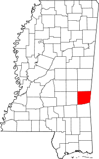 Location in the U.S. state of Mississippi | |
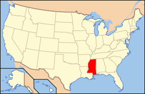 Mississippi's location in the U.S. | |
| Founded | December 23, 1833[1] |
| Seat | Quitman |
| Largest city | Quitman |
| Area | |
| • Total | 694 sq mi (1,797 km2) |
| • Land | 692 sq mi (1,792 km2) |
| • Water | 2.0 sq mi (5 km2), 0.3% |
| Population | |
| • (2010) | 16,732 |
| • Density | 24/sq mi (9/km²) |
| Congressional districts | 3rd, 4th |
| Time zone | Central: UTC-6/-5 |
Clarke County is a county located in the U.S. state of Mississippi. As of the 2010 census, the population was 16,732.[2] Its county seat is Quitman.[3] Clarke County is named for Joshua G. Clarke,[4] the first Mississippi state chancellor and judge.
The county is part of the Meridian, MS Micropolitan Statistical Area.
Geography
According to the U.S. Census Bureau, the county has a total area of 694 square miles (1,800 km2), of which 692 square miles (1,790 km2) is land and 2.0 square miles (5.2 km2) (0.3%) is water.[5]
Major highways
Adjacent counties
- Lauderdale County (north)
- Choctaw County, Alabama (east)
- Wayne County (south)
- Jasper County (west)
Demographics
| Historical population | |||
|---|---|---|---|
| Census | Pop. | %± | |
| 1840 | 2,986 | — | |
| 1850 | 5,477 | 83.4% | |
| 1860 | 10,771 | 96.7% | |
| 1870 | 7,505 | −30.3% | |
| 1880 | 15,021 | 100.1% | |
| 1890 | 15,826 | 5.4% | |
| 1900 | 17,741 | 12.1% | |
| 1910 | 21,630 | 21.9% | |
| 1920 | 17,927 | −17.1% | |
| 1930 | 19,679 | 9.8% | |
| 1940 | 20,596 | 4.7% | |
| 1950 | 19,362 | −6.0% | |
| 1960 | 16,493 | −14.8% | |
| 1970 | 15,049 | −8.8% | |
| 1980 | 16,945 | 12.6% | |
| 1990 | 17,313 | 2.2% | |
| 2000 | 17,955 | 3.7% | |
| 2010 | 16,732 | −6.8% | |
| Est. 2015 | 16,006 | [6] | −4.3% |
| U.S. Decennial Census[7] 1790-1960[8] 1900-1990[9] 1990-2000[10] 2010-2013[2] | |||
As of the census[11] of 2000, there were 17,955 people, 6,978 households, and 5,024 families residing in the county. The population density was 26 people per square mile (10/km²). There were 8,100 housing units at an average density of 12 per square mile (5/km²). The racial makeup of the county was 64.49% White, 34.81% Black or African American, 0.11% Native American, 0.11% Asian, 0.01% Pacific Islander, 0.17% from other races, and 0.30% from two or more races. 0.67% of the population were Hispanic or Latino of any race.
There were 6,978 households out of which 33.20% had children under the age of 18 living with them, 52.00% were married couples living together, 15.90% had a female householder with no husband present, and 28.00% were non-families. 25.50% of all households were made up of individuals and 11.80% had someone living alone who was 65 years of age or older. The average household size was 2.55 and the average family size was 3.06.
In the county the population was spread out with 26.80% under the age of 18, 8.60% from 18 to 24, 26.70% from 25 to 44, 22.80% from 45 to 64, and 15.10% who were 65 years of age or older. The median age was 37 years. For every 100 females there were 91.30 males. For every 100 females age 18 and over, there were 87.10 males.
The median income for a household in the county was $26,610, and the median income for a family was $33,396. Males had a median income of $27,580 versus $19,402 for females. The per capita income for the county was $14,288. About 18.80% of families and 23.00% of the population were below the poverty line, including 32.50% of those under age 18 and 24.10% of those age 65 or over.
Communities
Cities
- Quitman (county seat)
Towns
Unincorporated communities
Ghost town
See also
References
- ↑ "Clarke County, Mississippi Genealogy & History Network". Retrieved November 8, 2014.
- 1 2 "State & County QuickFacts". United States Census Bureau. Retrieved September 3, 2013.
- ↑ "Find a County". National Association of Counties. Archived from the original on 2011-05-31. Retrieved 2011-06-07.
- ↑ Gannett, Henry (1905). The Origin of Certain Place Names in the United States. Govt. Print. Off. p. 83.
- ↑ "2010 Census Gazetteer Files". United States Census Bureau. August 22, 2012. Retrieved November 3, 2014.
- ↑ "County Totals Dataset: Population, Population Change and Estimated Components of Population Change: April 1, 2010 to July 1, 2015". Retrieved July 2, 2016.
- ↑ "U.S. Decennial Census". United States Census Bureau. Archived from the original on May 11, 2015. Retrieved November 3, 2014.
- ↑ "Historical Census Browser". University of Virginia Library. Retrieved November 3, 2014.
- ↑ "Population of Counties by Decennial Census: 1900 to 1990". United States Census Bureau. Retrieved November 3, 2014.
- ↑ "Census 2000 PHC-T-4. Ranking Tables for Counties: 1990 and 2000" (PDF). United States Census Bureau. Retrieved November 3, 2014.
- ↑ "American FactFinder". United States Census Bureau. Archived from the original on 2013-09-11. Retrieved 2008-01-31.
 |
Lauderdale County | | ||
| Jasper County | |
Choctaw County, Alabama | ||
| ||||
| | ||||
| Wayne County |
Municipalities and communities of Clarke County, Mississippi, United States | ||
|---|---|---|
| City | | |
| Towns | ||
| Unincorporated communities | ||
| Ghost town | ||
.svg.png)
Coordinates: 32°02′N 88°41′W / 32.04°N 88.69°W