Clark County, Idaho
| Clark County, Idaho | ||
|---|---|---|
| ||
 Location in the U.S. state of Idaho | ||
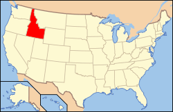 Idaho's location in the U.S. | ||
| Founded | February 1, 1919 | |
| Named for | State Senator Sam K. Clark | |
| Seat | Dubois | |
| Largest city | Dubois | |
| Area | ||
| • Total | 1,765 sq mi (4,571 km2) | |
| • Land | 1,764 sq mi (4,569 km2) | |
| • Water | 1.0 sq mi (3 km2), 0.1% | |
| Population | ||
| • (2010) | 982 | |
| • Density | 0.6/sq mi (0/km²) | |
| Congressional district | 2nd | |
| Time zone | Mountain: UTC-7/-6 | |
| Website |
www | |

Clark County is a rural county in the U.S. state of Idaho. As of the 2010 Census the county had a population of 982,[1] making it the least populous county in Idaho. The county seat and largest city is Dubois.[2] The county was established on February 1, 1919, partitioned from Fremont County. It was named for State Senator Sam K. Clark, an early pioneer on Medicine Lodge Creek.[3]
Geography
According to the U.S. Census Bureau, the county has a total area of 1,765 square miles (4,570 km2), of which 1,764 square miles (4,570 km2) is land and 1.0 square mile (2.6 km2) (0.1%) is water.[4]
The northern border of the county is the Bitterroot Range of the Rocky Mountains, which forms the state line with Montana and is also the continental divide. It is crossed by Interstate 15 over Monida Pass at 6,820 feet (2,079 m) above sea level. Monida Pass also marks an east-west divide between Bitterroot subranges: the Beaverhead Mountains are to the west and the Centennial Mountains are to the east.
Adjacent counties
- Lemhi County – west
- Butte County – southwest
- Jefferson County – south
- Fremont County – east
- Beaverhead County, Montana – north
Major highways
National protected areas
- Caribou-Targhee National Forest (part)
- Nez Perce National Historical Park (part)
- Salmon-Challis National Forest (part)
Demographics
| Historical population | |||
|---|---|---|---|
| Census | Pop. | %± | |
| 1920 | 1,886 | — | |
| 1930 | 1,122 | −40.5% | |
| 1940 | 1,005 | −10.4% | |
| 1950 | 918 | −8.7% | |
| 1960 | 915 | −0.3% | |
| 1970 | 741 | −19.0% | |
| 1980 | 798 | 7.7% | |
| 1990 | 762 | −4.5% | |
| 2000 | 1,022 | 34.1% | |
| 2010 | 982 | −3.9% | |
| Est. 2015 | 880 | [5] | −10.4% |
| U.S. Decennial Census[6] 1790-1960[7] 1900-1990[8] 1990-2000[9] 2010-2013[1] | |||
2000 census
As of the census[10] of 2000, there were 1,022 people, 340 households, and 257 families residing in the county. The population density was 1 person per square mile (0/km²). There were 521 housing units at an average density of 0 per square mile (0/km²). The racial makeup of the county was 74.17% White, 0.10% Black or African American, 0.98% Native American, 0.20% Asian, 0.10% Pacific Islander, 23.48% from other races, and 0.98% from two or more races. 34.25% of the population were Hispanic or Latino of any race. 14.3% were of English, 8.1% German and 5.8% Irish ancestry according to Census 2000.
There were 340 households out of which 45.00% had children under the age of 18 living with them, 61.80% were married couples living together, 7.10% had a female householder with no husband present, and 24.40% were non-families. 20.00% of all households were made up of individuals and 8.50% had someone living alone who was 65 years of age or older. The average household size was 3.01 and the average family size was 3.52.
In the county the population was spread out with 35.20% under the age of 18, 8.00% from 18 to 24, 27.50% from 25 to 44, 20.10% from 45 to 64, and 9.20% who were 65 years of age or older. The median age was 31 years. For every 100 females there were 110.70 males. For every 100 females age 18 and over, there were 112.20 males.
The median income for a household in the county was $31,576, and the median income for a family was $31,534. Males had a median income of $23,854 versus $20,192 for females. The per capita income for the county was $11,141. About 18.70% of families and 19.90% of the population were below the poverty line, including 24.10% of those under age 18 and 11.70% of those age 65 or over.
2010 census
As of the 2010 United States Census, there were 982 people, 345 households, and 243 families residing in the county.[11] The population density was 0.6 inhabitants per square mile (0.23/km2). There were 531 housing units at an average density of 0.3 per square mile (0.12/km2).[12] The racial makeup of the county was 72.4% white, 1.0% American Indian, 0.7% black or African American, 0.5% Asian, 23.8% from other races, and 1.5% from two or more races. Those of Hispanic or Latino origin made up 40.5% of the population.[11] In terms of ancestry, 14.8% were English, 7.4% were German, and 6.5% were American.[13]
Of the 345 households, 37.7% had children under the age of 18 living with them, 57.4% were married couples living together, 7.0% had a female householder with no husband present, 29.6% were non-families, and 24.3% of all households were made up of individuals. The average household size was 2.84 and the average family size was 3.41. The median age was 32.7 years.[11]
The median income for a household in the county was $40,909 and the median income for a family was $37,656. Males had a median income of $32,895 versus $24,125 for females. The per capita income for the county was $19,737. About 8.7% of families and 11.3% of the population were below the poverty line, including 21.5% of those under age 18 and 5.9% of those age 65 or over.[14]
Education
The public schools in the county are operated by Clark County School District #161, headquartered in Dubois. The website is http://www.clarkcountyschools161.org/
Communities
Cities
Unincorporated communities
See also
References
- 1 2 "State & County QuickFacts". United States Census Bureau. Retrieved June 28, 2014.
- ↑ "Find a County". National Association of Counties. Archived from the original on 2011-05-31. Retrieved 2011-06-07.
- ↑ Idaho.gov – Clark County – accessed 2009-05-28
- ↑ "US Gazetteer files: 2010, 2000, and 1990". United States Census Bureau. 2011-02-12. Retrieved 2011-04-23.
- ↑ "County Totals Dataset: Population, Population Change and Estimated Components of Population Change: April 1, 2010 to July 1, 2015". Retrieved July 2, 2016.
- ↑ "U.S. Decennial Census". United States Census Bureau. Archived from the original on May 11, 2015. Retrieved June 28, 2014.
- ↑ "Historical Census Browser". University of Virginia Library. Retrieved June 28, 2014.
- ↑ "Population of Counties by Decennial Census: 1900 to 1990". United States Census Bureau. Retrieved June 28, 2014.
- ↑ "Census 2000 PHC-T-4. Ranking Tables for Counties: 1990 and 2000" (PDF). United States Census Bureau. Retrieved June 28, 2014.
- ↑ "American FactFinder". United States Census Bureau. Archived from the original on 2013-09-11. Retrieved 2008-01-31.
- 1 2 3 "DP-1 Profile of General Population and Housing Characteristics: 2010 Demographic Profile Data". United States Census Bureau. Retrieved 2016-01-09.
- ↑ "Population, Housing Units, Area, and Density: 2010 - County". United States Census Bureau. Retrieved 2016-01-09.
- ↑ "DP02 SELECTED SOCIAL CHARACTERISTICS IN THE UNITED STATES – 2006-2010 American Community Survey 5-Year Estimates". United States Census Bureau. Retrieved 2016-01-09.
- ↑ "DP03 SELECTED ECONOMIC CHARACTERISTICS – 2006-2010 American Community Survey 5-Year Estimates". United States Census Bureau. Retrieved 2016-01-09.
| Wikimedia Commons has media related to Clark County, Idaho. |
External links
- Official website
- State of Idaho official site – Clark County
- Clark County School District #161
- Clark county historical photographs at the Harold B. Lee Library, Brigham Young University
 |
Beaverhead County, Montana | | ||
| Lemhi County | |
Fremont County | ||
| ||||
| | ||||
| Butte County | Jefferson County |
Municipalities and communities of Clark County, Idaho, United States | ||
|---|---|---|
| Cities | ||
| Unincorporated communities | ||
Coordinates: 44°17′N 112°23′W / 44.28°N 112.38°W