Cinque Torri
| Cinque Torri | |
|---|---|
 | |
| Highest point | |
| Elevation | 2,361 m (7,746 ft) |
| Prominence | 140 metres (460 ft) |
| Coordinates | 46°30′37″N 12°03′07″E / 46.510160°N 12.052065°ECoordinates: 46°30′37″N 12°03′07″E / 46.510160°N 12.052065°E |
| Geography | |
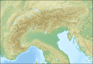 Cinque Torri Location in the Alps | |
| Location | Province of Belluno, Italy |
| Parent range | Dolomites |
Cinque Torri (sometimes named also Cinque Torri di Averau; German: Fünf Türme) are a small group belonging to Nuvolao group, in the Dolomiti Ampezzane (part of the Eastern Dolomites) north-west of San Vito di Cadore and south-west of Cortina d'Ampezzo.
Description
Cinque Torri, as all the other mountains in the area, are made of Dolomia, with a particular pale grey colour. The group is formed by five towers (which give the name to the mountain) with a maximum elevation of 2.361 m (Torre Grande). Every "tower" has its own name:
- Torre Grande, the highest one has three very appealing peaks for rock climbers: Cima Nord, Cima Sud e Cima Ovest;
- Torre Seconda, also named Torre del Barancio or Torre Romana;
- Terza Torre, or Torre Latina;
- Quarta Torre, formed by two blocks of rock with different height, respectively called then Torre Quarta Bassa and Torre Quarta Alta;
- Quinta Torre, or Torre Inglese.
They are located in the south-west area of the valley of Cortina d'Ampezzo, north of the Averau mountain, which Cinque Torri can be considered part of.
Summer and Winter activities
In the Cinque Torri area there are the following rifugi (mountain hut):
- Rifugio Cinque Torri, m 2.137
- Rifugio Scoiattoli, m 2.255
During summer it is possible to do excursions in the woods and on paths, among which it is worth to mention Alta Via 1 of the Dolomites, the "Muraglia di Giau" (along the border between comuni of Cortina and San Vito di Cadore, itineraries towards Nuvolau e il Passo Giau and the historical path in the trenches of the World War I.
The towers also provide good and popular rock climbing with various routes at a range of grades up all of the towers.
In winter, Cinque Torri are a very important ski area, whose tracks belong to the wider Dolomiti Superski area. Therefore, they are connected to the nearby mountains Lagazuoi and Col Gallina. Until a few years ago it was possible to ski only towards Lagazuoi - Col Gallina - Cinque Torri, but starting from winter season 2008-2009 it is possible also to go from the Cinque Torri area to the higher area of Falzarego Pass by mean of the lift "Croda Negra" and the corresponding track beyond Averau mountain.
History
This area was theater of conflicts between Italian and austro-Hungarian troops during World War I; countless testimonies of the fighting and of the war shelters built by the Italian army are present and have been recently restructured to create interesting historical itineararies.
References
- AA. VV.: Grande atlante escursionistico delle Dolomiti, Kompass - Fleischmann editori, Trento, 2004. ISBN 3-85491-607-8
- Ardito, Stefano: A piedi sulle Dolomiti di Cortina, Iter edizioni, 2001. ISBN 88-8177-036-9
- Dibona, Dino: Tutto quello che vorreste (e dovreste) sapere sulle Dolomiti, Newton & Compton editori, 2005. ISBN 88-541-0484-1
External links
- dolomiti.org
- Photo 360°: Cinque Torri, Cinque Torri
See also
- Dolomites
- Cortina d'Ampezzo
- Nuvolau
Comune of Cortina d'Ampezzo | ||
|---|---|---|
| Geography |  | |
| Architecture | ||
| Sport |
| |
| People |
| |