Chowilla Dam
| Chowilla Dam | |
|---|---|
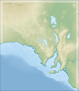 Location of the proposed Chowilla Dam | |
| Country | Australia |
| Location | 60 kilometres (37 mi) upstream of Renmark, South Australia |
| Coordinates | 33°58′15.6″S 140°53′41.1″E / 33.971000°S 140.894750°ECoordinates: 33°58′15.6″S 140°53′41.1″E / 33.971000°S 140.894750°E |
| Status | Cancelled |
| Construction began | 1963 |
| Demolition date | 1970 |
| Construction cost | A$68 million |
| Dam and spillways | |
| Type of dam | Embankment dam |
| Impounds | Murray River |
| Height (foundation) | 41 feet (12 m) |
| Length | 3.3 miles (5.3 km) |
| Spillways | 18[1] |
| Reservoir | |
| Surface area | 1372 km2 |
| Max. length | 55 miles (89 km) |
| Max. width | 20 miles (32 km) |
| Max. water depth | 55 feet (17 m) |
Chowilla Dam was a proposed water storage reservoir on the Murray River in the 1960s. The dam wall would have been in South Australia, but the reservoir behind it would have stretched upstream into Victoria and New South Wales. The site was selected in 1960. Early preparations for its construction were conducted before the project was halted. These included a 23km service railway from the Barmera railway line, which was dismantled without ever actually being used.
Purpose
The dam was proposed to provide flood regulation and reliable water supplies for South Australia, which pumps water from the lower Murray through pipelines across the Mount Lofty Ranges to Adelaide, and parts of the Mid North, Yorke Peninsula and Eyre Peninsula. It was announced on 21 April 1960 by Tom Playford, the Premier of South Australia.[1]
Cross border agreement
It had been agreed by the River Murray Commission in September 1961 and governments of South Australia, Victoria, New South Wales and Australia in 1963.[2] A preliminary meeting was held on 16 April 1962 to start discussion on Chowilla Dam. Participants in that meeting were Prime Minister of Australia Bob Menzies, Premier of South Australia Tom Playford, Premier of Victoria, Deputy Premier of New South Wales and Minister for Development Jack Renshaw, Treasurer of Australia Harold Holt, Minister for National Development Bill Spooner.[3] The followup meeting at which an agreement was reached was held on 19 November 1962. Participants were Spooner (also President of the River Murray Commission) and Menzies for the Commonwealth, Renshaw and George Enticknap for NSW, Premier of Victoria Henry Bolte and Premier of South Australia Thomas Playford. The four governments would share the costs evenly, however the Commonwealth would extend a loan for the New South Wales component in exchange for water from the Menindee Lakes during construction.[4]
Reservoir
The reservoir would have been 55 miles (89 km) long and up to 20 miles (32 km) wide with a surface area of 530 square miles (1,400 km2) due to the flat terrain. The dam wall would have been 18,000 feet (5,500 m) long and the reservoir depth up to 55 feet (17 m) with a capacity of 5.06 million acre feet (6,240 Gl).[2] The reservoir would have been approximately 45 square miles (120 km2) in South Australia, 160 square miles (410 km2) in Victoria and 195 square miles (510 km2) in New South Wales.[1]
Engineering
The dam was proposed to be an earth embankment up to 50 feet (15 m) high and 18,000 feet (5,500 m) long. It would include a concrete spillway 800 feet (240 m) long and a navigation lock. The lock was removed to save cost in later versions of the plans before the project was cancelled. The embankment would block the Murray River and both Chowilla Creek and Monoman Creek in the Chowilla floodplain. Most of both the impervious core and the compacted sand shoulders of the dam embankment would be sourced from local materials of specific layers of soil. There would also be an 80 foot (24 m) deep cut-off wall under the concrete spillway and lock to reduce seepage.[5]
The plan to deal with the highly saline groundwater was to drill relief wells and drains, and pump it to evaporation ponds several miles away.[5] This is similar to what has been done more recently at several points along the Murray for what are now known as "salt interception schemes". Rock would need to be transported from further away to provide protective riprap, filters, and aggregate in concrete and bituminous membrane. This would be transported by rail from 150 miles (240 km) away.
The South Australian Railways were engaged to transport the rock that was required. A new branch line 27.3 kilometres (17.0 mi) long was built from the Barmera railway line to the dam site. Sixty FCD-class flatcars were constructed especially for the job, designed to carry skips that could be taken off the train by crane to move the rock to where it was required.[6] Three new 930 class diesel locomotives were ordered, and a siding near Kinchina Quarry between Murray Bridge and Monarto South was built to collect the stone.[7][8]
Controversy
The dam and reservoir would have flooded the wetlands in what is now the Chowilla Game Reserve, Chowilla Regional Reserve and northern edge of the Murray-Sunset National Park and potentially raised salinity in the Riverland and lower Murray as the reservoir would have been quite shallow in a hot dry climate.
The dam was first proposed and announced by Tom Playford, the Liberal and Country League premier of South Australia in 1960. Playford's government had been in office since 1938, and through that time had presided over significant economic and infrastructure development in the state. This had included encouraging new industries, establishing satellite cities around Adelaide, nationalising the electricity generators and stimulating self-sufficiency by using Leigh Creek brown coal instead of importing black coal from interstate. The Chowilla Dam would have continued this theme by providing greater certainty and control over water supplies as Adelaide's water requirements were increasing.
Playford and the LCL won the 1962 state election only with the support of independent Tom Stott in an otherwise-hung parliament. Stott was a strong supporter of building the dam, which would be in his electorate. The Frank Walsh-led Australian Labor Party won the 1965 election. After leadership changes in both parties, the LCL led by Steele Hall defeated the ALP led by Don Dunstan in the 1968 election again through the support of Stott.
Hall became convinced that the Chowilla Dam was not a good idea and favoured agreements for water supply from Dartmouth Dam instead. This was due to a combination of the increasing cost estimates of building the dam, and the increasing awareness of the environmental impacts of the proposed dam.[9] As Stott still believed that the dam would be valuable in his electorate, and with local community support mostly in its favour, he switched his support from Hall to Dunstan (who supported both Chowilla and Dartmouth Dams), resulting in the 1970 election which returned the ALP with a majority to govern in its own right (27 out of 47 seats).[10]
Chowilla was one of the first issues where people spoke up for environmental protection.[9] The Sunraysia Salinity Committee opposed the dam as it believed that the combination of high evaporation and saline groundwater would lead to increased salinity downstream which would be harmful to horticulture.[11] The future salinity concerns were raised in contrast to the local economic benefits to be brought by the construction project. The Victorian government was the first to change from support to opposition of the project.[12]
Cancellation
The Dartmouth Dam was built on the Mitta Mitta River (a tributary of the Murray) in the 1970s. There are agreements in place to assure South Australia of a supply of water, and management to control the flow as it takes six weeks for water from Dartmouth Dam to reach South Australia. Lake Victoria in southwestern New South Wales on an anabranch of the Murray provides closer guaranteed supply and is operated by South Australian water authorities.[2]
References
- 1 2 3 Alison Painter. "21 April 1960 Chowilla Dam project". Professional Historians Association (SA). Retrieved 1 October 2015.
- 1 2 3 "Proposed Dam in 1968 for Chowilla, north of Renmark". Discover Murray River. Retrieved 1 October 2015.
- ↑ "Chowilla Dam Statement by the Prime Minister, The Rt. Hon. R.G. Menzies" (PDF). PM Transcripts. Department of the Prime Minister and Cabinet. 16 April 1962. P.M. No. 35/1962. Retrieved 1 October 2015.
- ↑ "Chowilla Dam Statement by the Prime Minister, The Rt. Hon. R.G. Menzies" (PDF). PM Transcripts. Department of the Prime Minister and Cabinet. 19 November 1962. P.M. No. 89/1962. Retrieved 1 October 2015.
- 1 2 Staplton, D. H. (January 1967). "Chowilla Dam, South Australia" (PDF). The Engineering Geologist. The Geological Society of America. 2 (1): 2–3. Retrieved 2 October 2015.
- ↑ ChrisBearADL. "Peterborough - Chowilla Dam stone wagons". Flickr. Retrieved 2 October 2015.
- ↑ "Paringa - Chowilla Railway, S.A". RailPage. Interactive Omnimedia Pty Ltd. Retrieved 2 October 2015.
- ↑ "Chowilla branch". RailPage. Interactive Omnimedia Pty Ltd. Retrieved 2 October 2015.
- 1 2 Jennifer Hamilton-McKenzie (23 April 2015). "Podcast transcript - The Chowilla Dam project". La Trobe university. Retrieved 2 October 2015.
- ↑ "The 1970s". SA Memory South Australia : past and present, for the future. State Library of South Australia. Retrieved 1 October 2015.
- ↑ "Lessons of a rural legend live on" (PDF). Retrieved 1 October 2015.
- ↑ Fleur Bainger (2014). "ABC Rural Legends : Jack Seecamp". ABC Rural online. Retrieved 2 October 2014.