Chorges
| Chorges | ||
|---|---|---|
|
Porte des Souchons | ||
| ||
 Chorges | ||
|
Location within Provence-A.-C.d'A. region 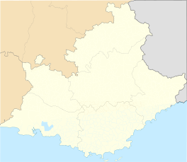 Chorges | ||
| Coordinates: 44°32′47″N 6°16′38″E / 44.5464°N 6.2772°ECoordinates: 44°32′47″N 6°16′38″E / 44.5464°N 6.2772°E | ||
| Country | France | |
| Region | Provence-Alpes-Côte d'Azur | |
| Department | Hautes-Alpes | |
| Arrondissement | Gap | |
| Canton | Chorges | |
| Intercommunality | Avance | |
| Government | ||
| • Mayor (2008–2014) | Christian Durand | |
| Area1 | 53.34 km2 (20.59 sq mi) | |
| Population (2008)2 | 2,542 | |
| • Density | 48/km2 (120/sq mi) | |
| Time zone | CET (UTC+1) | |
| • Summer (DST) | CEST (UTC+2) | |
| INSEE/Postal code | 05040 / 05230 | |
| Elevation |
773–2,485 m (2,536–8,153 ft) (avg. 864 m or 2,835 ft) | |
|
1 French Land Register data, which excludes lakes, ponds, glaciers > 1 km² (0.386 sq mi or 247 acres) and river estuaries. 2 Population without double counting: residents of multiple communes (e.g., students and military personnel) only counted once. | ||


Chorges is a commune in the Hautes-Alpes department in southeastern France.
It is close to Gap. The name Chorges derives from Latin Catorimagus, itself coming from the Alpine tribe of the Caturiges in the ancient Roman province of Alpes Maritimae.
Location
The village is 11 km (6.8 mi) away from La Bâtie-Vieille.
Population
| Historical population | ||
|---|---|---|
| Year | Pop. | ±% |
| 1962 | 1,141 | — |
| 1968 | 1,173 | +2.8% |
| 1975 | 1,242 | +5.9% |
| 1982 | 1,391 | +12.0% |
| 1990 | 1,561 | +12.2% |
| 1999 | 1,882 | +20.6% |
| 2008 | 2,485 | +32.0% |
See also
References
External links
| Wikimedia Commons has media related to Chorges. |
This article is issued from Wikipedia - version of the 3/15/2016. The text is available under the Creative Commons Attribution/Share Alike but additional terms may apply for the media files.