Cherokee Park, Lexington
Coordinates: 38°01′13″N 84°31′00″W / 38.02014°N 84.516654°W
| Cherokee Park | |
|---|---|
| Neighborhood of Lexington, Kentucky | |
| Country | United States |
| State | Kentucky |
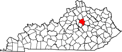
| County | Fayette |
| City | Lexington |
| Area | |
| • Total | 0.042 sq mi (0.11 km2) |
| • Water | 0.0 sq mi (0.0 km2) |
| Population (2000) | |
| • Total | 76 |
| • Density | 1,826/sq mi (705/km2) |
| Time zone | Eastern (EST) (UTC-5) |
| • Summer (DST) | EDT (UTC-4) |
| ZIP code | 40503 |
| Area code(s) | 859 |
Cherokee Park is a neighborhood in southwestern Lexington, Kentucky, United States. Its boundaries are Rosemont Garden on the south, Nicholasville Road to the east, Dantzler Drive, and the Norfolk Southern railroad tracks to the west.[1] It was developed by Dean William S. Taylor in the early 1920s.
Neighborhood statistics
- Area: 0.042 square miles (0.11 km2)
- Population: 76
- Population density: 1,826 people per square mile
- Median household income (2010): $57,280[1]
References
- 1 2 Cherokee Park Neighborhood Profile Retrieved 2013-07-08.


This article is issued from Wikipedia - version of the 8/18/2016. The text is available under the Creative Commons Attribution/Share Alike but additional terms may apply for the media files.